
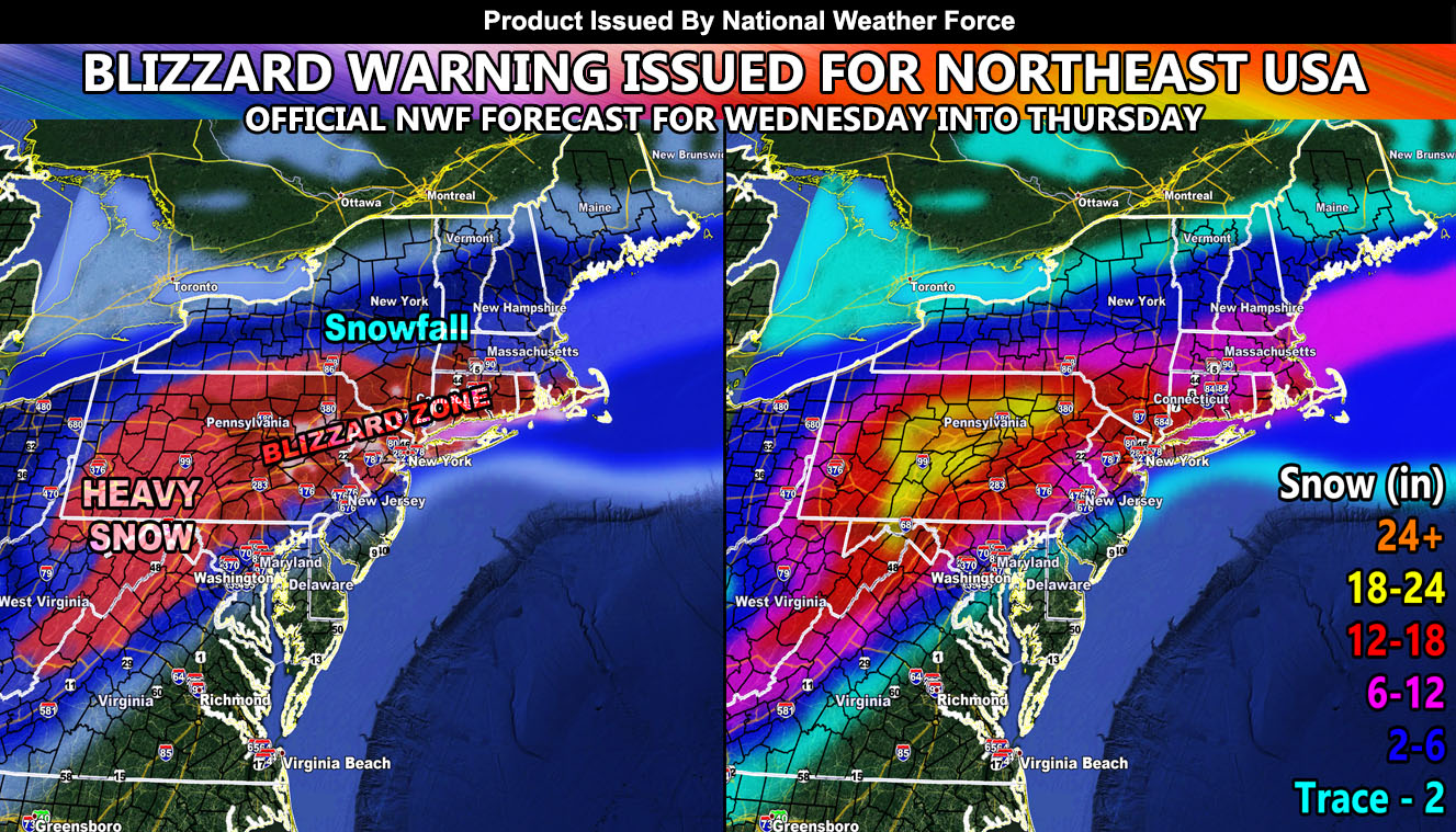
National Weather Force has issued a Blizzard Warning for portions of the larger scale Winter Storm Warning in place for Wednesday into Thursday for a strong system expected into the region then. Snow models, along with the exclusive in-office model are available by reading on …
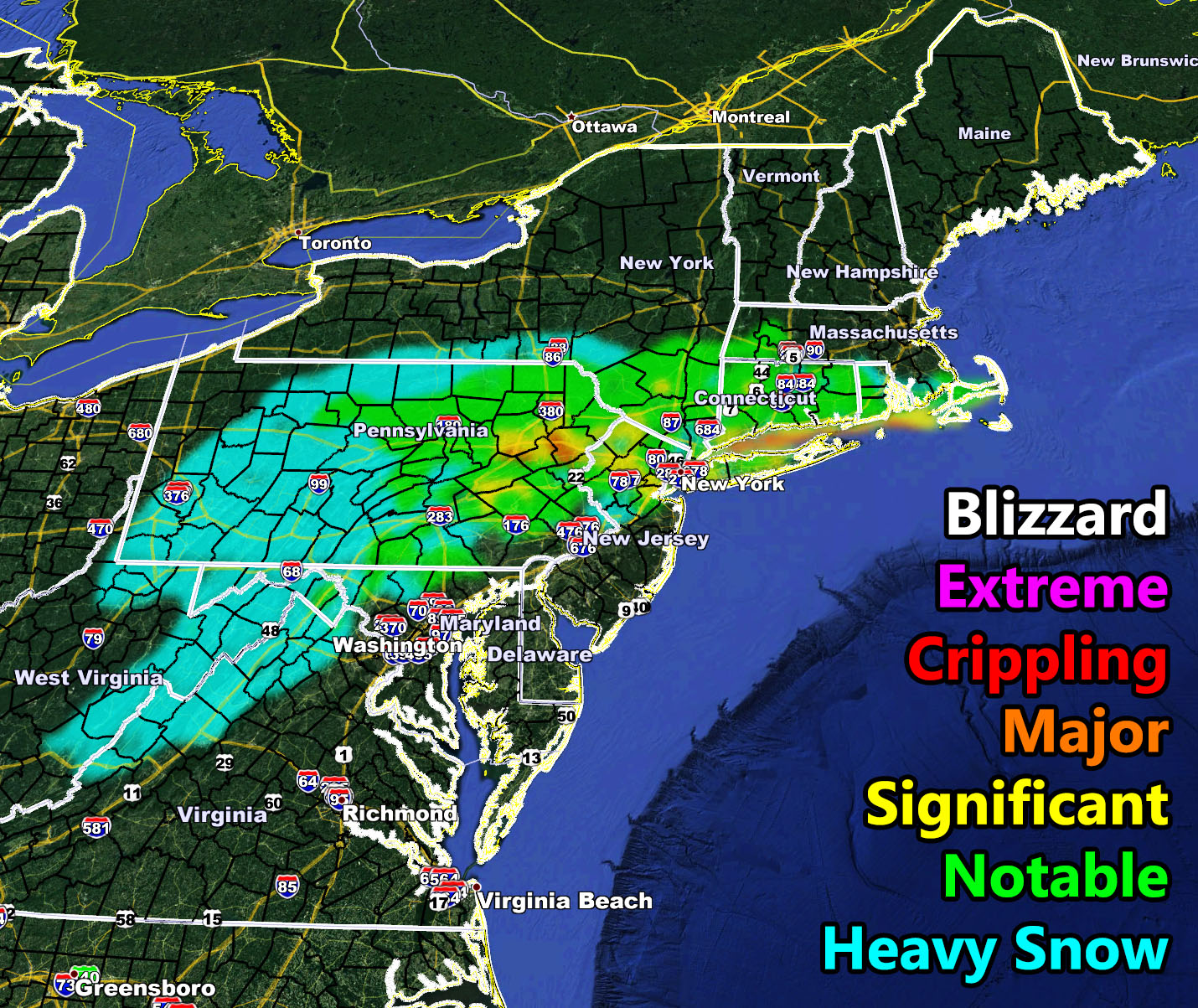
First I will go ahead and talk about the Blizzard Warning issued here at National Weather Force. Through the duration of the storm system, blizzard conditions will be likely in the Eastern half of PA, Northern half of NJ, all of Long Island including New York City, Southeast NY, all of Connecticut and Rhode Island, and as far east as Cape Cod. The National Weather Force blizzard model shows a wide area of notable category 1 conditions peppered with Category 2 and 3. The models below give you a better idea what to expect. The heavy snow location is for 1 inch or high hourly snowfall levels. Within that and the zones in the blizzard warning one will see one to even two inch per hour snowfall rates, which is pretty high.
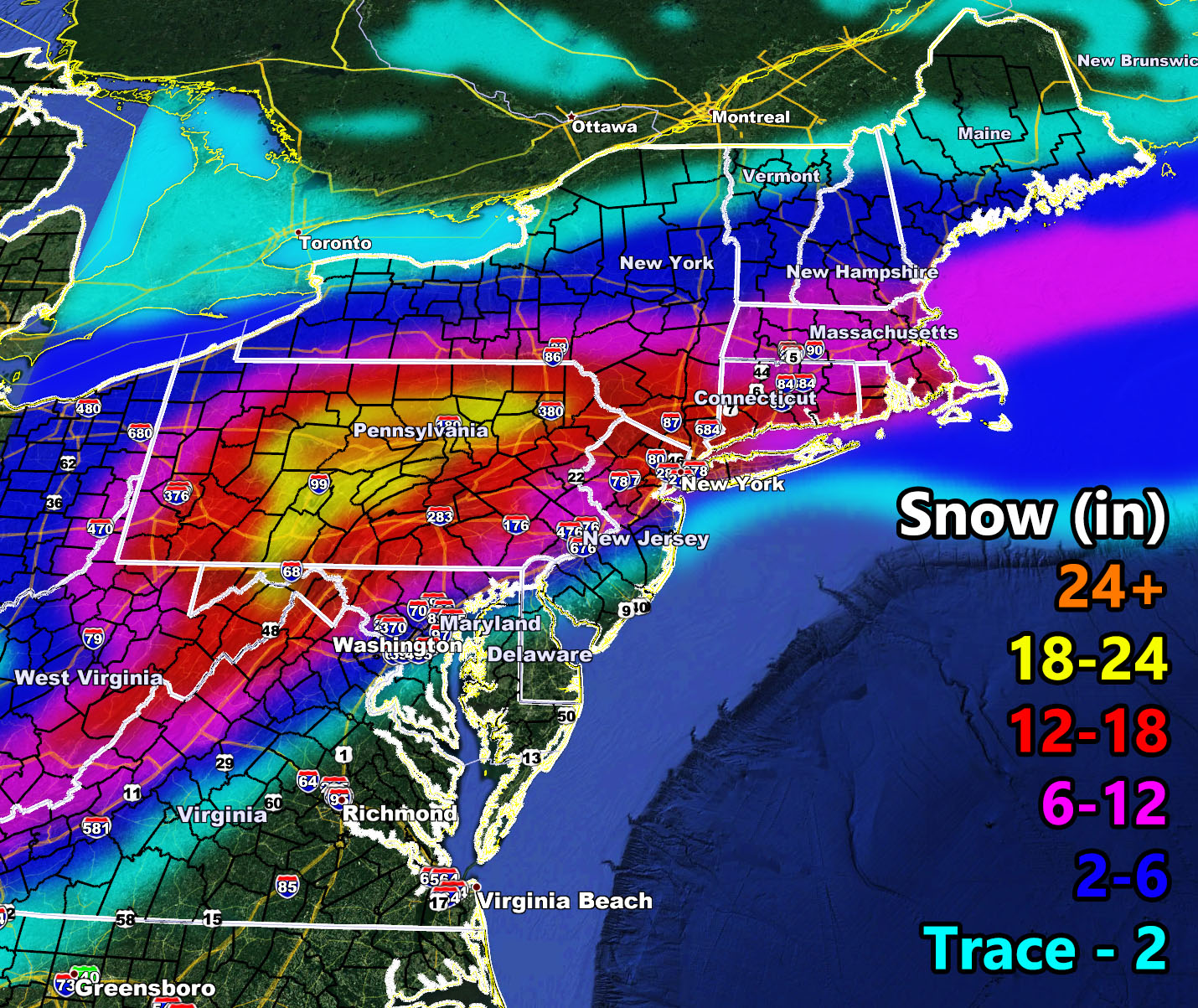
National Weather Force snowfall forecast is also below so have at it…
HOW TO GET THESE ALERTS?.
Join a regional state weather alert FB group
Click here
Download the Android/IOS notification app
Click Here
FOLLOW the Facebook Page
NOTE: ALL alerts for the nation can be viewed on the main website page.
CLICK HERE TO VIEW