
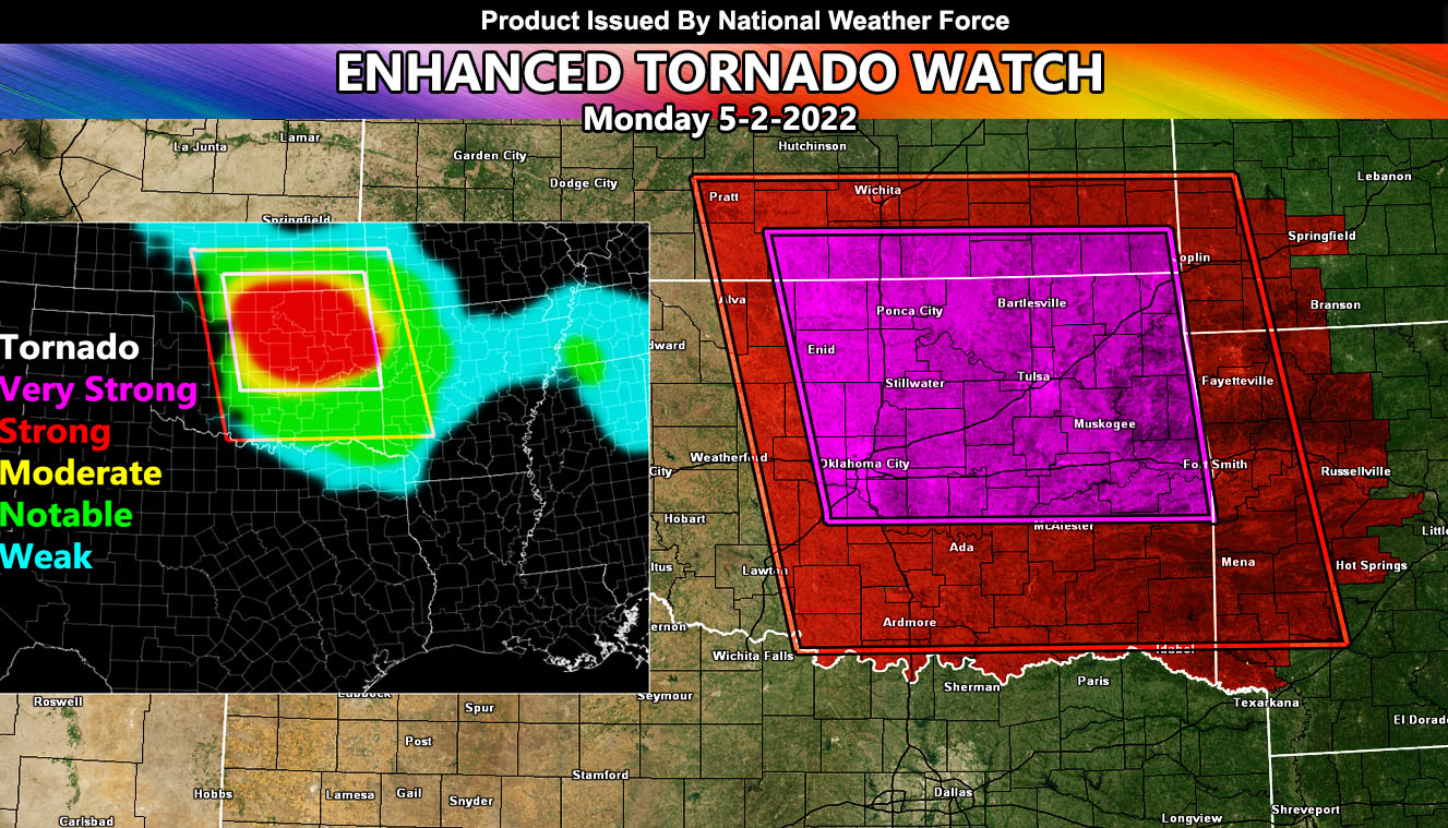
Issued or Partial Issued States: OK, KS, MO, AR – Map inside shows affected state areas.
Site: National Weather Force has issued an Enhanced Tornado Watch effective now through midnight CDT, May 2, 2022 – THIS IS A DANGEROUS SITUATION WITHIN THE ENHANCED TORNADO WATCH OUTLINE AND A STRONG/VIOLENT TORNADO SCENARIO HAS BEEN PREDICTED …
Date Issued: 5/2/22 at 11:30am Central Time
Forecast: A surface low currently in Western Kansas is gaining strength. At the surface, dewpoints in the mid/upper 60s in the watch areas are working with temperatures this afternoon/evening at or near 80. This will push instability values between 2000-3000 j k/g, which is more than enough for explosive severe thunderstorms.
These storms should start around the 20-21z hour, which is the 3pm to 4pm hour local CDT. The storms will start from around Alva, Oklahoma, north to around the Pratt areas. They will move eastward with time. As the evening moves along, stronger low-level moisture with strengthening surface winds in the Enid/Ponca City zones will boost low-level shear values in the red-zone, which indicates that there is a very strong chance of strong to violent tornadoes.
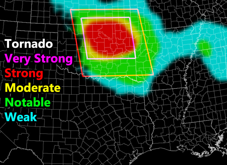
The system will be strongest in the magenta box in this article post, the Enhanced Tornado Watch. Areas within it should prepare for tornadoes, strong at times, very large hail, and damaging winds in excess of 70+ mph.
The red-boxes areas outside of the Enhanced Tornado Watch will be where storms will just be beginning (west end) or weakening tonight (east end). Storms should form into a line of severe storms that will move through OKC and into the Southwest Missouri and Western Arkansas areas tonight, with lesser strong tornado risks and therefore as the model below shows, the in-house developing National Weather FORCE model … notable/weak risks and an additional enhanced tornado watch outside of the current one will not be needed.
The activity should go below limits around midnight CDT and the event will end …
HOW TO GET THESE ALERTS?.
SIGN-UP TO THE FREE NWF E-MAIL ALERT SYSTEM FOR YOUR AREA HERE WHERE YOU PICK YOUR AREA IN YOUR OWN CONTROL PANEL BY STATE LOCATION AND GET NOTIFIED WHEN A POST IS MADE FOR YOU https://www.nationalweatherforce.com/national-weather-force-email-alert-system-sign-up/
FOLLOW the Facebook Page after reading this and interact with the post made about this, whether sharing, liking, or commenting … It will be answered