
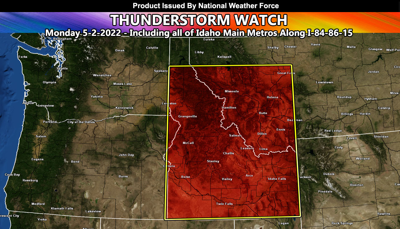
Issued or Partial Issued States: ID, MT – Map inside shows affected state areas.
Site: National Weather Force has issued a Thunderstorm Watch effective Monday May 2, 2022, including the populated zones of Idaho along I-84, 86, and 15 …
Date: 5/1/22 at 1:00pm Mountain Time
Forecast: A strong storm system will move into Idaho on Monday, bringing cold air aloft. A freezing level of just below 10,000 FT will work with a high EL level to support taller storm tops within the freeze column. This will up the instability profiles.
A strong jet stream will also be available, owning to strong upper dynamics, or divergence.
All this points to numerous thunderstorms across the watch area, with weaker storms in the extreme northeast sector of it … but Idaho will stand to see the most from this event. Thunderstorms will contain bouts of damaging wind potential, or isolated severe thunderstorm risks across the southern half of Idaho.
A NWF Thunderstorm Watch is issued when dynamics in the area warrant thunderstorms that cover over 50% of the boxed area …
HOW TO GET THESE ALERTS?.
SIGN-UP TO THE FREE NWF E-MAIL ALERT SYSTEM FOR YOUR AREA HERE WHERE YOU PICK YOUR AREA IN YOUR OWN CONTROL PANEL BY STATE LOCATION AND GET NOTIFIED WHEN A POST IS MADE FOR YOU https://www.nationalweatherforce.com/national-weather-force-email-alert-system-sign-up/
FOLLOW the Facebook Page after reading this and interact with the post made about this, whether sharing, liking, or commenting … It will be answered
CLICK HERE TO FOLLOW THE MAIN FACEBOOK PAGE