
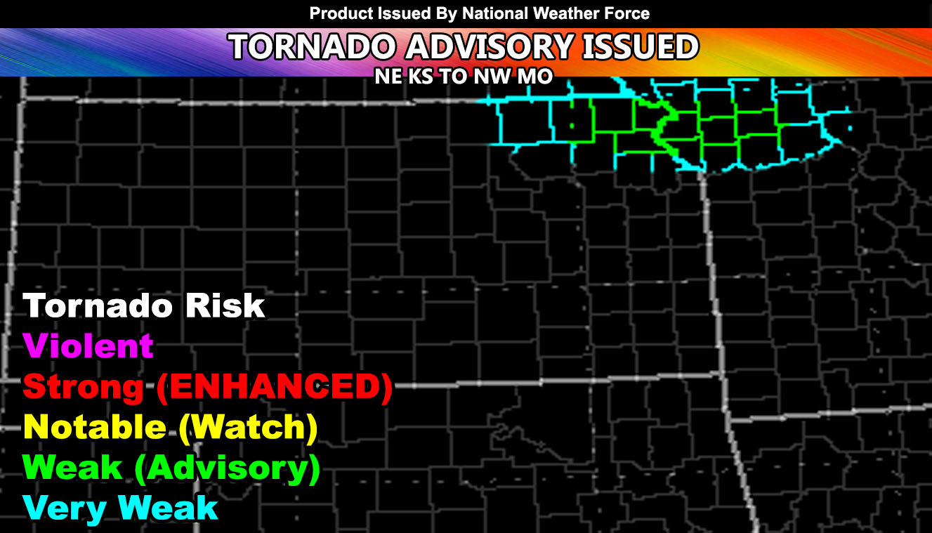
Weather Alert: Tornado Advisory
Office: National Weather Force
Date Issued: 6-24-2021 – 12pm CT
Issued From: NWF Tornado Risk Model
National Weather Force has issued a Tornado Advisory effective this evening into some of the night.
Thunderstorms are expected to form on the KS/NE border this evening. These storms will be in a strong low-level sheared environment for low-level rotation. Storms building before merging into a line later have the better chance for isolated tornadoes. The beginning stages show on the model that mainly weak tornadoes exist and weak meaning EF0-1 type. The model is centering between two cities in Northeast Kansas. Highland and Denton, KS.
Storms will eventually form a line through Eastern KS and Missouri overnight and the boundary layer will become stable, ending the tornado threat.
The upper divergence is lacking during storm development, a reason the model knocked a lot of the values down for stronger tornadoes. The upper divergence kicks in a lot during the night, but the boundary layer again.. cools and becomes stable so it turns into a damaging wind and large hail event through Missouri …
A Tornado Advisory is issued here at National Weather Force when conditions fall short of a full tornado watch and/or weak tornadoes are expected in or around the outlined area.
Want notifications? Sign into the free email alert system and choose your state area(s) -Southern California and Arizona are not served though.
LINK TO REGISTER IF ELSEWHERE – http://www.nationalweatherforce.com/national-weather-force-email-alert-system-sign-up/
Have a comment? Ask on the FB post in your regional Facebook weather group that National Weather Force runs – Click here to find and join yours today!