
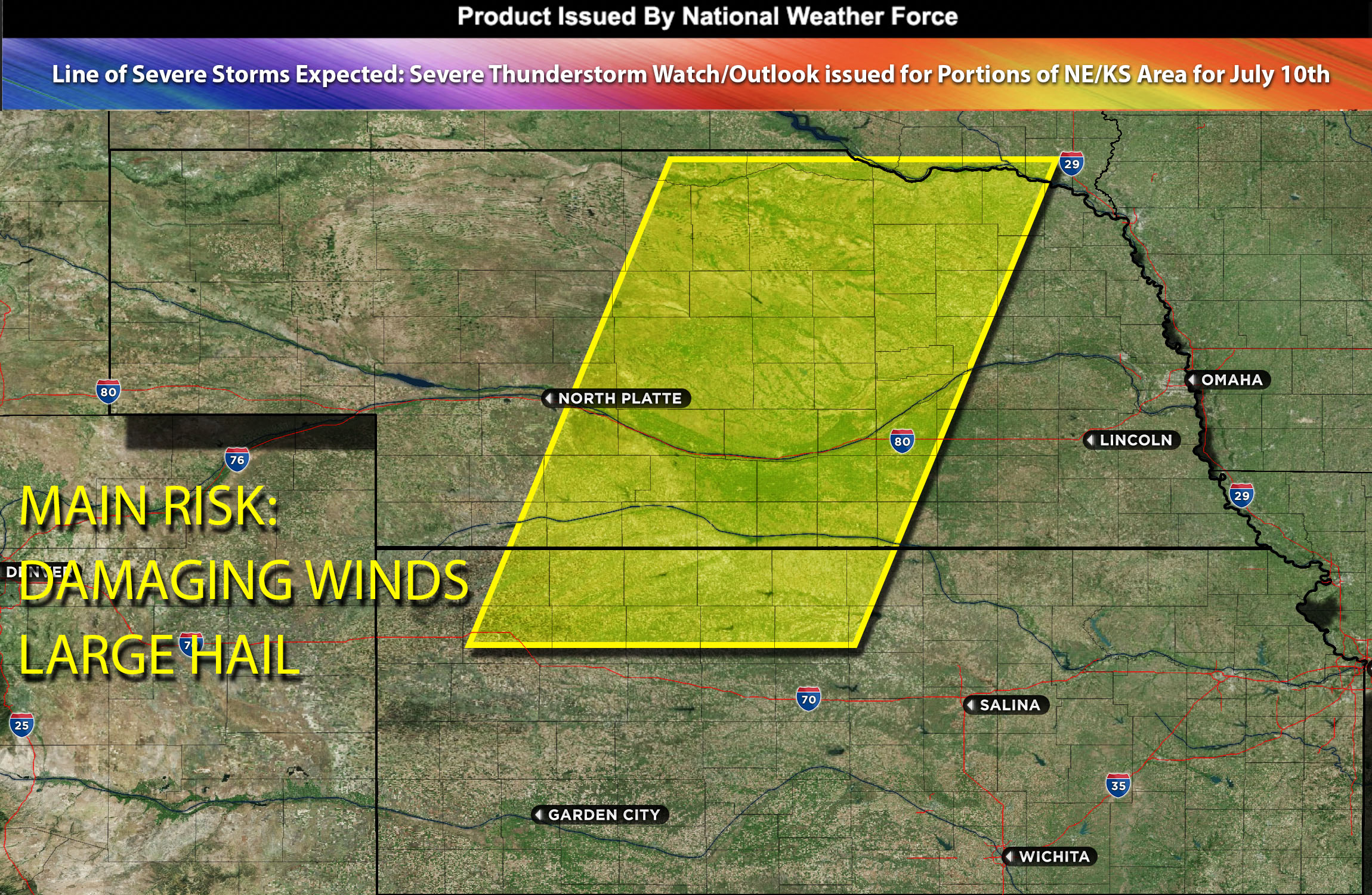
National Weather Force Severe Thunderstorm watch/outlook effective until 11pm CDT for a big portion of Nebraska (central, north, south) and portions of Kansas.
An intensifying cold front is set to move south, meeting sharp mid-level temperature drops that lead to heightened instability and increased moisture. This sets the stage for severe thunderstorms, with the potential to bring large hail and damaging winds, particularly from Nebraska to Kansas. The severest conditions, augmented by high mid-level wind shear, are expected in southern/central Nebraska. The storms’ primary threats are large hail and damaging winds, with the greatest risk of damaging winds in southern Nebraska and northern Kansas. Most of these storms will end up becoming mainly a wind producer as the evening hours continue especially when they become more linear. Some of these storms could continue into the overnight hours as well.
Main risk: large hail, damaging winds mainly with a very low risk for tornadoes given the lack of LLJ.
Timing: Late evening into overnight hours.
Stay tuned for more updates.
Sina⚡⚡
With over a decade of experience in forecasting severe thunderstorms, this individual is a seasoned forecaster and developer. Their expertise in severe weather forecasting and computer science is entirely self-taught, complemented by a foundation in Atmospheric Science from UNCO. They have dedicated their efforts to developing innovative tools that enhance the accuracy of analyzing large hail and tornadoes. As a significant contributor to the National Weather Force, they have played a crucial role in providing accurate and timely information, as well as developing tools to keep those affected well-informed.
NOTE: The alerts and outlooks posted here are customary made to inform. At times, which is often, you will see an alert forecast posted on here that you do not see elsewhere. That is fine, the track record of the main office is very high so maintain to follow an event when posted. These are custom concentrated alerts and outlooks that are created by National Weather Force team of experts. They do not intend to represent the NWS or SPC.