
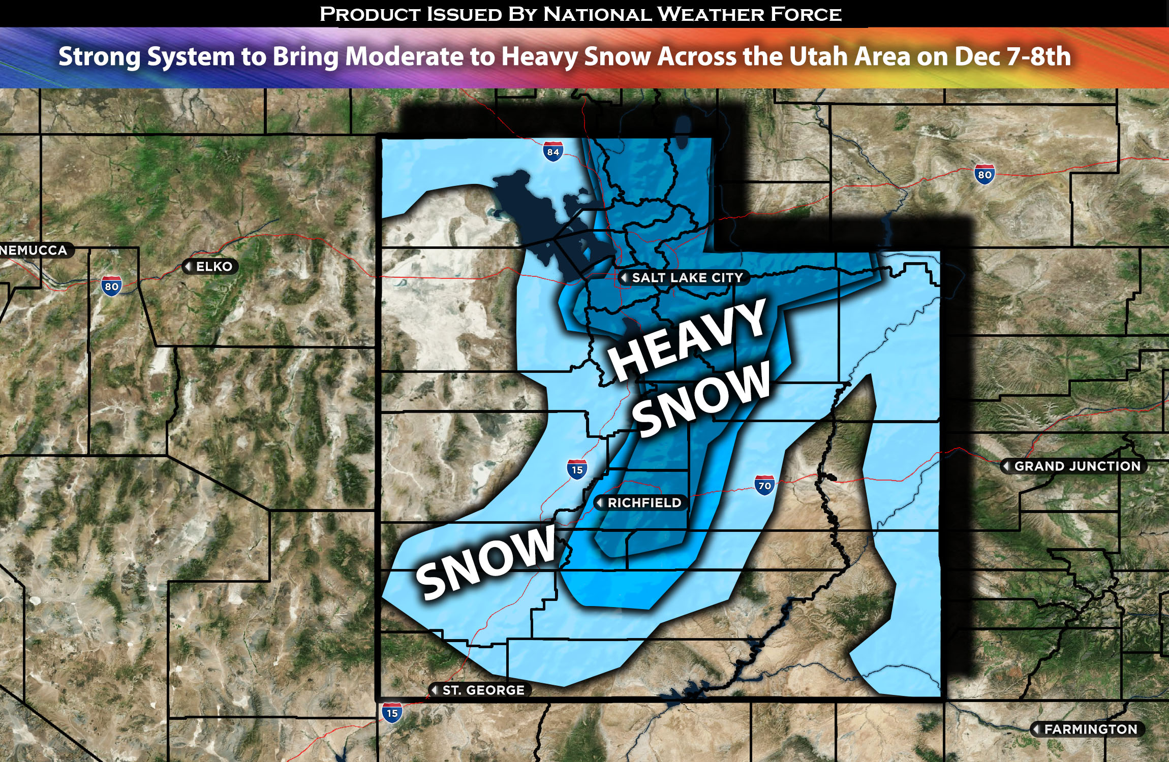
Across Utah area (especially northern portions):
An approaching system is expected to bring heavy snow across the Salt Lake City area in Utah, particularly in the mountains on Friday. Initially, rain showers are anticipated overnight, transitioning to light snow by noon or afternoon especially over the mountains with rain showers elsewhere. A subsequent wave from the same system, featuring significantly stronger dynamics, is expected to bring heavier snow, especially from Thursday very late at night into Friday. Periods of heavy snowfall will likely affect the early part of the Friday morning commute as well. Snow showers are expected to continue throughout the day before diminishing, with a few lingering snow showers in the mountains by early Saturday morning. Check the forecast details for any specifications.
Regions Impacted: Salt Lake City, Utah, northern Utah and portions of southern Utah.
Main impact: Rain showers, heavy snow and gusty winds.
Forecast Details:
An approaching trough is expected to bring multiple waves of precipitation, starting as rain showers overnight into early Thursday morning before transitioning into snow showers in the mountains especially. Only very light accumulation is anticipated due to the lack of moisture. Temperatures in the mid-levels of the atmosphere are expected to drop by 3°C behind the frontal boundary. Subsequently, another shortwave from the main trough, accompanied by an approaching cold front, will bring more concentrated mid to upper-level forcing. Concurrently, a dynamic jet stream and frontogenesis across Utah on Friday are forecast to produce heavy snowfall rates across the region. Locally heavier snowfall rates are also possible due to lake-effect, particularly across the Salt Lake Valley during Friday morning. Snowfall is anticipated to decrease and diminish throughout the rest of Friday.
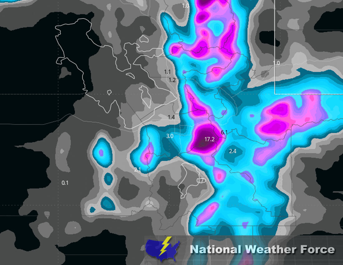
Approximate Snow Totals:
Stay tuned for more updates.
————————————
Sina⚡⚡
With over a decade of experience in forecasting severe thunderstorms, this individual is a seasoned forecaster and developer. Their expertise in severe weather forecasting and computer science is entirely self-taught, complemented by a foundation in Atmospheric Science from UNCO and an IT background from WGU. They have dedicated their efforts to developing innovative tools that enhance the accuracy of analyzing large hail and tornadoes. As a significant contributor to National Weather Force & Southern California Weather Force, they have played a crucial role in providing accurate and timely information, as well as developing tools to keep those affected well-informed.