
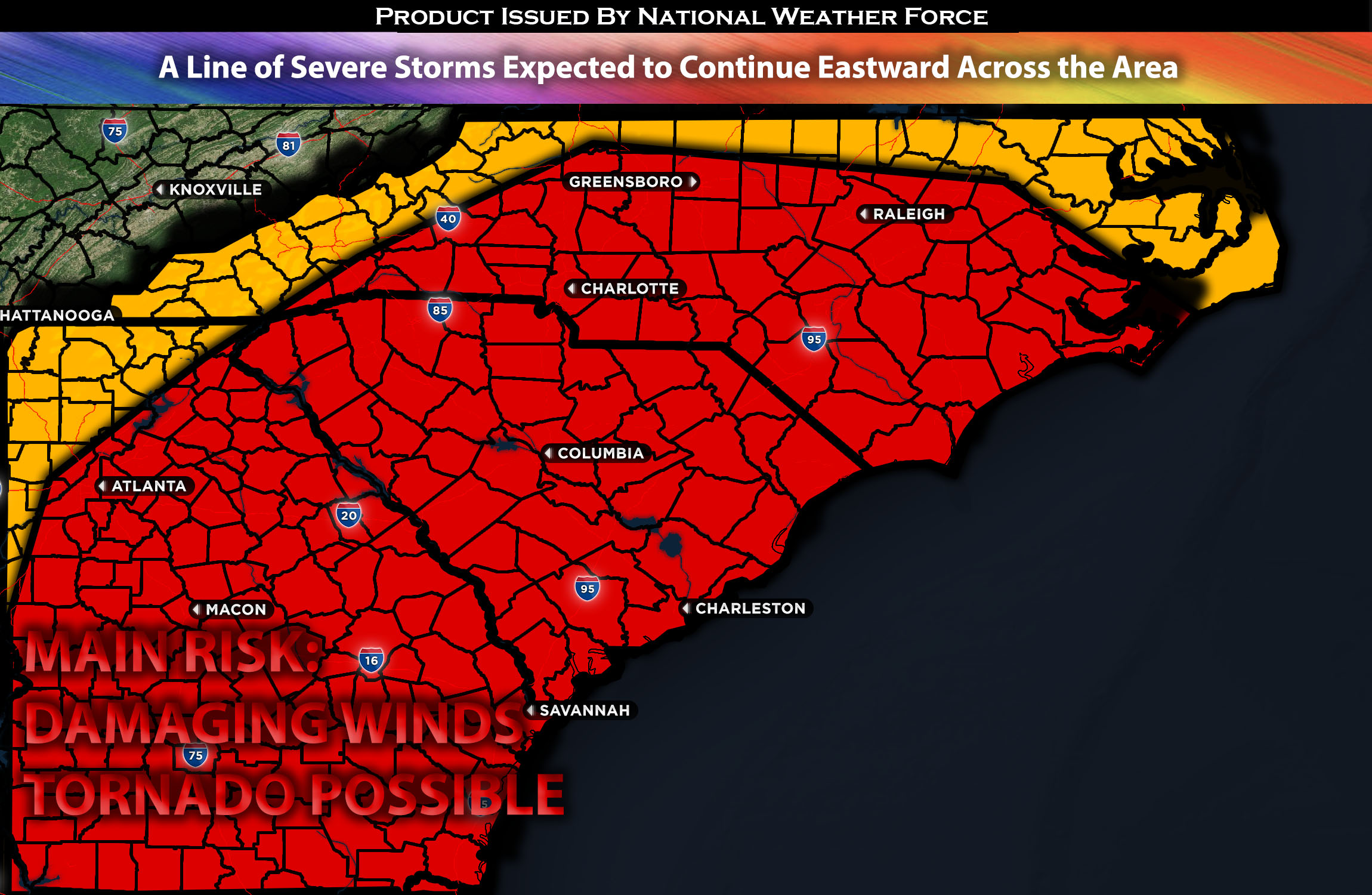
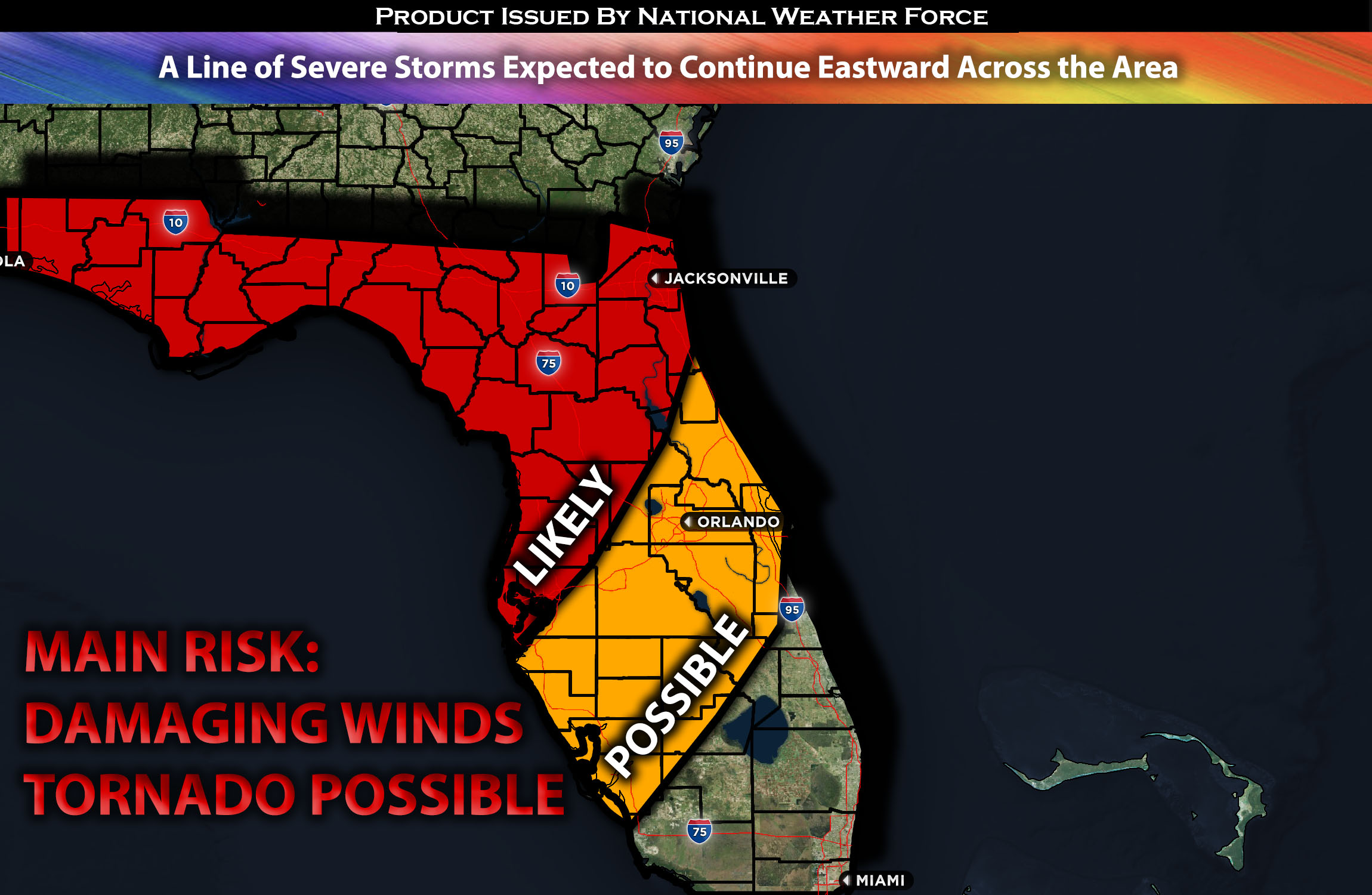
Across the Southeast:
Ahead of a powerful cold front that has already brought severe weather with widespread destruction across the Tennessee Valley from tornadoes, a line of severe storms is expected to continue moving eastward, impacting the regions from the Southern Appalachians towards the Southeast, capable of producing damaging winds (main threat), isolated tornadoes, and large hail with any discrete cells. (More details below).
Forecast Details:
In the upper atmosphere, a positively tilted trough, quickly transitioning to negative, is forecasted to move east and north by Sunday. This upper-level trough will encompass a shortwave trough, expected to traverse eastward during the day, affecting the designated region. At the surface, a potent advancing cold front will progress eastward across the Southern Appalachians and the Deep South. The acceleration of this cold front will likely lead to predominantly linear storm patterns. Ahead of the front, warm, moist air will blanket the Southeast, extending into the Appalachians and East Coast. This coupled with daytime heating, ample instability, and significant effective shear, is set to further allow storm cell development on Sunday before the cold front pushes through exiting the east coast. The primary threat will be damaging winds preceding the cold front, although the possibility of a tornado arising from any discrete cells cannot be ruled out. This contrasts with Saturday’s conditions, which featured exceptionally high low-level shear and pronounced atmospheric rotation.
Main risk: Damaging straight-line winds, tornado possible, and isolated large hail.
Stay tuned for more updates.
Sina⚡⚡
With over a decade of experience in forecasting severe thunderstorms, this individual is a seasoned forecaster and developer. Their expertise in severe weather forecasting and computer science is entirely self-taught, complemented by a foundation in Atmospheric Science from UNCO and an IT background from WGU. They have dedicated their efforts to developing innovative tools that enhance the accuracy of analyzing large hail and tornadoes. As a significant contributor to National Weather Force & Southern California Weather Force, they have played a crucial role in providing accurate and timely information, as well as developing tools to keep those affected well-informed.