

From New England Across the Mid-Atlantic Region:
Heavy rain leading to potential flooding and damaging winds are expected as a powerful system approaches the area, impacting the region from Sunday morning through Monday afternoon. Initially, the system will bring lighter showers across New England and the Mid-Atlantic Region before they become heavy, accompanied by strong gusty winds that may cause damage across the area, including potential power outages and tree damage.
Forecast Details:
The same upper-level trough that is bringing severe weather across the Tennessee Valley and Southeast is expected to move east and lift northward becoming negatively tilted across the area on Sunday. At the same time, a powerful cold front will approach, around Sunday afternoon, bringing very heavy rain and strong gusty winds due to the low-level jet. There will also be strong lift aloft combined with instability across a moist atmosphere, making thunderstorms, including a few strong ones, likely across the area, especially along the coast of New York.
In terms of wind strength, surface winds are expected to be around 50-65 knots, particularly late Sunday afternoon and evening. The cold front is expected to push through around Sunday night, bringing very cold air behind it with more mixed precipitation. However, not much snow accumulation is expected in the metropolitan areas, with more accumulation likely to the northwest of regions like New York City.
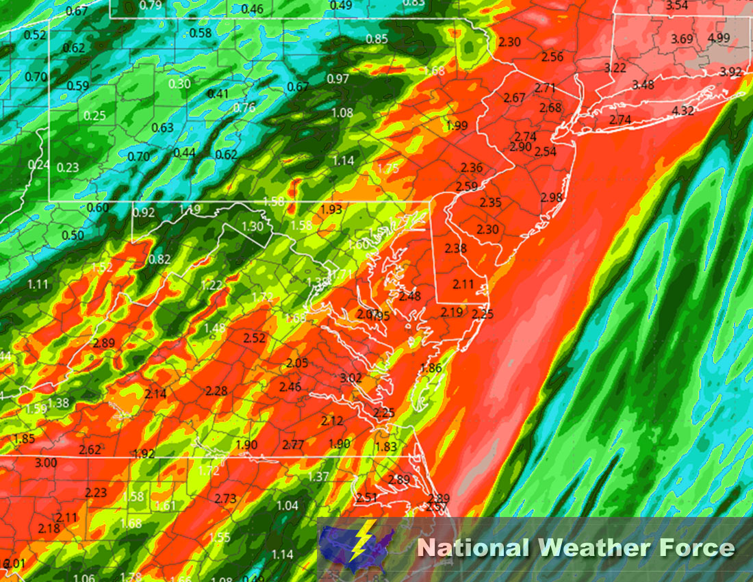
Approximate Rainfall Totals:
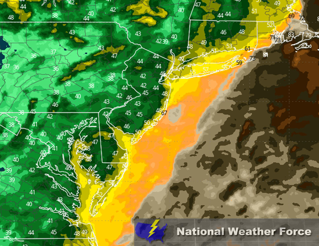
Approximate Maximum Wind Gusts (MPH):
Main impact: heavy rain leading to flooding, mixed precipitation, and gusty winds leading to potential damage.
Stay tuned for more updates.
Sina⚡⚡
With over a decade of experience in forecasting severe thunderstorms, this individual is a seasoned forecaster and developer. Their expertise in severe weather forecasting and computer science is entirely self-taught, complemented by a foundation in Atmospheric Science from UNCO and an IT background from WGU. They have dedicated their efforts to developing innovative tools that enhance the accuracy of analyzing large hail and tornadoes. As a significant contributor to National Weather Force & Southern California Weather Force, they have played a crucial role in providing accurate and timely information, as well as developing tools to keep those affected well-informed.