
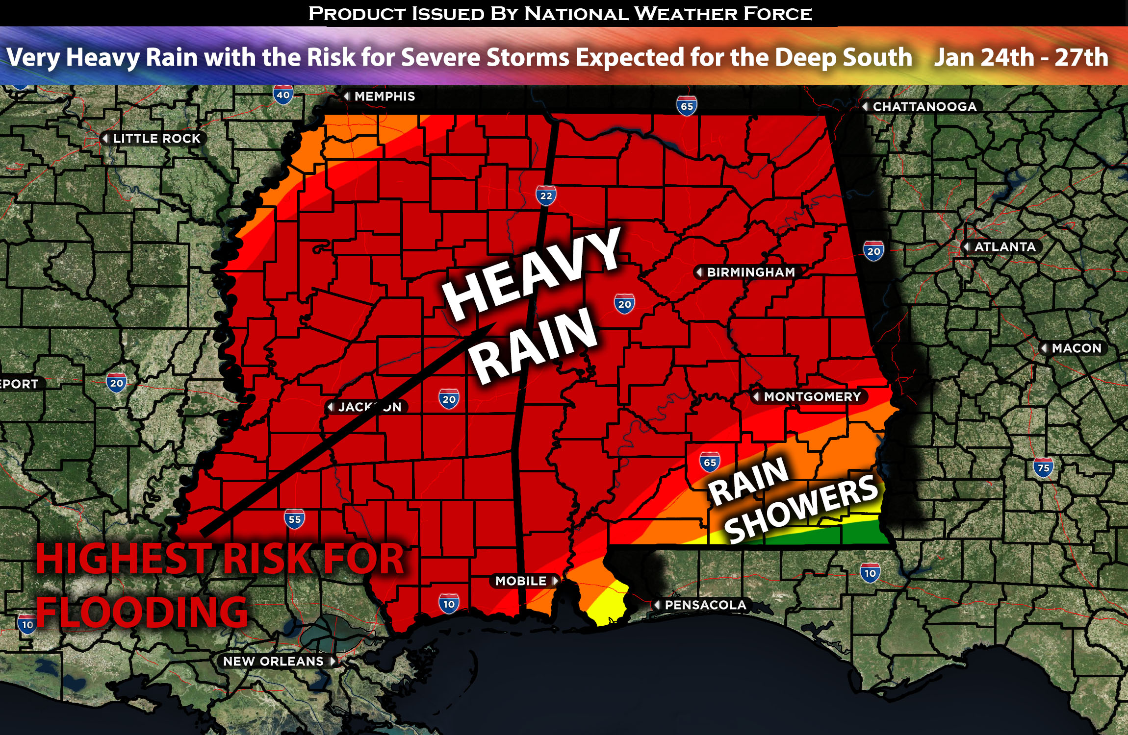
Across the Deep South:
The same system that brought heavy rain and widespread flooding across Texas will continue moving eastward, bringing very heavy precipitation. Significant impacts are expected across the Deep South from Wednesday through Thursday with back-to-back systems through Sunday. This system poses a significant risk for flooding and travel issues across the region, particularly in areas further south, closer to the deeper moisture aloft. Concurrently, there will be convective activity with a line of thunderstorms, some of which may be severe. This is especially likely if a line of severe storms forms, sweeping eastward across Mississippi and portions of Alabama capable of producing damaging winds perhaps an isolated tornado further south, before diminishing across the region. Further information and regional specifics of the forecast can be found below.
Overall Forecast:
In the mid/upper levels of the atmosphere, a weakening trough is expected to continue moving northeastward towards the ArkLaTex, bringing very deep Gulf moisture across the entire Deep South, especially Mississippi and Alabama. Dew points are already rising and by Wednesday, they are expected to reach the mid to potentially upper 60s. This, combined with a low-level jet guiding this setup and allowing for a deepening southwest flow aloft, will create conditions conducive to very heavy rainfall. At the same time, convection is also expected, with a few thunderstorms potentially being severe, albeit on the lighter side, due to sufficient effective shear and possibly some low-level shear. This poses a risk of flooding and a few isolated damaging wind occurrences, should the storms intensify, particularly in central and southern Mississippi. There will also be a slight tornado risk due to that slightly enhanced low-level shear capable of possibly producing an isolated tornado mainly on Wednesday late afternoon/evening.
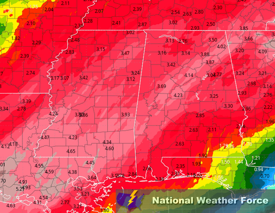
Timing & Impact: Scattered showers are expected to continue through Wednesday morning. Then, as destabilization occurs and combines with deep mid-level moisture, a heavy band of thunderstorms, some potentially strong and severe, will sweep across Mississippi from Wednesday morning through the afternoon. More showers will follow, moving into Alabama before diminishing as they encounter a more stable air mass. Subsequently, consecutive lines of storms will continue to move through each day, with a few potentially becoming stronger. This depends on the convergence of severe weather conditions and their sufficiency. This pattern is expected to persist through the weekend, when the back-to-back systems and associated moisture subside. Torrential heavy rainfall each day will accumulate, potentially causing flooding issues. The most widespread precipitation looks to be on Wednesday through Thursday, with additional precipitation each day through the weekend. For more information on rainfall details please check the approximate rainfall totals below.
Approximate Rainfall Totals (in inches):
Main impact: heavy rain leading to potential flooding, CG lightning, damaging winds, and perhaps an isolated tornado.
Stay tuned for more updates.
Sina⚡⚡
With over a decade of experience in forecasting severe thunderstorms, this individual is a seasoned forecaster and developer. Their expertise in severe weather forecasting and computer science is entirely self-taught, complemented by a foundation in Atmospheric Science from UNCO and an IT background from WGU. They have dedicated their efforts to developing innovative tools that enhance the accuracy of analyzing large hail and tornadoes. As a significant contributor to National Weather Force & Southern California Weather Force, they have played a crucial role in providing accurate and timely information, as well as developing tools to keep those affected well-informed.