
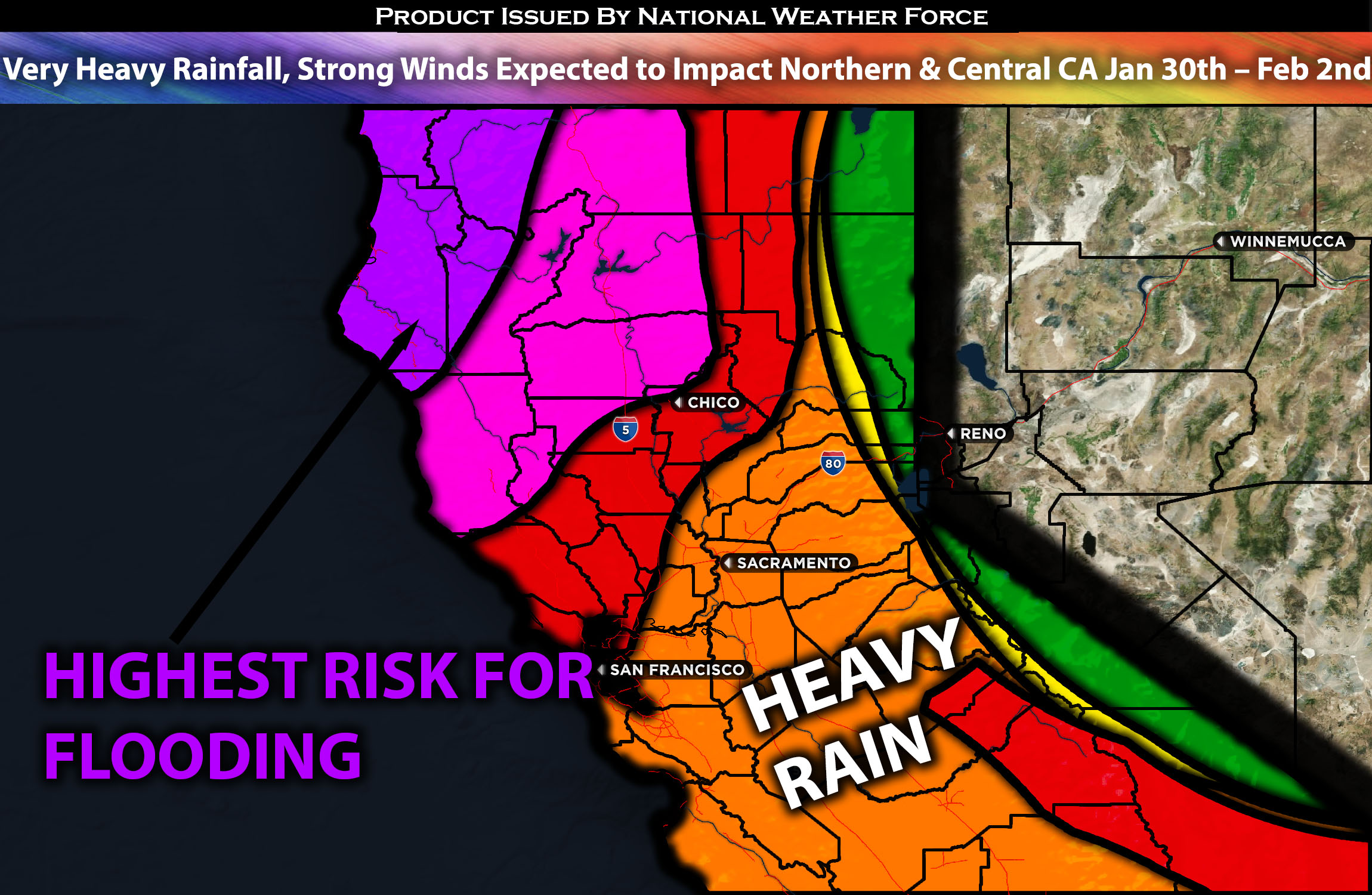
Across Northern & Central CA:
A very concentrated setup with a high risk for flooding is expected to impact the region. This is due to what meteorologists call a Pineapple Express setup, which is expected to slam into California, especially the northern part, starting tonight and continuing through at least Friday. More updates will be provided as we approach the next setup. This will create conditions for very heavy rainfall, locally strong gusty winds, and heavy snowfall in the mountains.
Overall Forecast:
In the mid/upper levels of the atmosphere, back-to-back troughs, which are expected to strengthen, are forecasted to impact Northern California. Multiple shortwave troughs, associated with and wrapped around the main troughs, will also affect the region. Simultaneously, the low-level jet stream, also wrapped around this system, will dip southward. At the surface, a cold front is expected to sweep through, bringing moisture ahead of it. Very deep moisture will be pushed into the region, resulting in multiple waves of very heavy rain and mountain snow across the region. Due to the cold front’s prime nature, convective activity, including potential thunderstorms, will be embedded, especially ahead of the front where the most significant lift is anticipated.
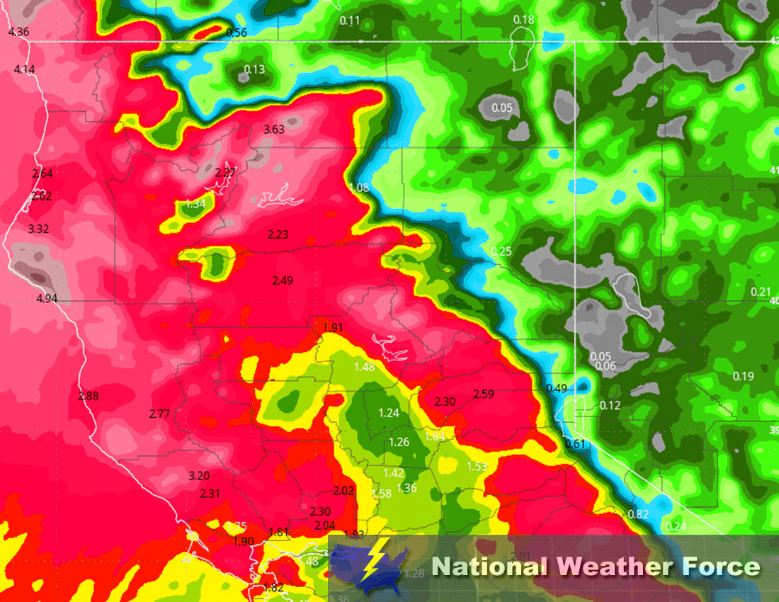
Timing & Impact: Scattered showers, along with heavier bands of rain, are expected after 9pm. This will intensify as increasing amounts of moisture are pushed into the area by the incoming system. Subsequently, widespread heavy rain will persist throughout the Wednesday morning commute and into the afternoon, with embedded thunderstorms possible west of the mountains, including in metropolitan areas. Widespread moderate to heavy rain will continue at least until Thursday morning before tapering off and becoming more scattered. The remaining moisture behind the front will be capable of producing additional scattered showers through Friday.
Approximate Rainfall Totals (in inches):
Main impact: heavy rain leading to potential flooding, CG lightning with any thunderstorms, and gusty winds.
Stay tuned for more updates.
Sina⚡⚡
With over a decade of experience in forecasting severe thunderstorms, this individual is a seasoned forecaster and developer. Their expertise in severe weather forecasting and computer science is entirely self-taught, complemented by a foundation in Atmospheric Science from UNCO and an IT background from WGU. They have dedicated their efforts to developing innovative tools that enhance the accuracy of analyzing large hail and tornadoes. As a significant contributor to National Weather Force & Southern California Weather Force, they have played a crucial role in providing accurate and timely information, as well as developing tools to keep those affected well-informed.