
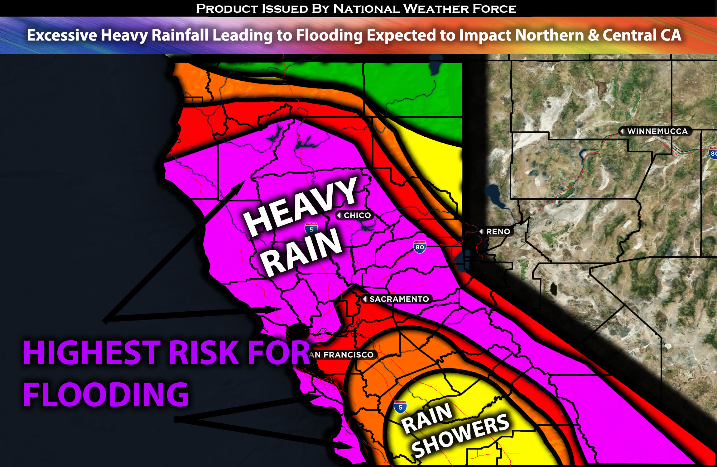
 Across Northern & Central CA:
A powerful atmospheric river setup is expected with multiple waves of heavy rainfall and strong gusty winds, leading to potential major flooding, damage to property, trees, and much more, from Saturday night through at least Tuesday. Given the combination of ingredients, a very potent situation is expected with impacts across all of California. For more details on the forecast, please check below. For more details on the forecast please check below.
Overall Forecast:
In the mid/upper levels of the atmosphere, a powerful setup is anticipated with a bomb cyclone (a weather term for quickly intensifying low pressure) expected to slowly move over central California. Simultaneously, at the surface, a warm front is expected to push through much of California, with a cold front closely following. Concurrently, a surge of very deep moisture, trapped between two high-pressure systems, will slam into California as an atmospheric river from Saturday through Tuesday night. As a result, very heavy rainfall is expected across the entire region of California, especially in the central and southern parts, with Northern California also receiving a significant amount. There will also be strong gusty winds, which may bring down some trees and power lines. This will result in major flooding in some areas, along with other issues such as mudslides, landslides, river flooding, power outages, and much more. There will also be heavy mountain snow, especially over the Sierra Nevada mountains, with several feet of snow expected above 5,000-6,000 feet. Due to the nature of the low pressure, the low-level jet will also affect the region.
Timing & Impact: The first wave of heavy rainfall, featuring widespread precipitation, is expected from 9 to 11 pm Saturday, coming from the south-southwest and becoming very heavy at times. Embedded thunderstorms are expected through at least Sunday morning, spreading from south to north across central and northern California. Then, the second wave of storms is expected to continue through Sunday, becoming more scattered through Monday, with isolated thunderstorms here and there before the front pushes through by Tuesday. The strongest winds are expected on Saturday evening, continuing throughout Sunday before decreasing in strength by midnight on Sunday. Winds will still be gusty throughout Monday but less significant. Check the maps for rainfall, wind gusts, and snowfall below.
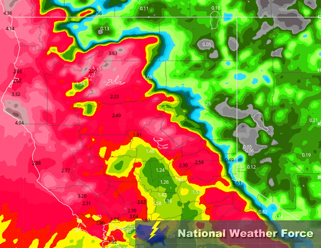
Approximate Rainfall Totals (in inches):
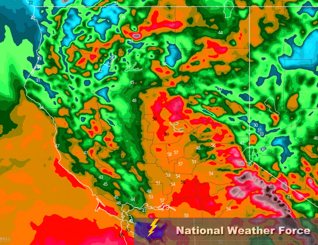
Approximate Snowfall Totals (in inches):
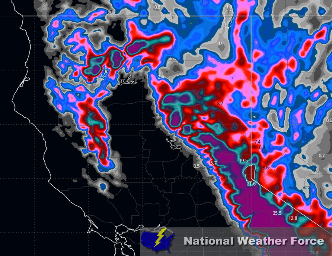
Approximate Maximum Wind Gusts (MPH):
Main impact: heavy rain leading to potential major flooding, CG lightning with any thunderstorms, strong gusty winds, and mountain heavy snowfall.
Stay tuned for more updates.
Sina⚡⚡
With over a decade of experience in forecasting severe thunderstorms, this individual is a seasoned forecaster and developer. Their expertise in severe weather forecasting and computer science is entirely self-taught, complemented by a foundation in Atmospheric Science from UNCO and an IT background from WGU. They have dedicated their efforts to developing innovative tools that enhance the accuracy of analyzing large hail and tornadoes. As a significant contributor to National Weather Force & Southern California Weather Force, they have played a crucial role in providing accurate and timely information, as well as developing tools to keep those affected well-informed.