
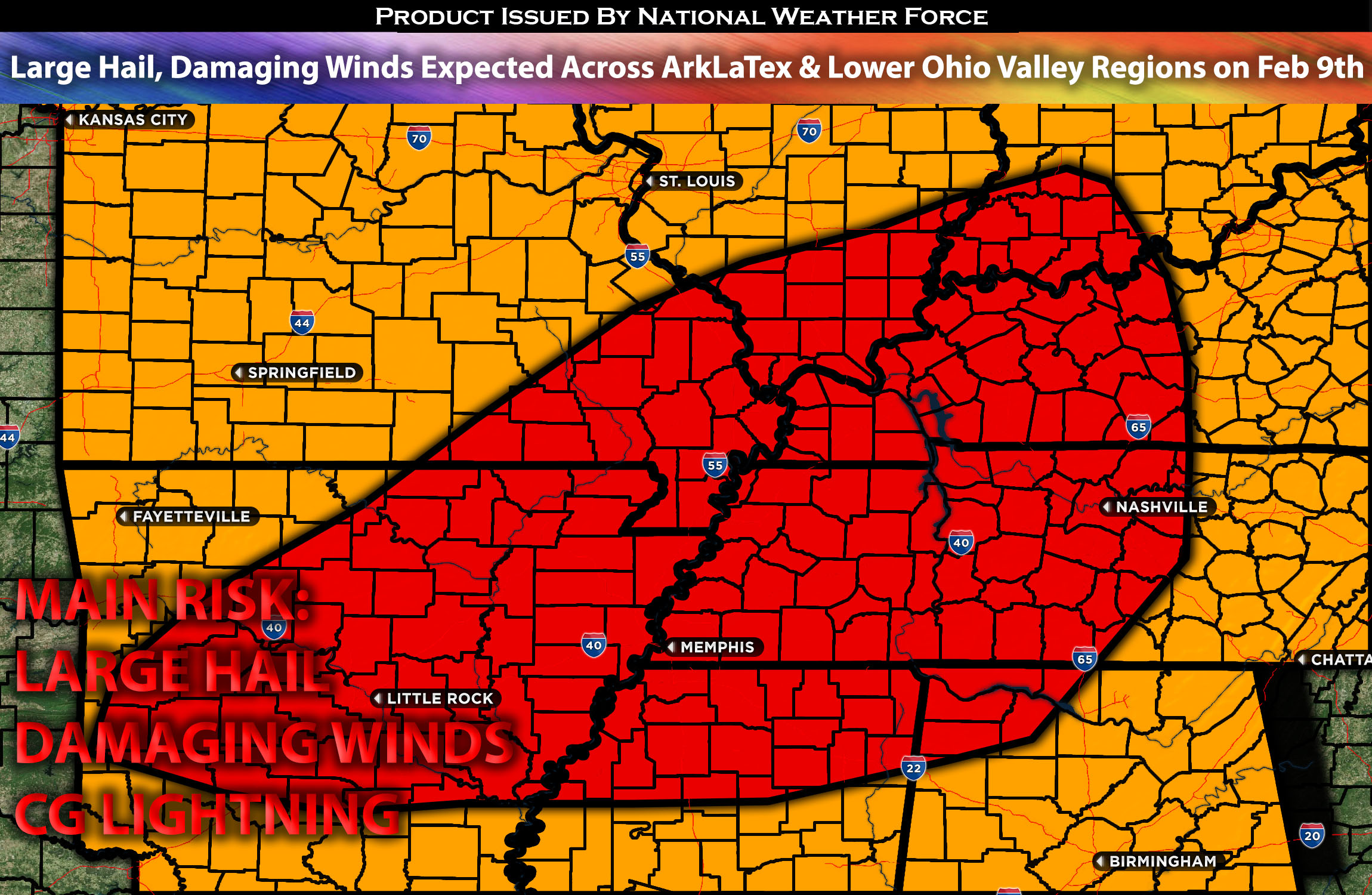
Outlook for ArkLaTex Through Portions of the Lower Ohio Valley:
A limited but notable setup primarily for large hail and damaging winds is anticipated across the ArkLaTex Region through the lower Ohio Valley later this evening through the overnight hours pushing eastward. These storms will develop similarly to a summer setup although later in the d day, becoming severe quickly, with large hail as the main risk given the conditions. After merging, they will primarily pose a damaging wind threat overnight. For more details on the forecast, please check below.
Main impact: large hail, damaging winds, very low risk for an isolated tornado, and CG lightning.
Approximate Timing: Expected to form around the late evening mainly pushing north eastward through the impacted regions into the overnight hours and early morning hours of Saturday.
Overall Forecast: In the mid/upper levels of the atmosphere, a southwesterly mid/high-level flow, combined with a shortwave trough over the south-central High Plains, will continue northeastward as it slowly weakens. At the surface, a boundary will sweep across the region, bringing somewhat elevated warm air advection ahead of it. Dew points are anticipated to reach the low 60s across the impacted regions. This, combined with somewhat elevated instability (CAPE values mainly in the mid to upper hundreds) and elevated effective shear, will enable the formation of some storms in the ArkLaTex area and across Arkansas. The main risks from these storms include large hail and potentially damaging winds, especially given the downward instability values mainly in the late evening through the overnight hours. Due to the lack of low-level shear, the risk for isolated tornadoes will be very low, so the primary concerns with these cells will be large hail and damaging winds.
Timing & Impact: The atmosphere is expected to destabilize late Friday evening, between 5-8pm CST, across the ArkLaTex region, extending through Arkansas and into the lower Ohio Valley regions. These storms will continue to move northeastward, strengthening quickly, with mainly large hail and damaging winds being the primary threats across the area. Multiple lines of somewhat organized storms will continue to form and push across the regions of Tennessee, Kentucky, and into portions of southern Indiana, moving east northeastward throughout the overnight and into the morning hours of Saturday.
Stay tuned for more updates.
Sina⚡⚡
With over a decade of experience in forecasting severe thunderstorms, this individual is a seasoned forecaster and developer. Their expertise in severe weather forecasting and computer science is entirely self-taught, complemented by a foundation in Atmospheric Science from UNCO and an IT background from WGU. They have dedicated their efforts to developing innovative tools that enhance the accuracy of analyzing large hail and tornadoes. As a significant contributor to National Weather Force & Southern California Weather Force, they have played a crucial role in providing accurate and timely information, as well as developing tools to keep those affected well-informed.