
 Outlook for Central TX and Eastern TX Overnight:
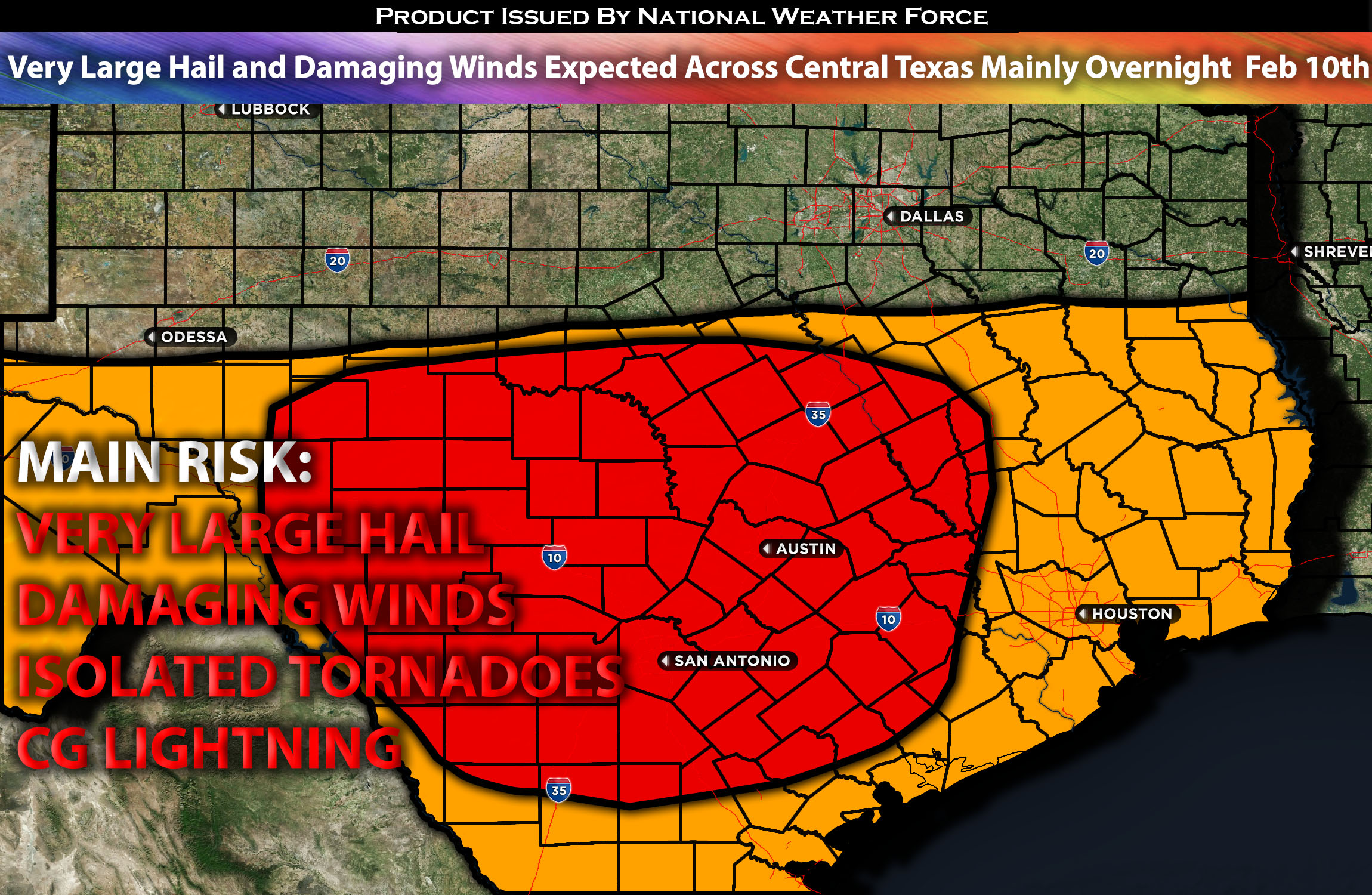
A slightly more interesting setup unfolds as the system that previously brought havoc across California moves from the southwest into Texas. As it does so, it will bring the risk of severe storms capable of producing large to very large hail in some cells and damaging winds, especially overnight Saturday into Sunday morning. Additionally, a few isolated tornadoes may be possible during this evening’s hours. For more details on the forecast, please check below.
Main impact: large to very hail, damaging winds, isolated tornadoes possible, and CG lightning.
Approximate Timing: Expected to form around the late evening mainly pushing eastward through the impacted regions into the overnight hours and early morning hours of Sunday.
Overall Forecast: Across the mid/upper levels of the atmosphere, a trough is expected to move from the southwest into the western Texas area by late tonight. At the same time, a jet stream with a speed maximum will eject northeastward across Texas and eventually into the Southern Tennessee Valley. At the surface, a surface low with a front is expected to move into the central Texas region and stall, with warm air advection ahead of it. Storms are already expected across the area on the cooler side of the front, with more convective activity anticipated to form later this evening and through the overnight hours ahead of the front. Additionally, steeper mid-level lapse rates with elevated instability across the region will allow for a cluster of storms to form, capable of producing large hail, damaging winds, and perhaps a few isolated tornadoes, given the somewhat elevated low-level shear. The main risk appears to be very large hail, up to 2.5 inches or more, and damaging winds as these storms collide overnight.
Timing & Impact: The atmosphere is expected to destabilize later Saturday evening, especially overnight, between 5-10pm CST. Storms are first expected to form across western portions of Texas and will immediately undergo rapid strengthening, becoming severe as they push eastward ahead of the front through central Texas. Initially, these storms will be clustered and discrete, which will present the highest risk for large to very large hail across central Texas. Before merging and forming a line as they move towards eastern portions of Texas, they will primarily become a damaging wind threat at that point.
Stay tuned for more updates.