
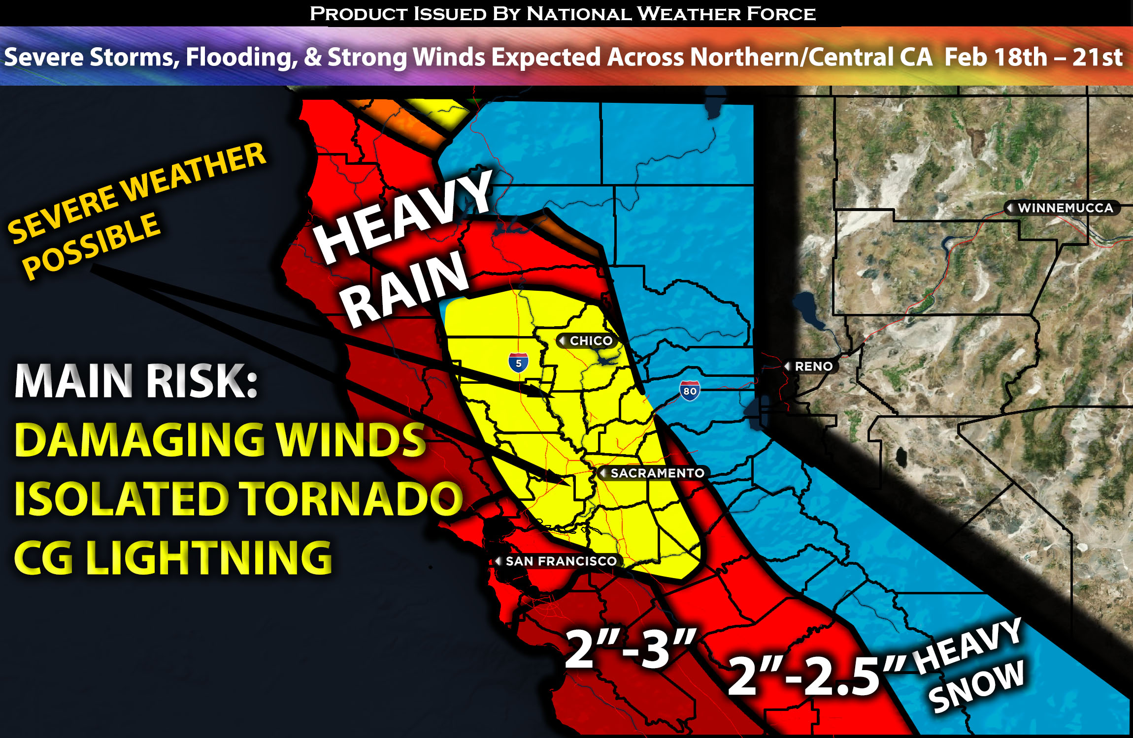
 Across Northern and Central CA:
A significant weather system is expected to impact northern and central California early this week, with ongoing showers already today. The system’s main effects will be felt from Sunday through Wednesday of next week. This system will not only bring significant precipitation but also poses the risk of strong to severe thunderstorms, scattered and embedded, especially on Monday. Additionally, significant snowfall is expected in the mountains, with several feet of snow anticipated. Check overall forecast’s for further specific details on the forecast.
Overall Forecast:
In the atmosphere over northern and central California, an approaching powerful closed low-pressure system is expected to impact the region, bringing very significant moisture and various weather types. At the same time, at the surface, a deepening low-pressure system with a cold front is approaching from the west. Ahead of that front, warm air advection will combine with instability and elevated shear. Additionally, with the low-level jet stream over the region creating spin, scattered thunderstorms are expected on Monday. Some areas may experience severe storms capable of producing isolated tornadoes, waterspouts, and damaging winds. Additionally, significant precipitation is expected to fall for multiple days, with flooding anticipated in low-lying areas, streets, and other flood-prone regions. Flooding will also be likely elsewhere given the rate of rainfall. Strong winds will also be another risk with wind gusts expected to be around 30-45mph locally gusting over 50mph on Sunday evening through Sunday night and into Monday morning. Above 6,000 feet, 1-2 feet of snow is expected, with 2-5 feet of snow above 7,000 feet, especially from Sunday evening through Wednesday morning before tapering off as the system exits. For more updates on the hourly forecast and further details on the timing, check below.
Timing & Impact: Moisture ahead of the system is already moving into the regions of northern and central California, bringing rain showers, a few of which may be heavy at times tonight. Then, as the cold front approaches—while still far out—and more deep moisture begins to advect across the area, very heavy rain will move in from west to east. Coverage will increase across the Bay Area, extending northward and southward into central California through Sunday morning. There will be only lingering showers around Sunday from 1-10 am before the main wave of storms begins moving into northern and central California from west to east. This time, the rain will be much heavier and more widespread, with embedded thunderstorms also possible. Then, on Monday around noon, ahead of the front, warm air advection combined with cool air aloft behind the front will create lift. This, combined with effective shear, a low-level jet, and elevated instability, will allow for scattered thunderstorms, a few of which may be strong to severe, especially in the valleys of northern California. These storms will be capable of producing a brief tornado and damaging winds through Monday night. Then, a few more rounds of showers are expected through Tuesday and into Tuesday night, with lingering moisture, before the system completely pushes out. Snowfall in the mountains is expected from Sunday evening onwards, with periods of continuous snowfall through Wednesday morning. Check below for maps for rainfall, snowfall and potential wind gusts.
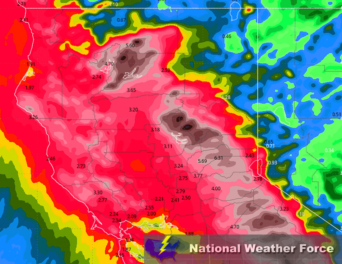
Approximate Rainfall Totals (in inches):
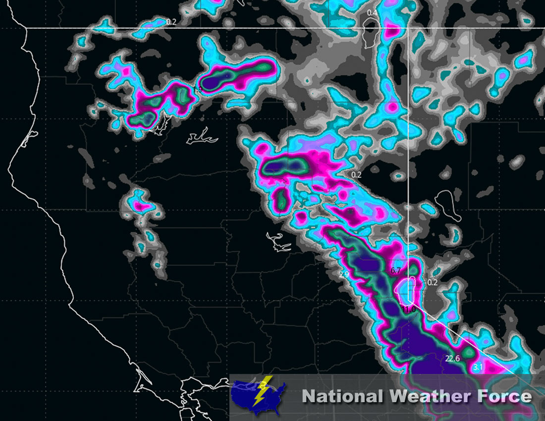
Approximate Snowfall Totals (in inches):
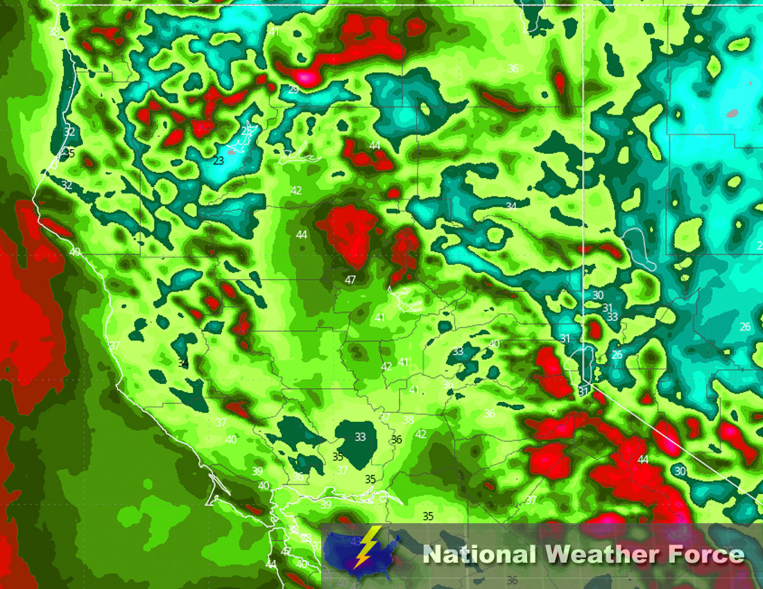
Approximate Maximum Wind Gusts (MPH):
Main impact: moderate to heavy rainfall leading to potential flooding, strong winds, heavy mountain snow, brief tornado possible.
Stay tuned for more updates.
Sina⚡⚡
With over a decade of experience in forecasting severe thunderstorms, this individual is a seasoned forecaster and developer. Their expertise in severe weather forecasting and computer science is entirely self-taught, complemented by a foundation in Atmospheric Science from UNCO and an IT background from WGU. They have dedicated their efforts to developing innovative tools that enhance the accuracy of analyzing large hail and tornadoes. As a significant contributor to National Weather Force & Southern California Weather Force, they have played a crucial role in providing accurate and timely information, as well as developing tools to keep those affected well-informed.