
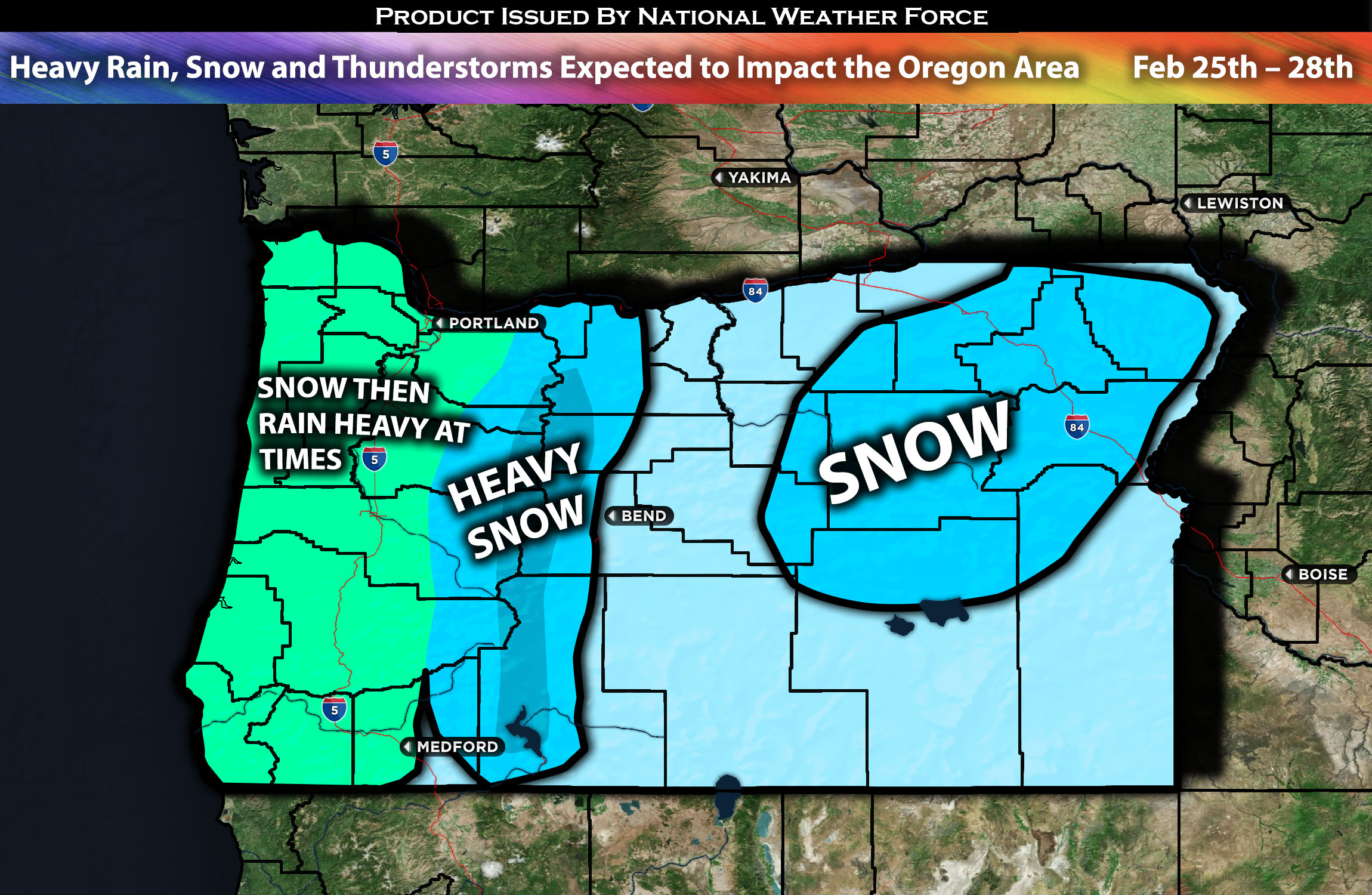
 Across the Oregon Area:
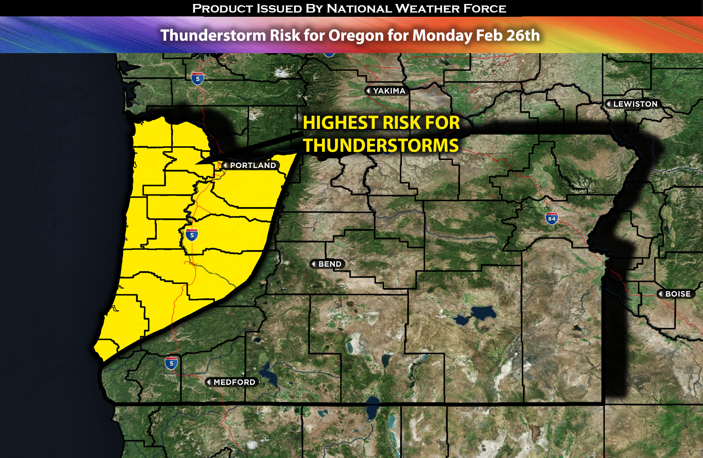
As the system moves in, rain showers and primarily mountain snow are expected to sweep through the region. There will also be the potential for lower elevation snowfall, as discussed earlier. The rain will be heavy at times, especially closer to the coastal regions of Oregon. Then, behind the front, cold air aloft combined with elevated instability will bring widespread showers and thunderstorms on Monday, capable of producing hail or graupel across the entire region west of the mountains. Check below for maps of rainfall, snowfall, and potential wind gusts. Check overall forecast’s for further specific details on the forecast.
Overall Forecast:
In the upper levels of the atmosphere over Portland, a trough is expected to approach, dipping down off the coast. At the same time a cold front is expected to sweep through from the northwest towards the southeast. Starting Sunday night, colder air will come in, making it cooler this week. There’s a good chance of snow in mountain areas like the Cascades and nearby hills above 1000 feet. Due to significant incoming moisture, substantial snow accumulation is possible, especially in the mountains, where some areas might receive over a foot of snow. If you live in the Coast Range or Willapa Hills above 1000 feet, expect 2-5 inches of snow early on. Additionally, strong winds may reduce visibility due to blowing snow.
On Monday, expect on-and-off rain and snow if you’re above 1000 feet. The weather could get stormy by Monday afternoon, with thunderstorms possible even in lower areas. These storms might bring small hail or soft hail known as graupel. By the end of Monday night, the risk for storm development will decrease as more stable air moves in followed by snow then rain showers some heavy at times on Tuesday. For more updates on the hourly forecast and further details on the timing, check below.
Timing & Impact: As the system pushes in, rain showers with mainly mountain snow is expected to sweep through the region on Saturday night. There will also be the potential for lower elevation snowfall as discussed earlier. The rain will be heavy at times especially the closer you are to the coast regions of OR. Then behind the front cold air aloft combined with elevated instability will bring widespread showers and thunderstorms on Monday capable of producing hail/grapple across the entire region west of the Mountains. Then snow expected on Tuesday before it all turns into rain after the morning hours with snow levels rising to 1500ft higher. Check below for maps for rainfall, snowfall and potential wind gusts.
Thunderstorm Risk Outlook:
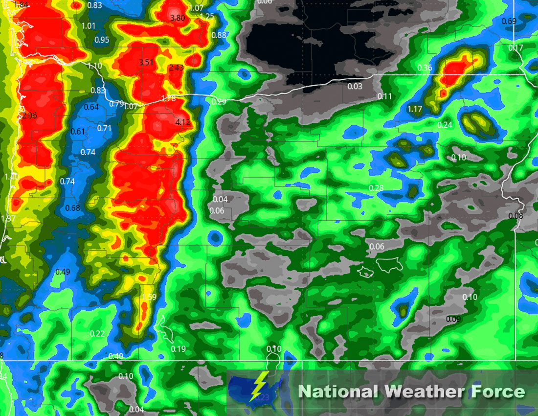
Approximate Rainfall Totals (in inches):
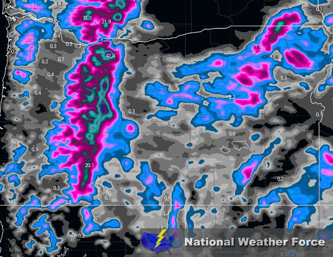
Approximate Snowfall Totals (in inches):
Main impact: moderate to heavy rainfall, heavy mountain snow, and small hail/grapple.
Stay tuned for more updates.
Sina⚡⚡
With over a decade of experience in forecasting severe thunderstorms, this individual is a seasoned forecaster and developer. Their expertise in severe weather forecasting and computer science is entirely self-taught, complemented by a foundation in Atmospheric Science from UNCO and an IT background from WGU. They have dedicated their efforts to developing innovative tools that enhance the accuracy of analyzing large hail and tornadoes. As a significant contributor to National Weather Force & Southern California Weather Force, they have played a crucial role in providing accurate and timely information, as well as developing tools to keep those affected well-informed.