
Outlook for the Plains Stretching to Mid-Mississippi Valley Area:
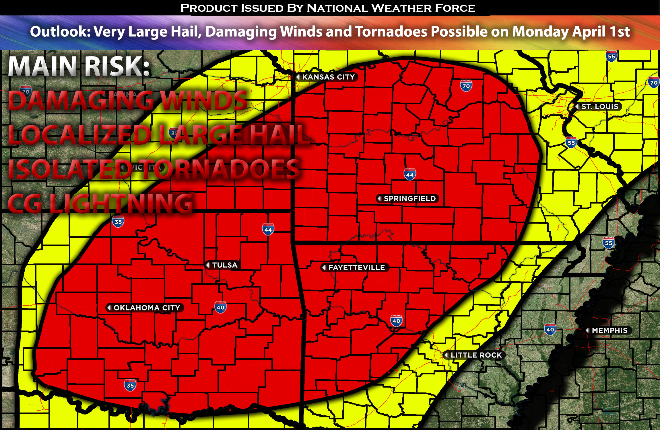
On Monday and Monday night, a broad severe weather threat is anticipated, stretching from the southern Plains northeastward into the mid-Mississippi Valley. All types of severe weather hazards, such as large hail, wind damage, and tornadoes, are possible. The severe weather risk is also expected to extend into parts of the Ohio Valley Monday night. For preliminary forecast check below for details.
Preliminary Outlook:
On Monday, a positively tilted upper-level trough will traverse the western U.S., accompanied by a 100-knot mid-level jet moving northeastward ahead of it. This jet will bolster a very strong wind field over a moist and unstable air mass throughout the day. At ground level, a cold front moving southward into central Oklahoma and extending northeastward into north-central Missouri is likely to trigger widespread convective initiation in the afternoon, driven by surface heating and low-level convergence near the front. With surface dewpoints in the mid to upper 60s F, a moderately unstable air mass will develop across most areas by the afternoon, especially from north Texas northeastward into the mid-Mississippi Valley, where an MCS (Mesoscale Convective System) is anticipated during the afternoon and evening hours.
Evening/night soundings along and near the instability axis on Monday indicate very strong deep-layer shear, expected to reach 60 to 70 knots as the mid-level jet’s nose moves over the warm sector, promoting strong large-scale ascent over a wide area. This dynamic will likely support a widespread severe threat, with storms increasing rapidly in coverage during the afternoon and likely producing wind damage, large hail, and tornadoes. The greatest tornado risk may coincide with a surface boundary extending eastward from a surface low across central and eastern Missouri, where surface winds will be locally backed. The steepest lapse rates are expected in central and eastern Oklahoma, raising the possibility of very large hail with the most intense supercells. The developing MCS, moving eastward toward the mid-Mississippi Valley in the early to mid-evening, is also expected to present a widespread wind-damage threat through a combination of supercells and multicell line segments. This severe threat should persist through much of the overnight hours.
Potential risk: large hail, damaging straight-line winds, tornadoes possible.
Stay tuned for the next update, which will provide timing details, more specific information on impacted locations, and threats for specific micro-zones in the coming day.
Sina⚡⚡
With over a decade of experience in forecasting severe thunderstorms, this individual is a seasoned forecaster and developer. Their expertise in severe weather forecasting and computer science is entirely self-taught, complemented by a foundation in Atmospheric Science from UNCO and an IT background from WGU. They have dedicated their efforts to developing innovative tools that enhance the accuracy of analyzing large hail and tornadoes. As a significant contributor to National Weather Force & Southern California Weather Force, they have played a crucial role in providing accurate and timely information, as well as developing tools to keep those affected well-informed.