
Outlook for the Midwest:
On Sunday through Sunday evening, a marginal severe weather threat is anticipated, mainly featuring large hail and potentially a few damaging gusts perhaps an isolated tornado. This threat is primarily expected to affect areas from northern Missouri and central Illinois across central Indiana to far western Ohio.
Overall Forecast:
A significant upper trough with a positive tilt will cover a large part of the West, alongside a wide swath of strong southwest airflow aloft throughout much of the Midwest. This movement will lead to gradual atmospheric pressure height increases over the Ohio Valleys, even as mid-level temperatures stay cool, producing steep lapse rates. Surface conditions will see low pressure intensifying over the central High Plains, with a warm front stretching eastward across Illinois and Indiana, reaching into northern Kentucky by the evening. This setup will facilitate a broad influx of southerly winds, warming the area south of the warm front and bringing dewpoints back to near 60°F.
Such conditions are conducive to the development of early to midday thunderstorms over northern Missouri and surrounding areas, positioned at the forefront of a low-level jet stream where elevated instability is likely. Weather soundings indicate the presence of moisture under steep mid-level lapse rates. With an effective shear of 40 knots, there is a potential for large hail and damaging winds from any developing storm cells in the region.
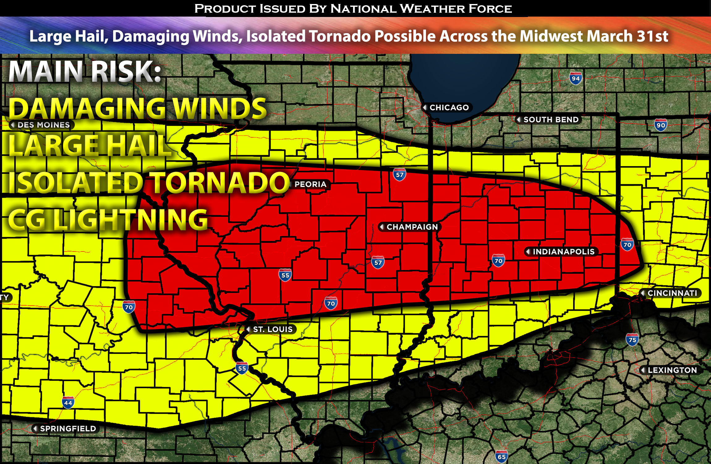
Impact:
Destabilization is anticipated to occur around 3pm CDT or earlier, with storms expected to form and scatter across the impacted area, moving quickly eastward. More scattered activity is anticipated throughout the evening across Illinois and neighboring states as well. These storms will be capable of producing large hail, damaging winds, and perhaps an isolated tornado. Storms will diminish overnight.
Main impact: large hail, damaging winds, isolated tornado possible and CG lightning.
Approximate Timing: Destabilization is anticipated to occur around 3pm CDT or earlier, with storms expected to form and scatter across the impacted area, moving quickly eastward. More scattered activity is anticipated throughout the evening across Illinois and neighboring states as well. These storms will be capable of producing large hail, damaging winds, and perhaps an isolated tornado.
Locations Impacted: northern MO, central IL, portions of central IN and OH.
Stay tuned for more updates.
Sina⚡⚡
With over a decade of experience in forecasting severe thunderstorms, this individual is a seasoned forecaster and developer. Their expertise in severe weather forecasting and computer science is entirely self-taught, complemented by a foundation in Atmospheric Science from UNCO and an IT background from WGU. They have dedicated their efforts to developing innovative tools that enhance the accuracy of analyzing large hail and tornadoes. As a significant contributor to National Weather Force & Southern California Weather Force, they have played a crucial role in providing accurate and timely information, as well as developing tools to keep those affected well-informed.