
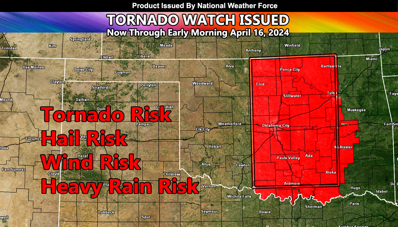
National Weather Force has issued a Tornado Watch effective now through early Tuesday morning, April 16, 2024
Zones: Mostly Central half of Oklahoma, right down I-35.
Discussion: A dryline evident across West-Central Texas is slowly moving to the east through West-Central Oklahoma. An upper-level system ejecting out of the Rocky Mountain Zones tonight with it will be the focus spot for rapid thunderstorm development along I-44 right into the Oklahoma City Metro Zones.
Best Chance of severe thunderstorms will be Oklahoma City southward through Southern Oklahoma and east from there for another 75 to 100 miles eastward as the early morning moves along. This is a night-time event, so take precautions as tornadoes are the most dangerous at night.
In addition to the tornado threat, large hail and damaging winds will also be likely.
A Tornado Watch issued here at National Weather Force means that severe thunderstorms are 100%, and a chance of tornadoes is there as well.
– Raiden Storm –
https://www.nationalweatherforce.com
Master General Meteorologist – is the owner and CEO of National Weather Force and is the only one authorized to issue weather watches here such as thunderstorm, tornado, hurricane, and severe. A consulting meteorologist with over 26 years’ experience for over 50 companies, including energy, agriculture, aviation, marine, leisure, and many more areas. He has certs from Mississippi State for broadcast met and Penn State forecasting certs MET 101, 241, 341 and 361 as a meteorologist, but before t