
 Outlook:
Severe storms are highly likely in multiple rounds from portions of the Southern Plains into parts of the Upper Mississippi Valley from Sunday through Sunday night. The main risks associated with these storms will be damaging winds, hail, and a few tornadoes.
Overall Forecast:
During the morning, broad upward motion within a large warm sector characterized by mid to upper 60s F surface dewpoints is expected to sustain one or more clusters of strong to severe storms across the Mississippi Valley, eastern Oklahoma, Kansas, and northeast Texas. Most projections anticipate a decrease in severe storm activity through the morning due to a lack of critical storm-fueling ingredients. The primary risk is projected to be isolated damaging winds, facilitated by deep meridional shear profiles and limited buoyancy within these persisting morning storms.
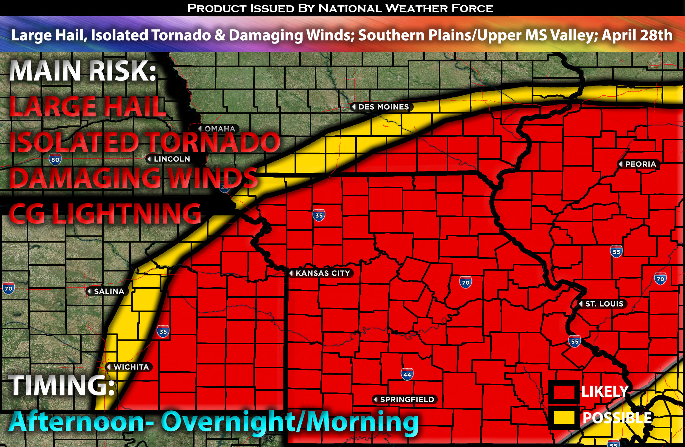
Across NE, KS, MS and IA:
Later, isolated storm redevelopment is possible near the surface low, ahead of the dryline across eastern Nebraska, Kansas, northwest Missouri, and southern Iowa. This could potentially lead to the formation of a few supercells capable of producing all hazard types. However, the probability of such events is uncertain, as extensive cloud cover and convection could inhibit sufficient warming.
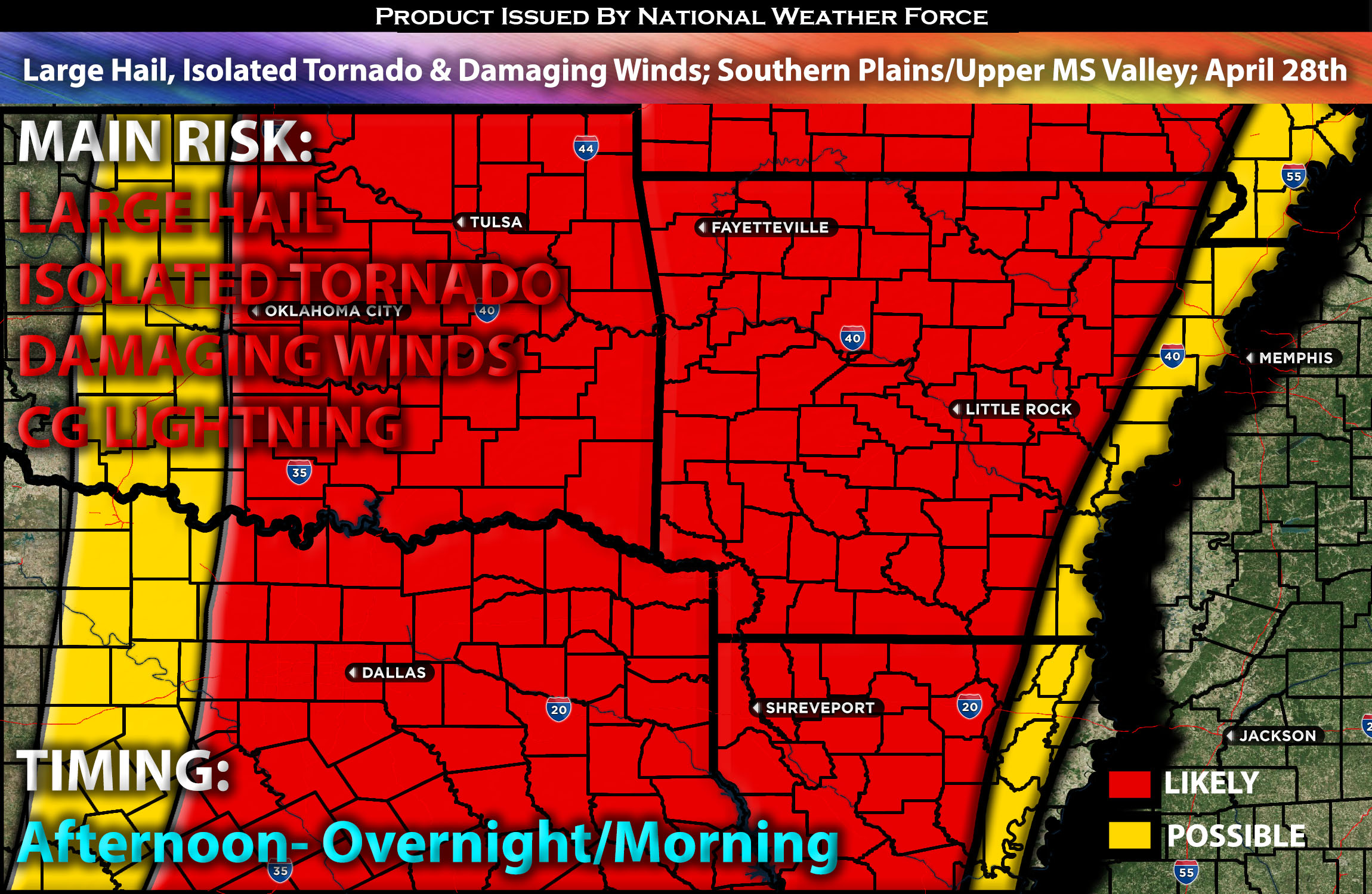
 Across the Southern Plains:
In northeast Texas, eastern Oklahoma, and western Arkansas, storm redevelopment behind the initial line is likely from early to mid-afternoon as the main trough moves northeast. Persistent low-level warm advection is expected to sustain weak uplift across the warm sector and along the dryline. A very moist and deep boundary layer with upper 60s dewpoints will promote significant instability, though modest mid-level lapse rates and broad, weak ascent, in conjunction with predominantly meridional shear, may lead to a gradual evolution of storms into clusters and line segments. Nonetheless, strong low-level shear could enhance storm-scale rotation within semi-discrete convection, increasing the potential for large hail and a few tornadoes. As the day progresses, these storms may merge into linear clusters by late afternoon and evening, with damaging winds and isolated tornadoes posing ongoing threats as these clusters progress eastward into the Mississippi Valley, potentially persisting into early Monday morning.
Main Risk: large hail, tornadoes, damaging winds and CG lightning (cloud to ground).
Approximate Timing: Multiple clusters of strong to severe storms are anticipated early in the day over the Mississippi Valley, extending into eastern Oklahoma, Kansas, and northeast Texas. These storms are expected to persist into the morning, primarily posing a threat of isolated damaging winds. Later, there is potential for additional isolated storms to develop ahead of the dryline in parts of eastern Nebraska, Kansas, northwest Missouri, northwest Arkansas, and southern Iowa, closer to the surface low during the afternoon and evening. This activity may give rise to a few supercells capable of producing all types of severe weather hazards.
Stay tuned for more updates.
Sina⚡⚡
With over a decade of experience in forecasting severe thunderstorms, this individual is a seasoned forecaster and developer. Their expertise in severe weather forecasting and computer science is entirely self-taught, complemented by a foundation in Atmospheric Science from UNCO and an IT background from WGU. They have dedicated their efforts to developing innovative tools that enhance the accuracy of analyzing large hail and tornadoes. As a significant contributor and partner at National Weather Force Innovations LLC, they have played a crucial role in providing accurate and timely information. Additionally, they have been instrumental in developing tools and organizing projects that focus on accuracy and performance, ensuring those affected are well-informed.