
 Outlook:
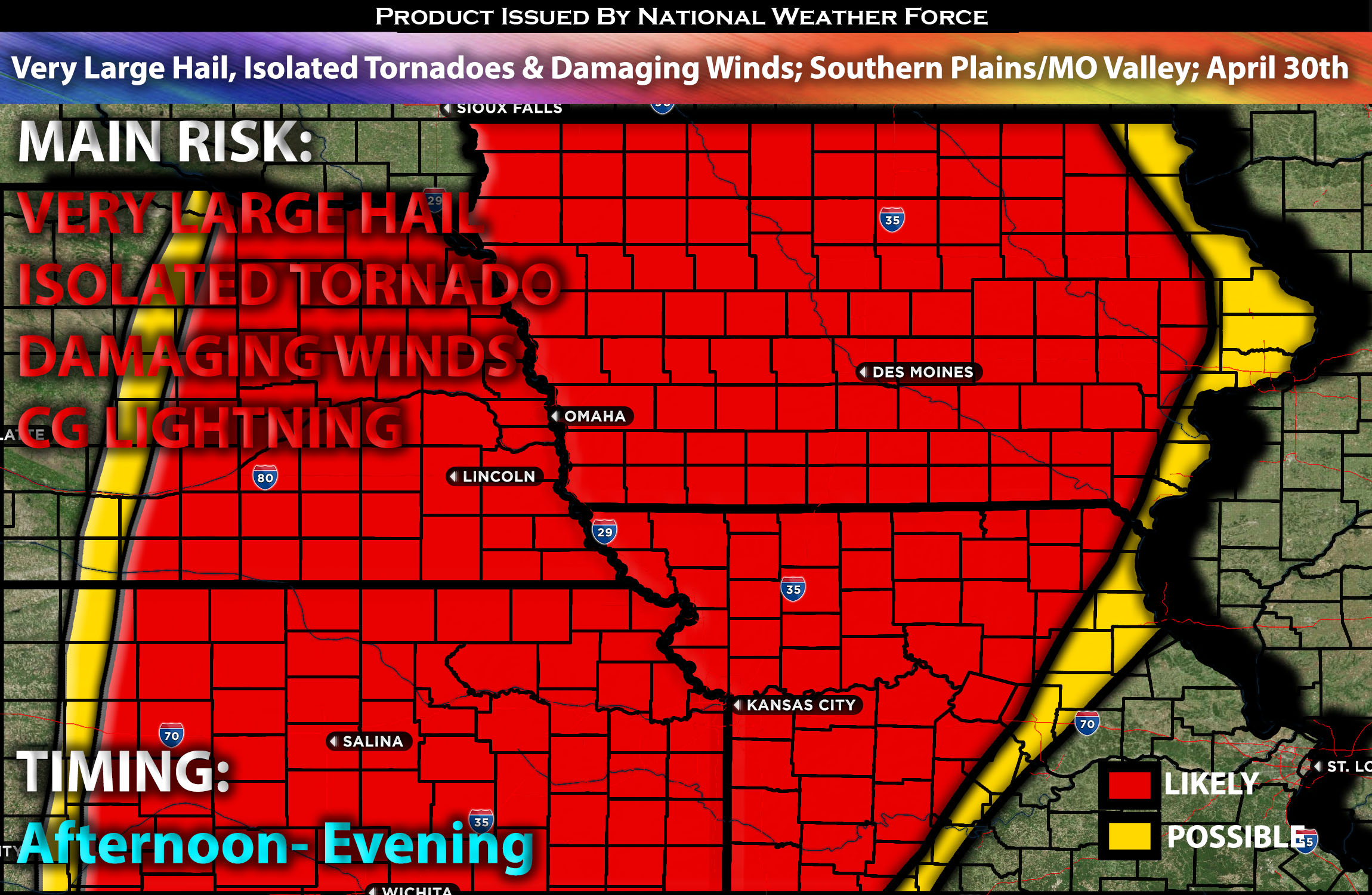
Severe storms are likely on Tuesday across parts of the Missouri Valley and into the southern Plains. The primary threats are expected to be very large hail and damaging winds, with the possibility of isolated embedded tornadoes due to the limited potential for discrete storm modes. Check below for the details on timing, impact and much more.
Overall Forecast:
An upper-level low is expected to be positioned over British Columbia by Tuesday morning. Concurrently, multiple shortwave troughs will introduce moderate mid-level flow across the affected region. At the surface, a weak cold front will precede these shortwaves, with significant consolidation of the low expected from the Mid Missouri Valley into the Upper Midwest during the afternoon and evening. The northern segment of this front near the surface low will progress eastward through the Upper Midwest into the overnight and early morning hours of Wednesday. However, the southern segment of the front will slow and eventually stall across Kansas, with potential for further surface cyclogenesis along the western end of this boundary over western Kansas, eastern Texas/Oklahoma Panhandles and vicinity area.
Across Mid MO Valley into Portions of the Plains:
Additionally, low-level moisture will quickly advect northward throughout the day ahead of the approaching shortwave trough and associated surface cold front. This modest low-level moisture, combined with modest daytime heating and steep mid-level lapse rates, will support moderate and efficient instability conducive to storm development. Storms are anticipated to initiate along the front during the afternoon, beginning across eastern South Dakota/southwestern Minnesota and extending southwestward across eastern Nebraska. Given the moderate buoyancy, vertical shear will be strong enough to support organized storm structures. Large to very large hail is likely with initial development before the storms quickly undergo upscale growth, transitioning to a more linear mode that favors strong damaging winds, with some gusts potentially reaching 75 mph. The tornado risk is likely to consist of embedded tornadoes, as maintaining a discrete mode will be challenging with rapid storm clustering into a line. The best chances for tornadoes will be in the evening when the low-level jet intensifies.
Main Risk: very large hail, tornadoes possible (mainly isolated embedded), damaging winds and CG lightning (cloud to ground).
Approximate Timing: Destabilization is expected to occur around late afternoon and continue through the evening. Storms are expected to form quickly and mature, mostly in a linear mode and clustering into a line. These storms will move eastward, with the most intense storm activity occurring in Iowa before eventually dissipating as they move southeastward into Missouri. Storms will also appear in parts of Kansas in a linear mode.
Stay tuned for more updates.
Sina⚡⚡
With over a decade of experience in forecasting severe thunderstorms, this individual is a seasoned forecaster and developer. Their expertise in severe weather forecasting and computer science is entirely self-taught, complemented by a foundation in Atmospheric Science from UNCO and an IT background from WGU. They have dedicated their efforts to developing innovative tools that enhance the accuracy of analyzing large hail and tornadoes. As a significant contributor and partner at National Weather Force Innovations LLC, they have played a crucial role in providing accurate and timely information. Additionally, they have been instrumental in developing tools and organizing projects that focus on accuracy and performance, ensuring those affected are well-informed.