
 Outlook:
Another severe weather outbreak is possible due to the ingredients and unstable airmass present across the Ohio Valley for Tuesday afternoon and evening. These storms will be capable of producing very large hail, and perhaps strong tornadoes, along with damaging winds. For detailed information on timing, impacts, and more, refer below.
Overall Forecast:
The same upper trough is set to progress northeastward across the mid/upper Mississippi Valley early on, with a 90+kt 500mb speed maximum shifting from northern Oklahoma into western Illinois by the afternoon, and then into extreme southwest Michigan by early evening. Simultaneously, a southwesterly Low-Level Jet (LLJ) will transition into Indiana by the afternoon and further into the mid-Ohio Valley by late afternoon. This development will facilitate increased moistening early in the timeframe, with buoyancy notably rising by midday within a strongly sheared environment over the region. This combination of ingredients creates ideal conditions for the formation of more widespread thunderstorms across the area.
Across the Ohio Valley & Upper Midwest:
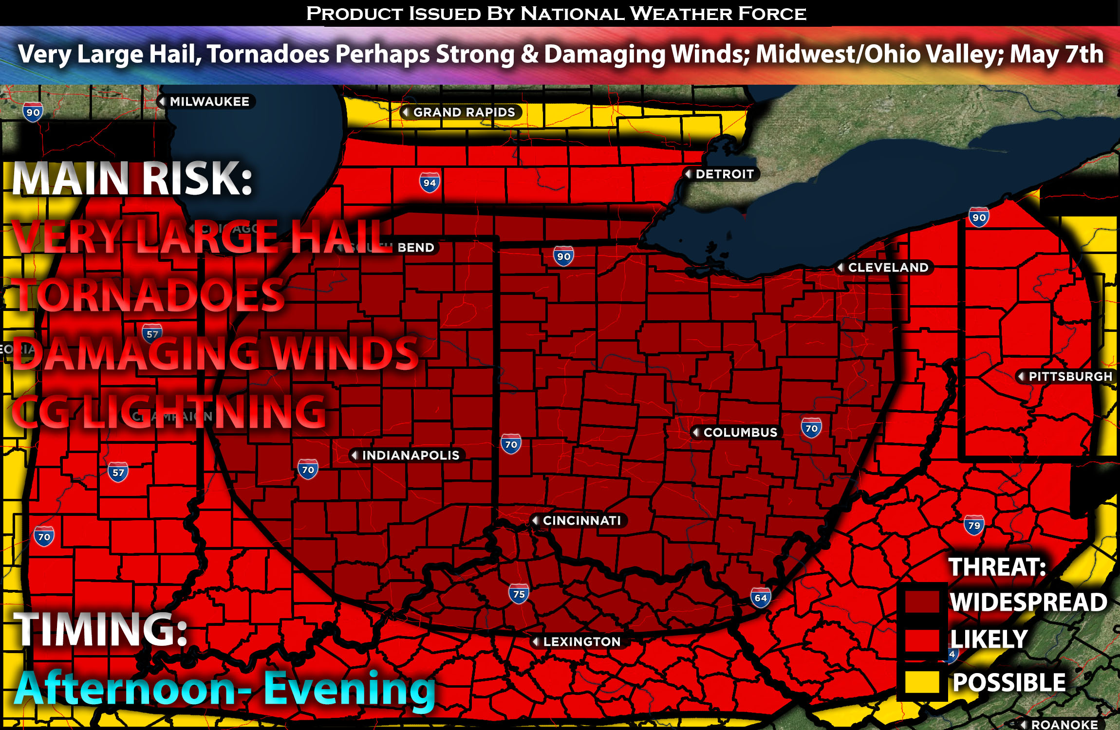
Warm air advection is expected over the Ohio Valley, accompanied by strong instability, deep effective layer shear, and low-level shear. These conditions will enable storms to potentially produce very large hail, damaging winds, and perhaps even strong tornadoes, given the dynamic interplay of shear dynamics.
Coverage Details:
Storms are expected to persist, with a line of storms continuing from the overnight hours, and additional cells anticipated to form across the unstable airmass in Indiana and Ohio. These storms will mature rapidly into powerful storms capable of all hazard types, including the potential for a strong tornado and very large hail, which is the main threat. The timing indicates that storms will continue throughout the morning, with the main activity expected in the afternoon and evening hours.
Future Radar Scenario:
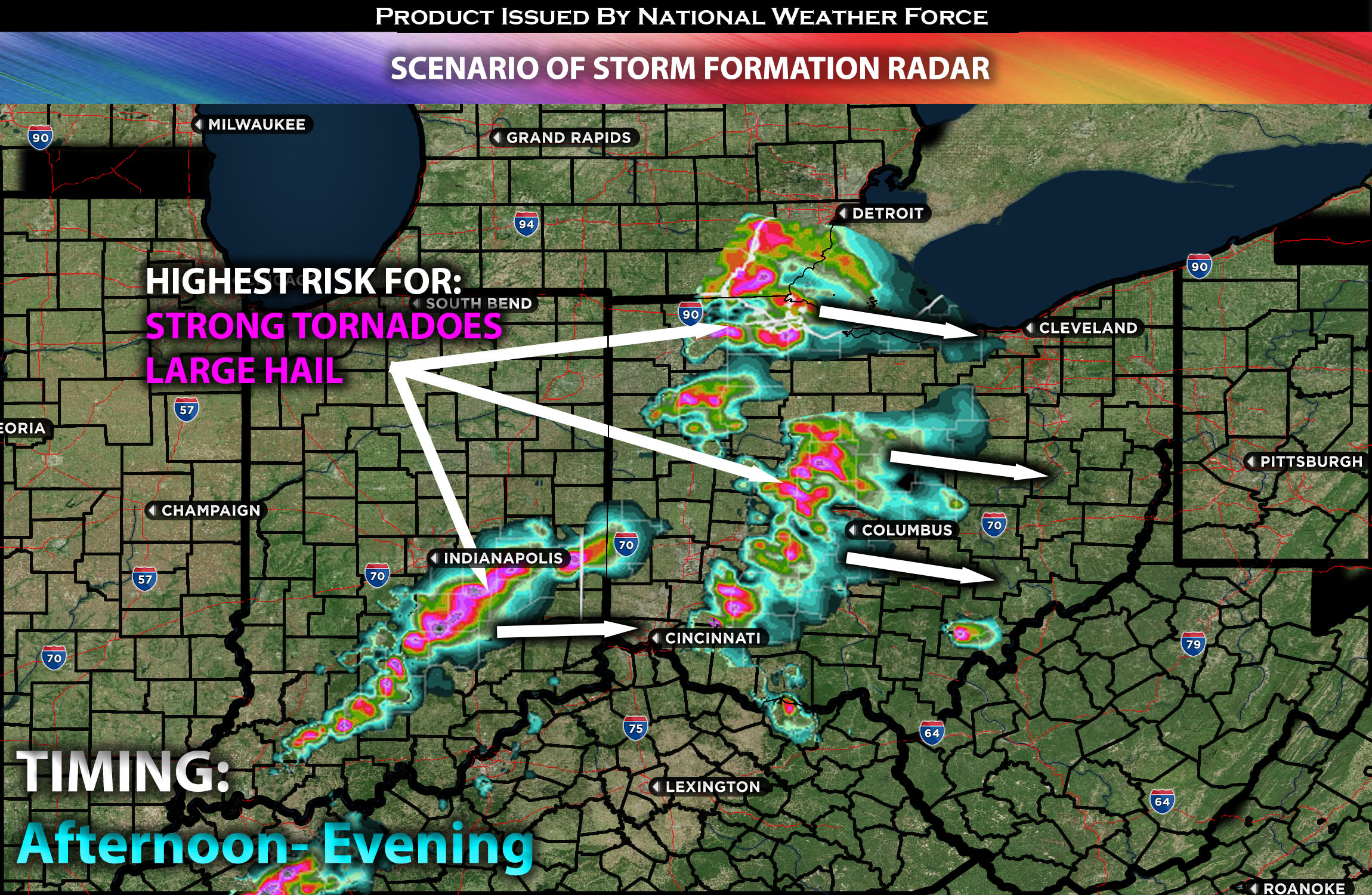 Main Risk: very large hail, tornadoes a few strong (if ingredients align), damaging winds and CG lightning (cloud to ground).
Stay tuned for more updates.
Sina⚡⚡
With over a decade of experience in forecasting severe thunderstorms, this individual is a seasoned forecaster and developer. Their expertise in severe weather forecasting and computer science is entirely self-taught, complemented by a foundation in Atmospheric Science from UNCO and an IT background from WGU. They have dedicated their efforts to developing innovative tools that enhance the accuracy of analyzing large hail and tornadoes. As a significant contributor and partner at National Weather Force Innovations LLC, they have played a crucial role in providing accurate and timely information. Additionally, they have been instrumental in developing tools and organizing projects that focus on accuracy and performance, ensuring those affected are well-informed.