

Outlook:
Clusters of severe storms are expected to occur in multiple rounds across the Deep South and into parts of the Southeast throughout the day and night hours of Thursday. These storms will be capable of producing damaging winds, sometimes exceeding 70 mph, and perhaps some large hail and tornadoes if a discrete mode can be sustained. Some of the tornadoes could be strong. For detailed information on timing, impacts, and more, refer below.
Overall Forecast:
Multiple rounds of clustered storms are expected to impact the Southeast and Deep South. Forecasts indicate that an ongoing Mesoscale Convective System (MCS) will persist into the overnight and early morning hours, with a trajectory set to move southeastward towards southeastern Georgia and far southern South Carolina by Thursday. This movement aligns with a shortwave impulse traversing the region, accompanied by 40 knots of mid-level and low-level southwesterly flow over a highly moist air mass.
Across the Deep South/Southeast:
The expectation is for downstream destabilization ahead of the MCS, particularly across central/southern Georgia and potentially portions of eastern Alabama, where strong instability is anticipated. Moreover, mid-level lapse rates around 6.5-7 C/km (change in temperature with height which is important) and elongated hodographs (track rotation) further support this scenario. The primary concern lies in the potential for severe/damaging winds, especially given the expected bowing convective mode. However, should any discrete convection develop, the environment is conducive to supporting supercells, increasing the risk for large hail and tornadoes.
These supercells, primarily occurring in clusters, are anticipated to bring the potential damaging winds. Isolated gusts exceeding 75 mph could occur. If discrete mode, these storms will also be capable of large hail and a higher tornado risk.
Coverage Details:
Clusters of storms are expected to persist throughout the night, primarily in a linear structure, and bow out from morning through evening and overnight in multiple waves moving southward across the area. These storms will be severe, fueled by an unstable air mass, and capable of producing various hazards, notably very damaging winds. If discrete mode occurs, there is also a risk of large hail and tornadoes.
With the front, another line of severe storms, as an MCS, will sweep across Mississippi, Alabama, and Georgia in a south-southeast motion, capable of producing damaging winds in excess of 70 mph. Perhaps a few discrete cells may also bring hail and a tornado or two.
Future Radar Scenario:
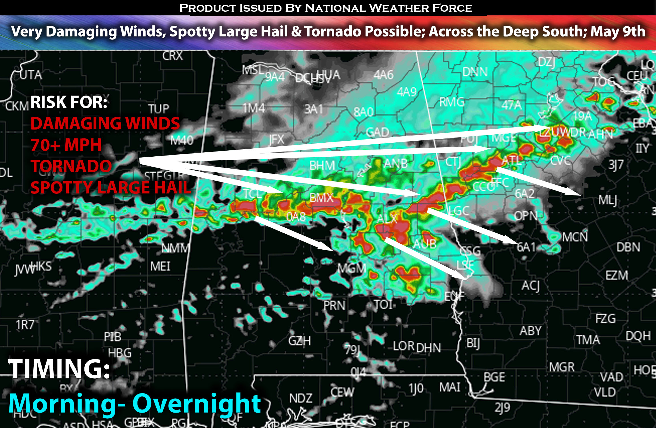
Main Risk: large hail possible, tornado (if ingredients align), damaging winds in excess of 70 mph and CG lightning (cloud to ground).
Stay tuned for more updates.
Sina⚡⚡
With over a decade of experience in forecasting severe thunderstorms, this individual is a seasoned forecaster and developer. Their expertise in severe weather forecasting and computer science is entirely self-taught, complemented by a foundation in Atmospheric Science from UNCO and an IT background from WGU. They have dedicated their efforts to developing innovative tools that enhance the accuracy of analyzing large hail and tornadoes. As a significant contributor and partner at National Weather Force Innovations LLC, they have played a crucial role in providing accurate and timely information. Additionally, they have been instrumental in developing tools and organizing projects that focus on accuracy and performance, ensuring those affected are well-informed.