
 Outlook:
Severe storms are expected to form this morning and continue into the afternoon and evening hours. These storms will be capable of producing all types of hazards. For detailed information on timing, impacts, and more, refer below.
Overall Forecast:
A weak surface low will approach the Atlantic Coastline as a surface boundary stretches across the central Florida Peninsula. Moisture advection south of this boundary will support the development of strong to potentially severe thunderstorms, especially with the presence of sufficient vertical wind shear.
Across Florida:
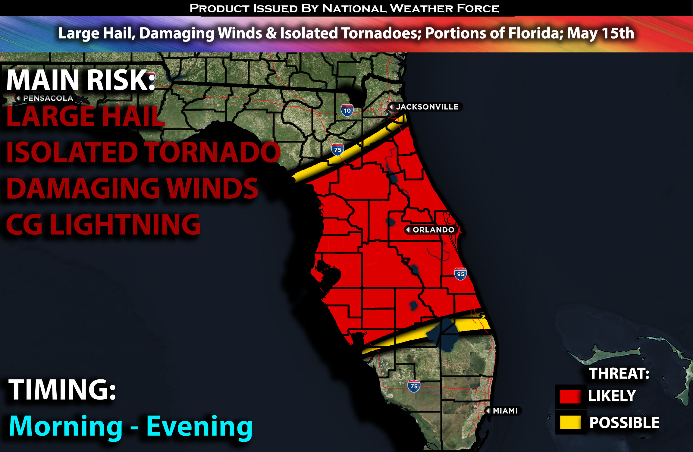
Storms are expected to initiate and strengthen along the boundary across northern and central portions of the Florida Peninsula by this morning/afternoon. Throughout the morning, a 60+ kt westerly mid-level jet streak will move over the boundary, accompanied by 30+ kts of southwesterly low-level flow. At the same time, with effective bulk shear and 2500-3500 J/kg surface instability driven by steep mid-level lapse rates and mid-70s F dewpoints, there is potential for semi-discrete supercell structures. However, linear convection is likely as the mean wind field will largely parallel the boundary. Severe wind and hail should be the primary threats, though a few tornadoes are possible, especially if any supercell structures can sustain themselves ahead of the convective line.
Coverage Details:
Storms are expected to initiate and strengthen along the boundary across northern and central portions of the Florida Peninsula by this morning/afternoon. These storms will form in clusters, mostly with embedded supercells capable of producing all hazard types across the Florida Peninsula.
Future Radar Scenario:
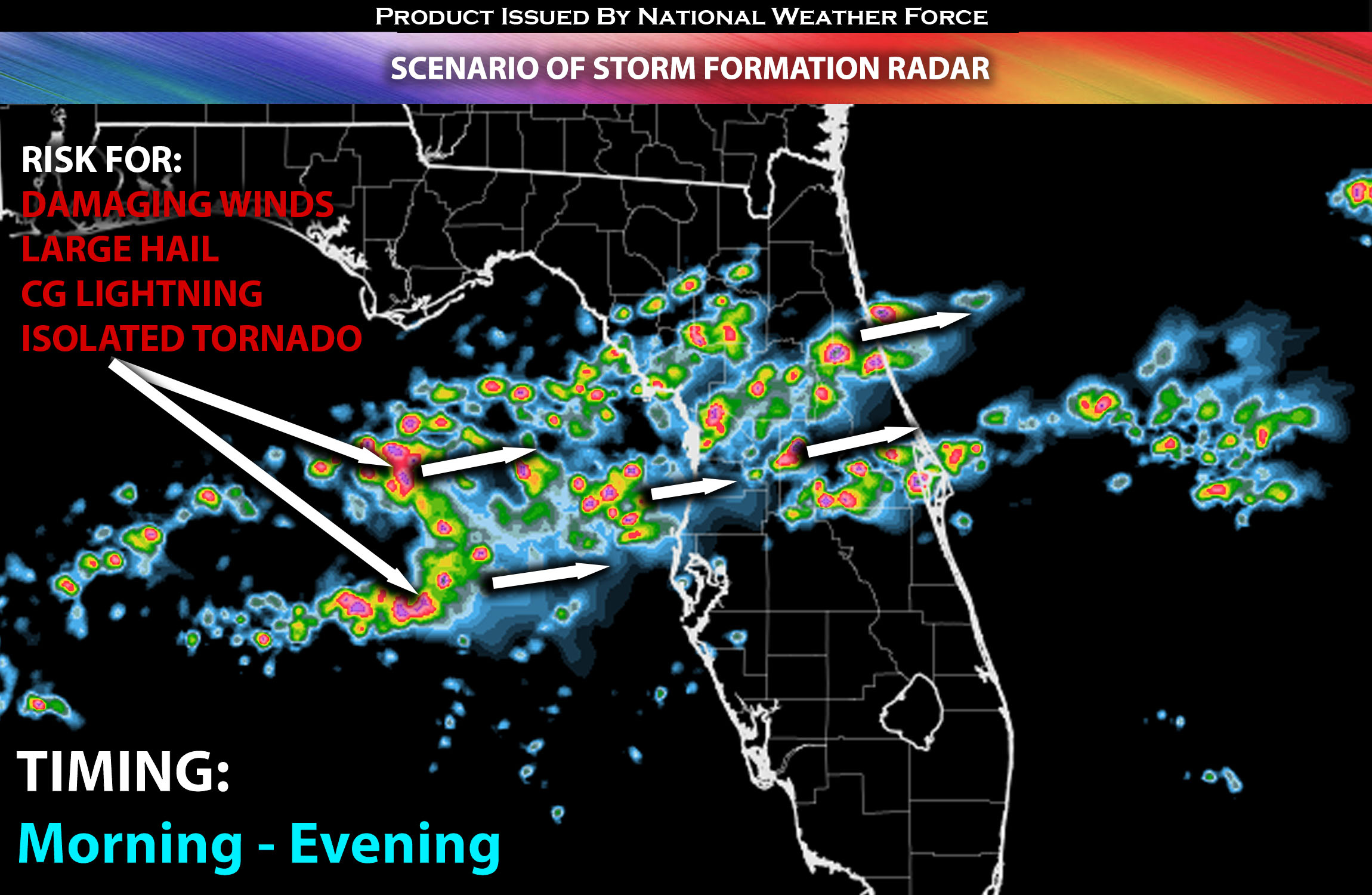 Main Risk: Large hail, damaging winds, isolated tornadoes (if ingredients align) and CG lightning (cloud to ground).
Stay tuned for more updates.
Sina⚡⚡
With over a decade of experience in forecasting severe thunderstorms, this individual is a seasoned forecaster and developer. Their expertise in severe weather forecasting and computer science is entirely self-taught, complemented by a foundation in Atmospheric Science from UNCO and an IT background from WGU. They have dedicated their efforts to developing innovative tools that enhance the accuracy of analyzing large hail and tornadoes. As a significant contributor and partner at National Weather Force Innovations LLC, they have played a crucial role in providing accurate and timely information. Additionally, they have been instrumental in developing tools and organizing projects that focus on accuracy and performance, ensuring those affected are well-informed.