
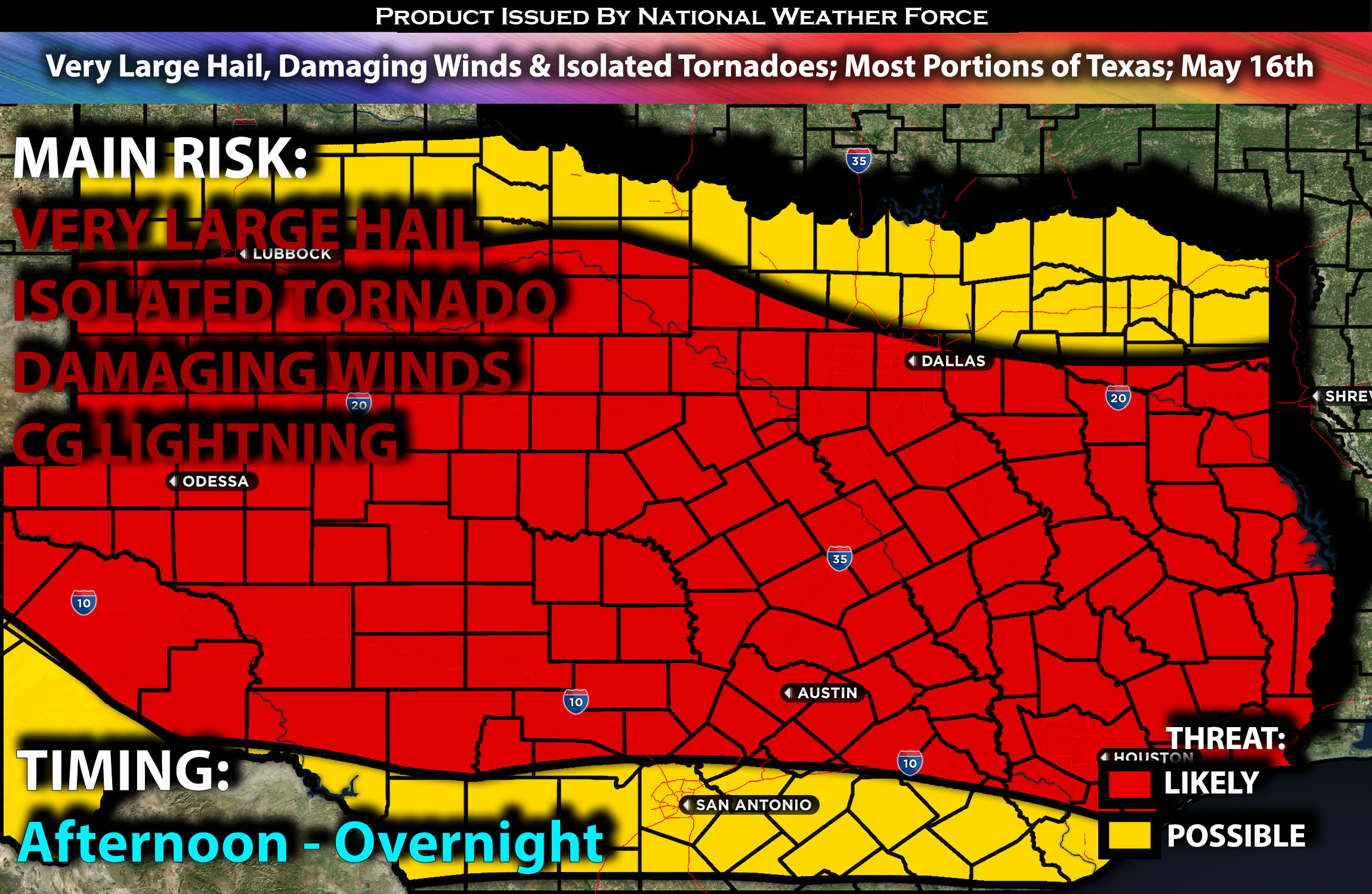
Outlook:
Severe storms are expected to form this afternoon and continue into the evening hours. These storms will be capable of producing all types of hazards. For detailed information on timing, impacts, and more, refer below.
Overall Forecast:
A shortwave trough will move eastward into the southern Great Plains on Thursday. Concurrently, strong mid-level flow will extend across most of Texas, south of the trough. Although the low-level jet will weaken after noon, warm-advection convection is expected to persist into the early afternoon.
Across the Texas Region:
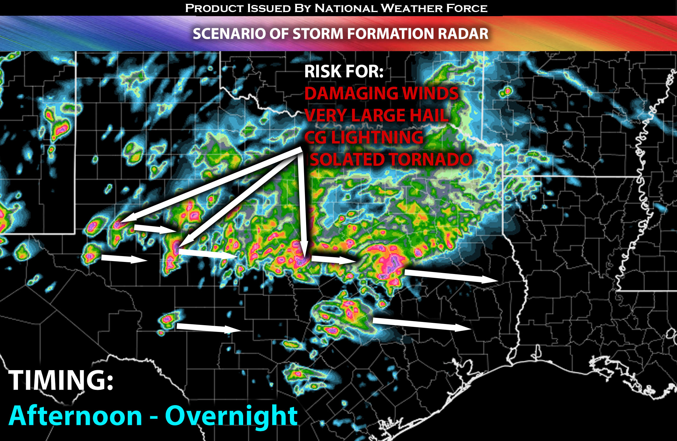
At the same time, very strong instability will also be present allowing for an unstable airmass, primarily conducive to producing very large hail. Due to the low-level moisture gradient from southeast to north Texas, storm development may continue throughout the morning into the afternoon in parts of north and central Texas. Outflows from these storms could lead to the formation of a Mesoscale Convective System (MCS) that spreads east-southeast across central to southeast Texas during the afternoon, impacting the most favorable areas for upstream supercell development.
The most conducive area for any supercells is expected to be near the dryline and boundaries. In this region, conditions will favor supercells with a vertical wind profile capable of producing very large hail and a couple of isolated tornadoes.
Coverage Details:
Storms will form as destabilization occurs along the boundary, particularly around and ahead of the dryline. These storms will mature quickly and become severe, moving somewhat east-southeast and impacting areas from the west towards the central and north-central regions of Texas. Initially, these storms will produce mainly very large hail and perhaps isolated tornadoes. However, as an MCS forms, the primary threat will shift to damaging winds.
Future Radar Scenario:
 Main Risk: Very large hail, damaging winds, isolated tornadoes (if ingredients align) and CG lightning (cloud to ground).
Stay tuned for more updates.
Sina⚡⚡
With over a decade of experience in forecasting severe thunderstorms, this individual is a seasoned forecaster and developer. Their expertise in severe weather forecasting and computer science is entirely self-taught, complemented by a foundation in Atmospheric Science from UNCO and an IT background from WGU. They have dedicated their efforts to developing innovative tools that enhance the accuracy of analyzing large hail and tornadoes. As a significant contributor and partner at National Weather Force Innovations LLC, they have played a crucial role in providing accurate and timely information. Additionally, they have been instrumental in developing tools and organizing projects that focus on accuracy and performance, ensuring those affected are well-informed.