
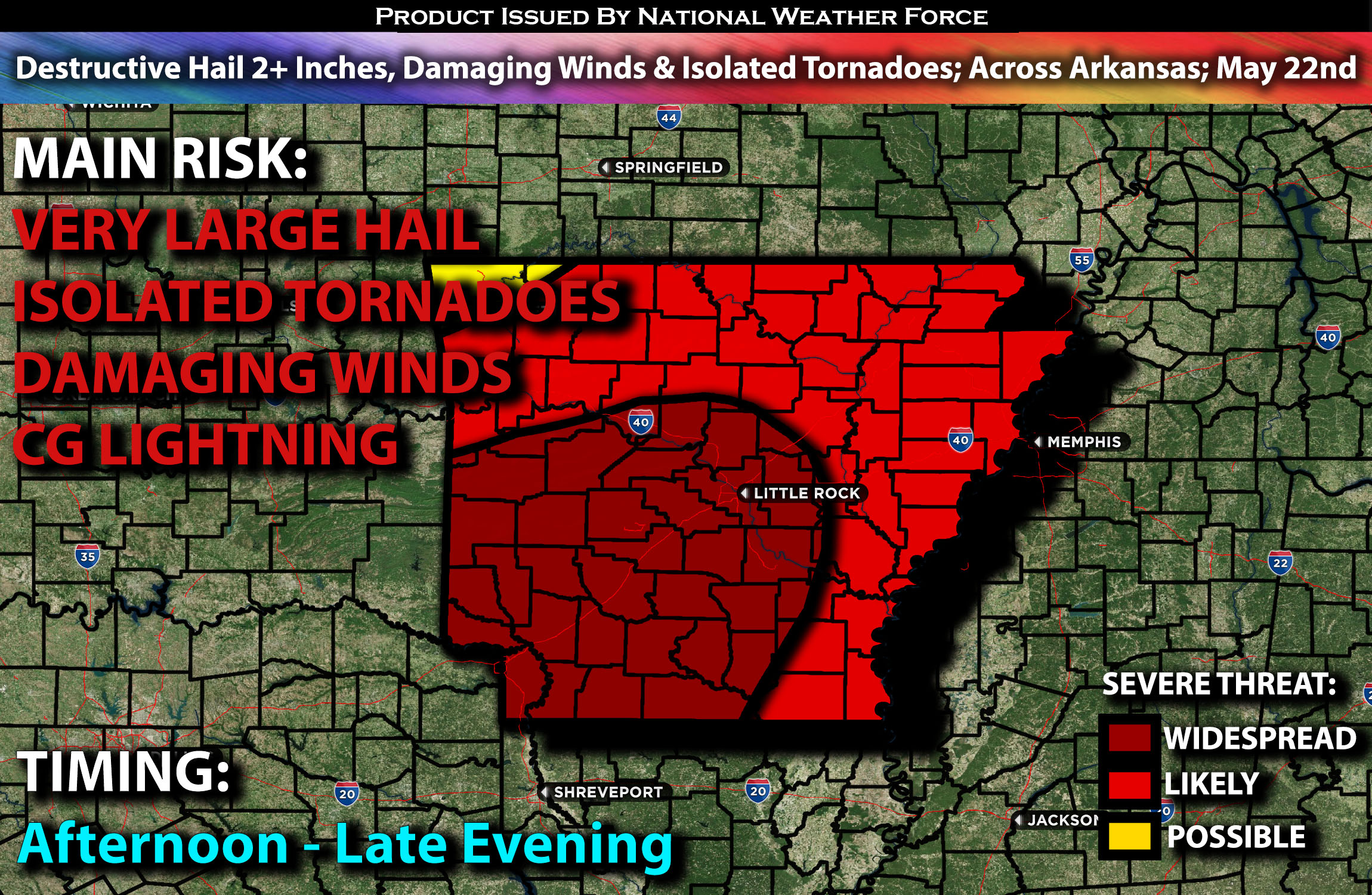
Outlook:
Severe storms are expected across much of Arkansas especially southwest but also including the rest of the region as they develop within an unstable airmass. These storms will be capable of producing all types of hazards, especially very large hail that could be destructive locally, from the afternoon through late evening hours. For detailed information on timing, impacts, and more, refer below.
Overall Forecast:
Across the Arklatex region, west to southwest mid-level flow will interact with a very moist and unstable airmass. Combined with a cold front that will slowly sweep southeast with an unstable airmass ahead of it. As surface temperatures rise and low-level convergence increases along and near the front, numerous storms are expected to develop and move east southeastward across AR in the late afternoon and evening.
Across Arkansas:
The warm sector (region of warm moist air) southeast of the front will be very moist. Steep mid-level lapse rates and strong surface heating will lead to extreme instability. This, combined with low-level and mid-level shear, will support the development of destructive large hail. The risk will be especially high over southwestern Arkansas, where the ingredients are most favorable.
Coverage Details:
Storms are expected to form across OK/AR and continue in coverage across AR, as destabilization occurs in the afternoon. Initially, these storms will be mostly discrete, capable of producing all types of hazards before transitioning into clusters in the evening. The storms will continue to move southeastward. The main risk will be damaging winds and very large hail with any remaining discrete cells especially.
Future Radar Scenario:
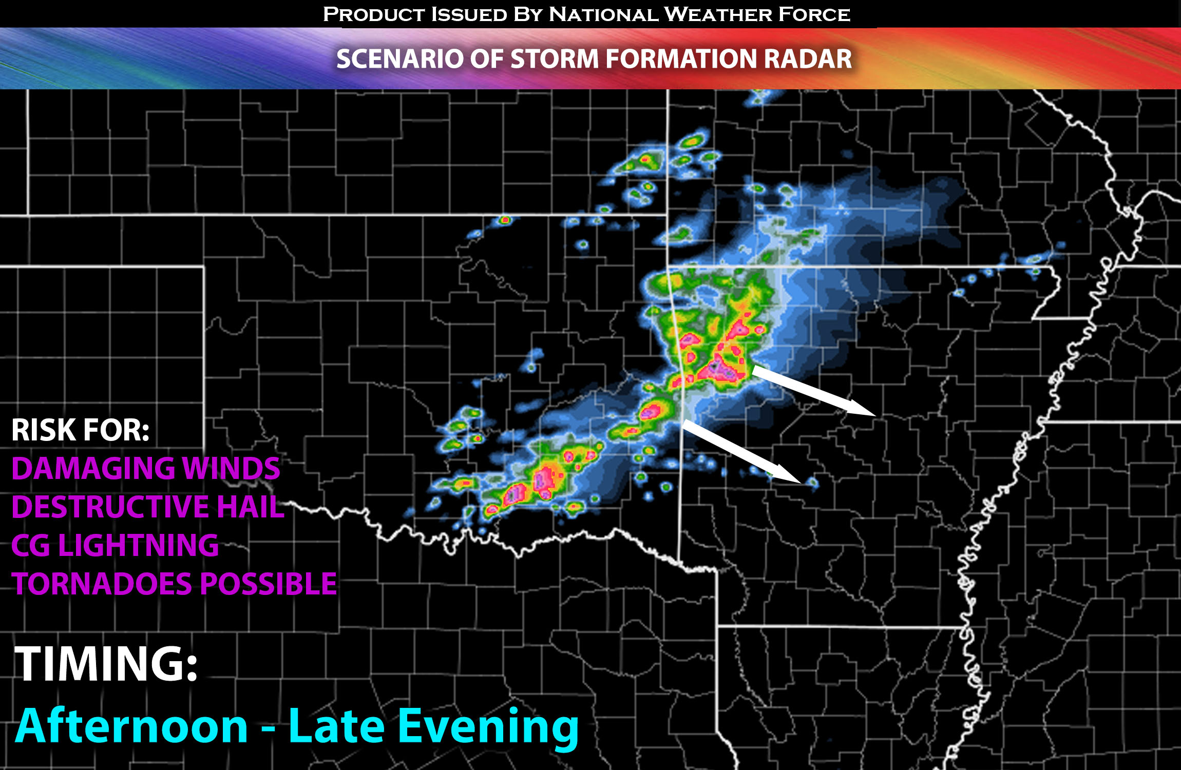
Main Risk: very large hail, damaging winds, isolated tornadoes (if ingredients align) and CG lightning (cloud to ground).
Stay tuned for more updates.
Sina⚡⚡
With over a decade of experience in forecasting severe thunderstorms, this individual is a seasoned forecaster and developer. Their expertise in severe weather forecasting and computer science is entirely self-taught, complemented by a foundation in Atmospheric Science from UNCO and an IT background from WGU. They have dedicated their efforts to developing innovative tools that enhance the accuracy of analyzing large hail and tornadoes. As a significant contributor and partner at National Weather Force Innovations LLC, they have played a crucial role in providing accurate and timely information. Additionally, they have been instrumental in developing tools and organizing projects that focus on accuracy and performance, ensuring those affected are well-informed.