
Outlook:
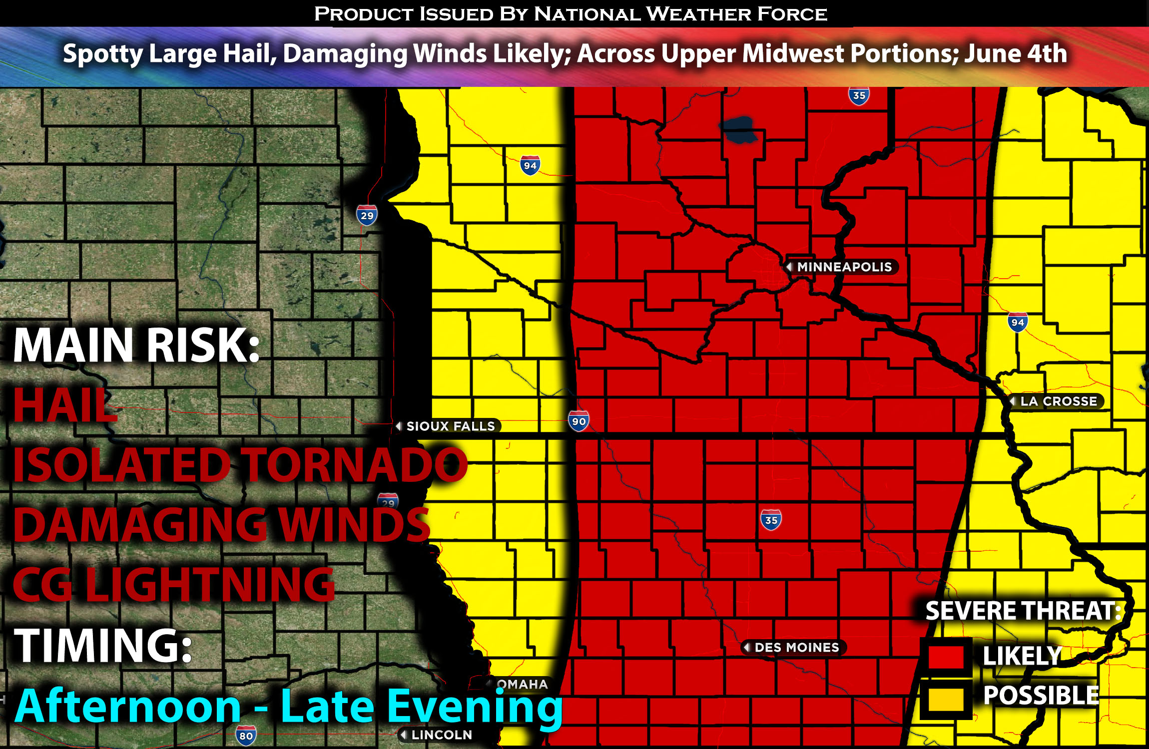
Severe storms are anticipated across portions of MN stretching down south through MO this afternoon and evening. These storms will pose a risk for hail, damaging winds mainly. For detailed information on timing, impacts, and more, refer below. For detailed information on timing, impacts, and more, refer below.
Overall Forecast:
An upper shortwave trough is expected to become negatively tilted as it moves toward the Upper Midwest. However, the severity of storms will not be as concentrated due to the lack of vertical shear ahead of the trough, which remains confined to the backside of the system.
From MN Stretching to MO:
At the surface, a cold front stretching from the central Dakotas southward will shift east with time. The southern extent of this boundary will be somewhat diffuse. Another day with MCV systems is anticipated, concentrating lift across the unstable air mass. This setup will be sufficient for severe storms to develop ahead of the boundary and where the MCV is located to the east. A seasonally moist air mass will be present ahead of the eastward-advancing cold front. Daytime heating will aid in modest destabilization, resulting in efficient instability values. Vertical shear will be marginal across the region, with effective shear magnitudes around 30 kt expected. Additionally, deep-layer flow will be more meridional and parallel to the surface boundary across Minnesota. Despite these conditions, a corridor of damaging wind and hail potential will exist from the Mid-Missouri Valley into southeast and east-central Minnesota, where stronger heating will enhance destabilization and support severe storms in this area.
Coverage Details:
Storms are expected to form ahead of the cold front from MN stretching down into portions of MO late afternoon through the evening hours. These storms will be multi cells mainly as a line. Given the present ingredients, these storms will be mostly producing damaging winds and perhaps some hail here and there. These storms will move eastward with time before losing strength rapidly around IL/WI area.
Main Risk: large hail, very low risk for tornado, damaging winds and CG lightning (cloud to ground).
Stay tuned for more updates.
Sina⚡⚡
With over a decade of experience in forecasting severe thunderstorms, this individual is a seasoned forecaster and developer. Their expertise in severe weather forecasting and computer science is entirely self-taught, complemented by a foundation in Atmospheric Science from UNCO and an IT background from WGU. They have dedicated their efforts to developing innovative tools that enhance the accuracy of analyzing large hail and tornadoes. As a significant contributor and partner at National Weather Force Innovations LLC, they have played a crucial role in providing accurate and timely information. Additionally, they have been instrumental in developing tools and organizing projects that focus on accuracy and performance, ensuring those affected are well-informed.