
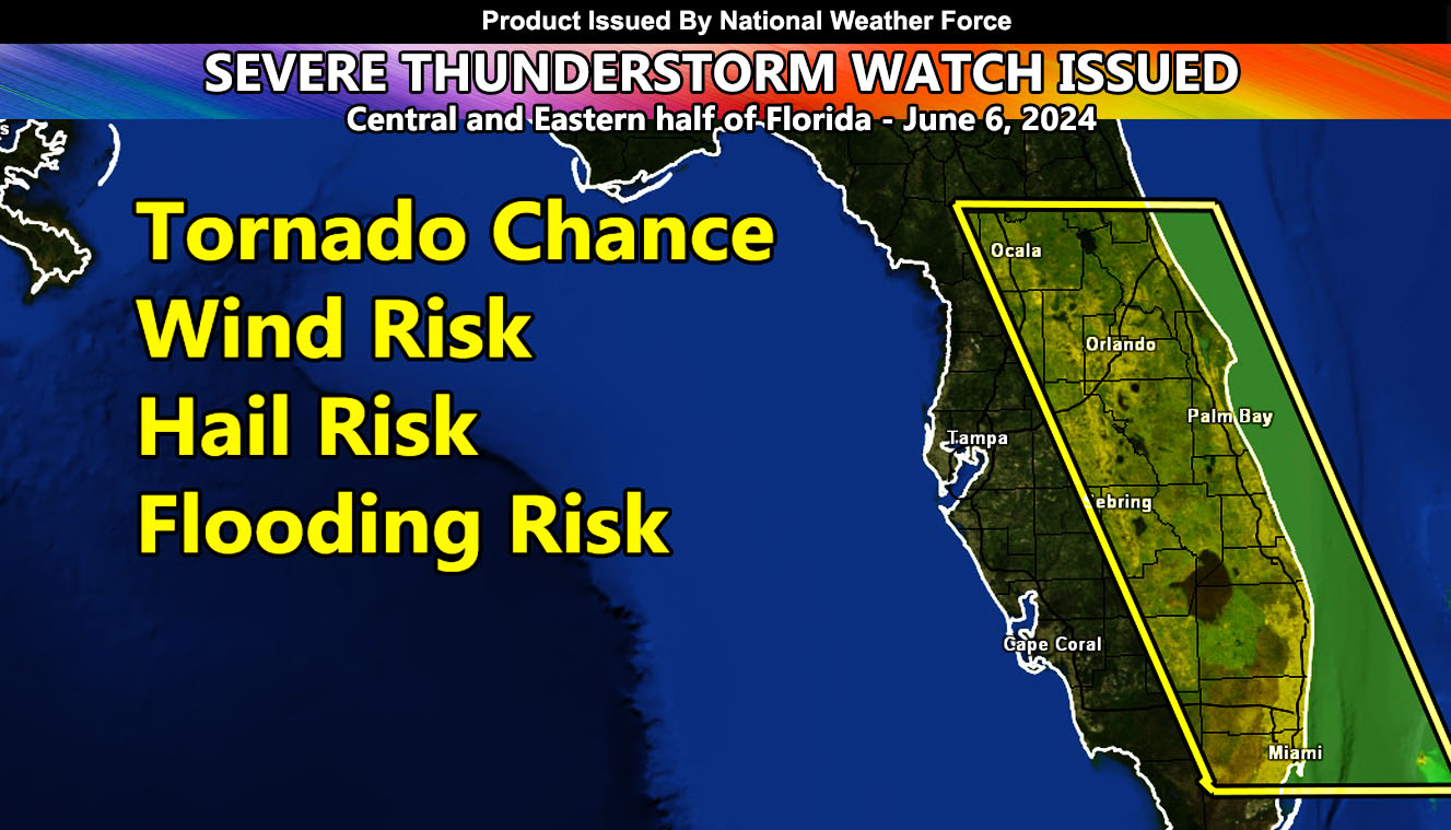
National Weather Force has issued a Severe Thunderstorm Watch effective now through 9pm local time for the following zones:
Zones affected: Central and Eastern half of Florida, including the Orlando Themepark zones.
Discussion: A Seabreeze convergence zone across Central Florida will extend from just north of Ocala southward through Orlando and further south into the Southern Florida Everglades. This convergence zone will be the focus spot for rapid thunderstorm development this afternoon.
The Seabreeze convergence zone will move eastward with the afternoon and evening, affecting the east coast resort areas, including Cape Canaveral.
Storms today will have the chance of a hail and wind risk, along with a flood risk. Because the cells will be isolated at times from one another, low-level rotation along the convergence zone will bring a tornado chance as well.
Storms will not affect the western coast of Florida with this event as the Seabreeze boundary will be too far east.
– Raiden Storm –
https://www.nationalweatherforce.com
Master General Meteorologist – is the owner and CEO of National Weather Force and is the only one authorized to issue weather watches such as thunderstorm, tornado, hurricane, and severe. A consulting meteorologist with over 26 years’ experience for over 50 companies, including energy, agriculture, aviation, marine, leisure, and many more areas. He has certs from Mississippi State for broadcast met and Penn State forecasting certs MET 101, 241, 341 and 361 as a meteorologist, but before then was completely self-taught, barely learning a thing from the schools that he did not already know.