
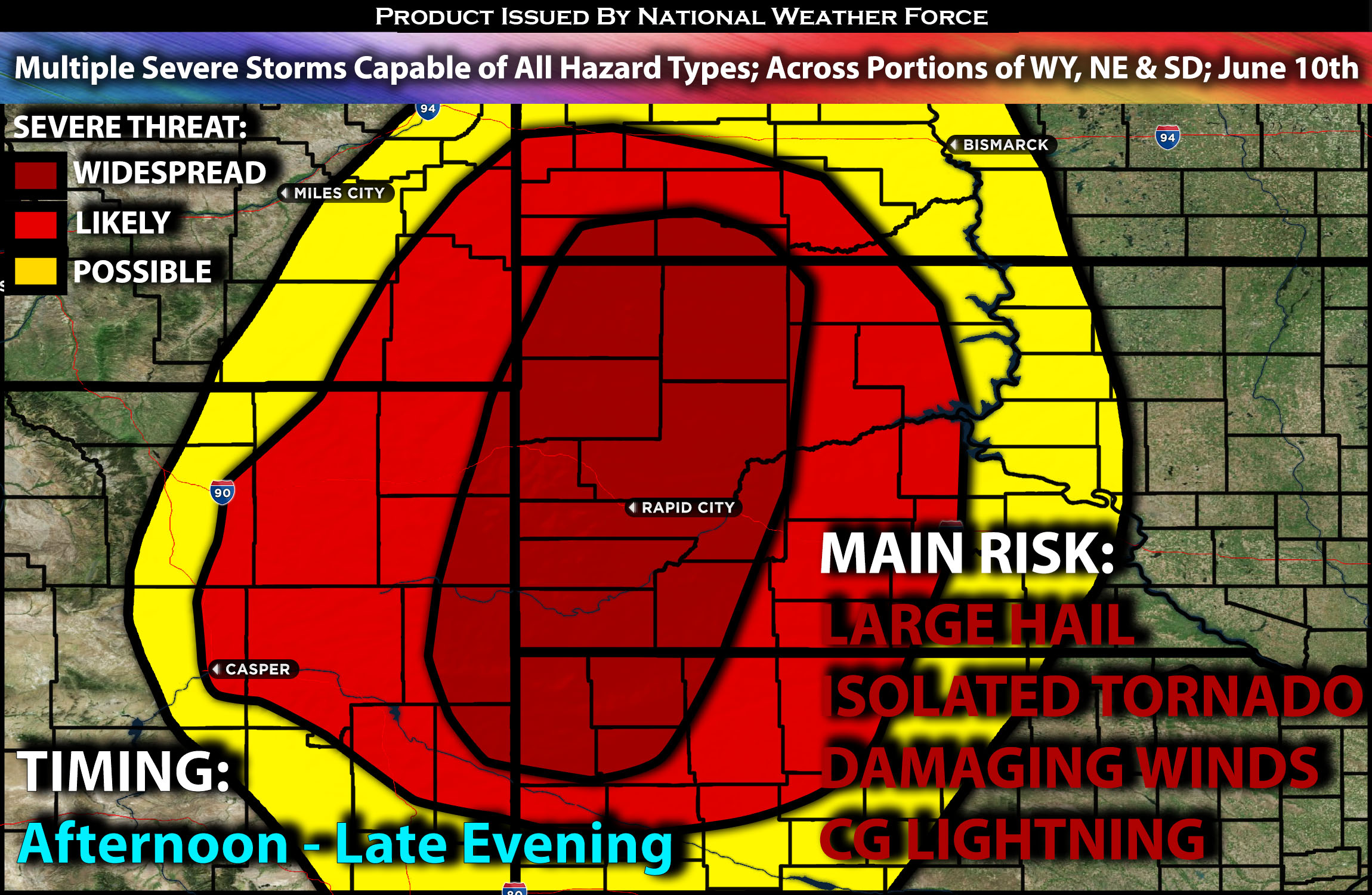
Outlook:
Severe storms are anticipated across portions of Wyoming, Nebraska, and South Dakota this afternoon into the evening hours due to the unstable airmass setting up. The main risks with these storms will be damaging winds and large hail, but isolated tornadoes are also possible given the ingredients present. For detailed information on timing, impacts, and more, refer below. For detailed information on timing, impacts, and more, refer below.
Overall Forecast:
There are already signs of a very strong shortwave trough across the western Montana area. Given this, combined with an unstable air mass ahead of it, the shortwave trough will provide the necessary lift for scattered thunderstorms to form across Wyoming, Nebraska, and the southern Dakotas later this afternoon.
Across Portions of WY, NE and Southern Dakota:
At the same time, there will be a surface boundary extending from western North Dakota down into eastern Wyoming. This will further enhance thunderstorm formation around this boundary. Ahead of it, the combination of moisture, steep mid-level lapse rates, efficient instability, veering low-level winds, and strong effective mid-level shear will allow these storms to become severe, with a few supercells expected given the ingredients. These storms will be capable of producing large hail, damaging winds, and, given the low-level shear, isolated tornadoes.
Coverage Details:
As destabilization occurs, storms are anticipated to form along this boundary in the afternoon hours, quickly becoming severe, with the highest concentration in eastern Wyoming and into western South Dakota. However, storms are also expected to form all along the boundary, stretching into portions of western Nebraska through the evening hours before dissipating quickly.
Future Radar Scenario:
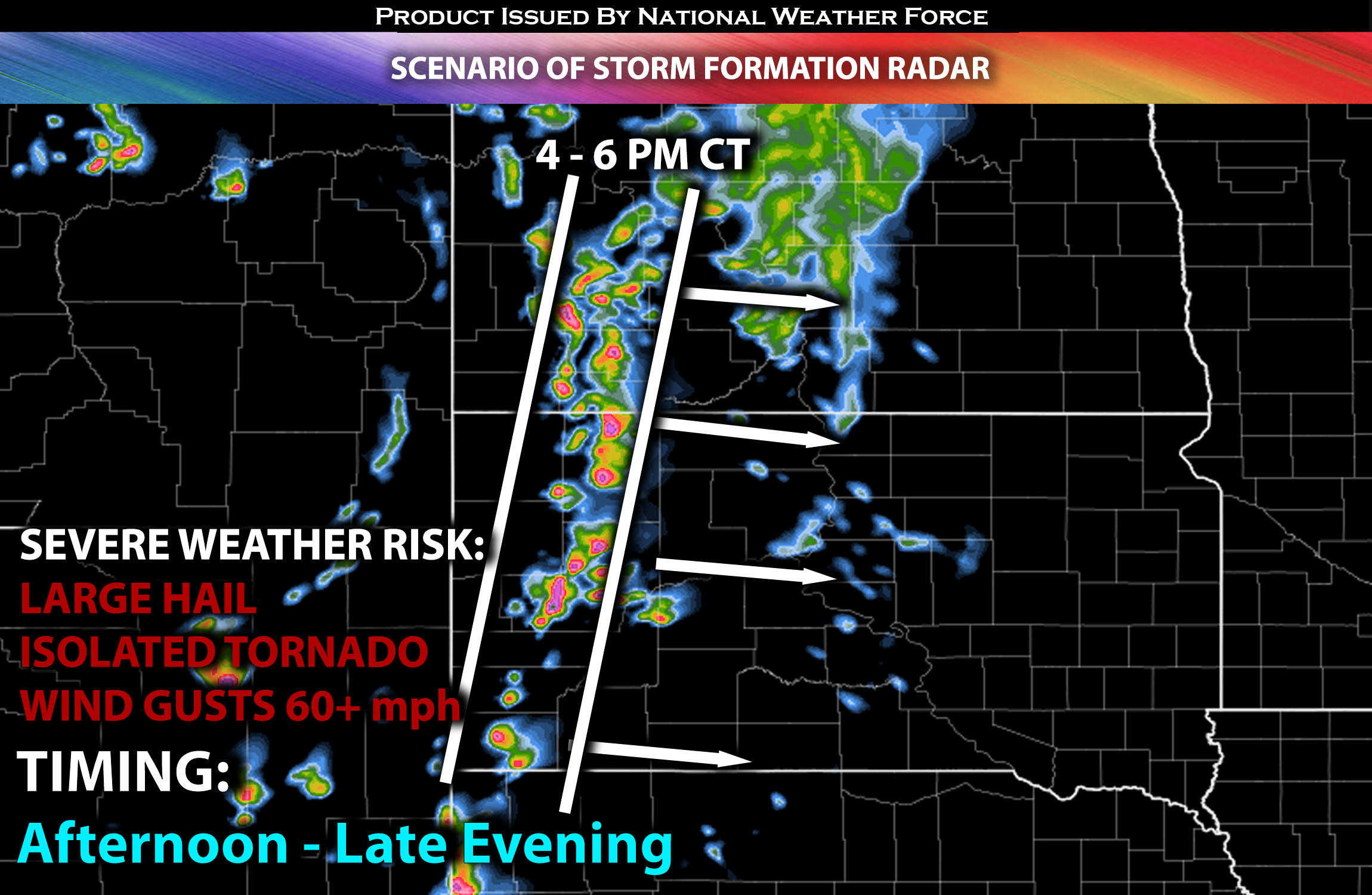 Main Risk: large hail, damaging winds, isolated tornado and CG (cloud to ground) lightning.
Stay tuned for more updates.
Sina⚡⚡
With over a decade of experience in forecasting severe thunderstorms, this individual is a seasoned forecaster and developer. Their expertise in severe weather forecasting and computer science is entirely self-taught, complemented by a foundation in Atmospheric Science from UNCO and an IT background from WGU. They have dedicated their efforts to developing innovative tools that enhance the accuracy of analyzing large hail and tornadoes. As a significant contributor and partner at National Weather Force Innovations LLC, they have played a crucial role in providing accurate and timely information. Additionally, they have been instrumental in developing tools and organizing projects that focus on accuracy and performance, ensuring those affected are well-informed.