
Outlook:
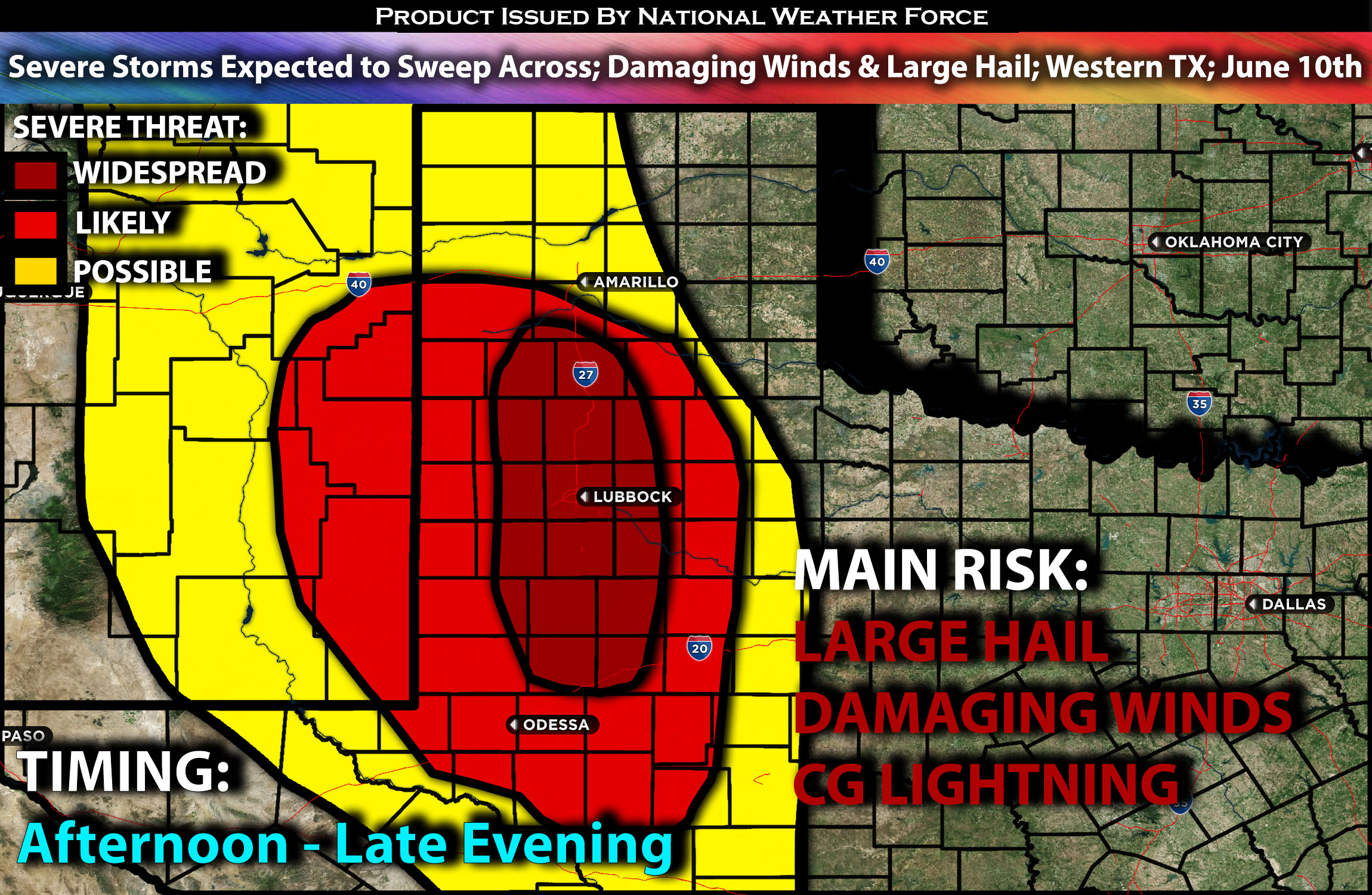
Severe storms are anticipated across western Texas later this afternoon into the evening hours due to the unstable airmass setting up. The main risks with these line of storms will be damaging winds and large hail. For detailed information on timing, impacts, and more, refer below.
Overall Forecast:
In the upper levels of the atmosphere, most of the systems are being pushed northward over the northern portions of the High Great Plains due to ridging. Regardless, shortwave troughs will still push through areas further south, creating more disturbances and making the air mass unstable for sporadic severe storms.
Across Western Texas:
A shortwave trough over southern New Mexico will cause strengthening westerly mid-level winds across parts of West Texas later this afternoon. Scattered thunderstorms are expected to form along a southeastward-moving surface front over eastern New Mexico by mid-afternoon and track across West Texas through the evening. Steep low and mid-level lapse rates, coupled with strong winds aloft and efficient instability, will bring the risk of locally damaging wind gusts and large hail.
Coverage Details:
As destabilization occurs, storms are anticipated to form along the western TX/NM border and continue to push eastward. Eventually, these storms will merge, forming a line that will sweep across Western Texas, including areas such as Lubbock, through the evening hours. These storms will be capable of producing large hail and damaging straight-line winds.
Future Radar Scenario:
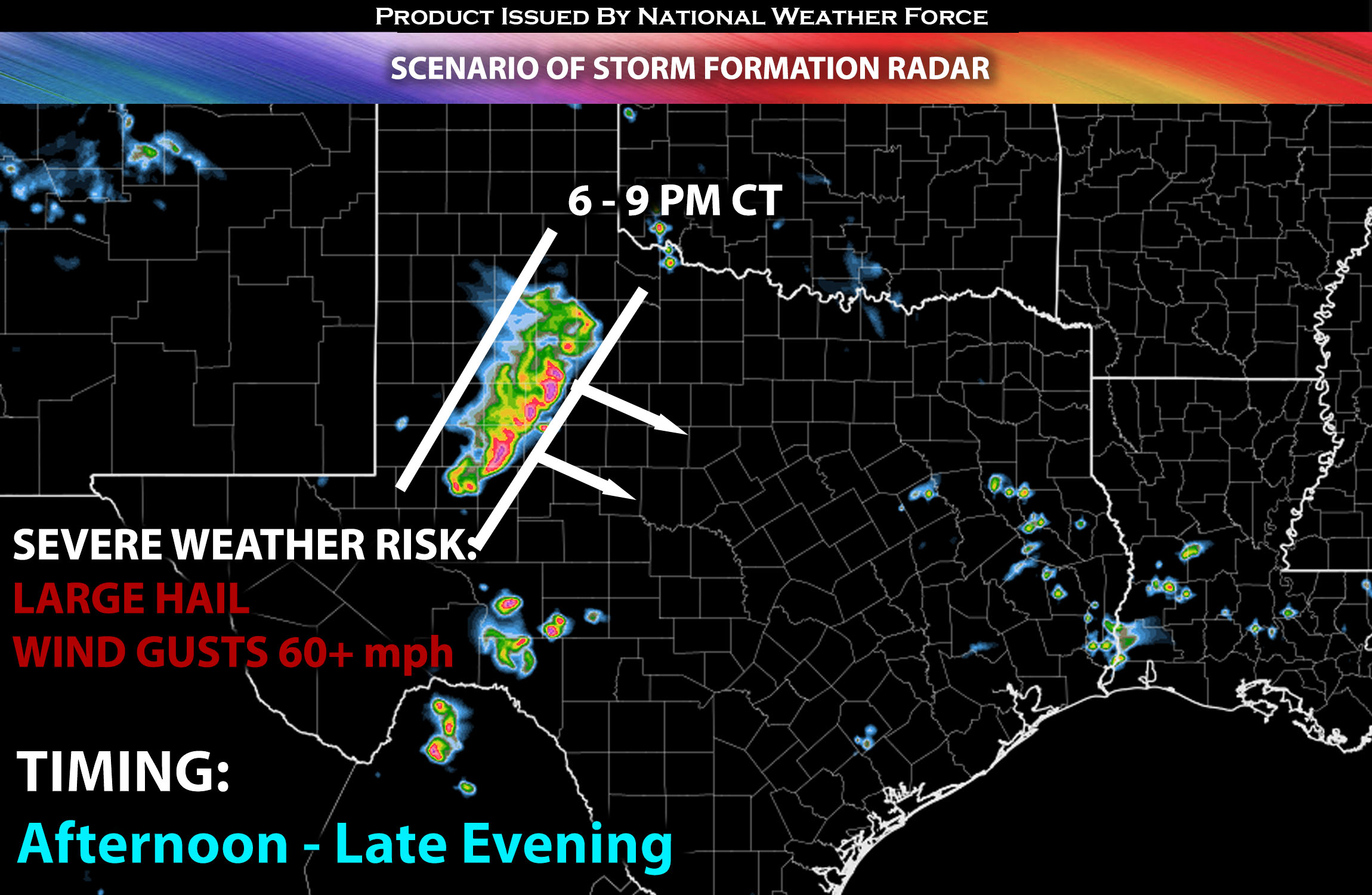
Main Risk: large hail, damaging winds and CG (cloud to ground) lightning.
Stay tuned for more updates.
Sina⚡⚡
With over a decade of experience in forecasting severe thunderstorms, this individual is a seasoned forecaster and developer. Their expertise in severe weather forecasting and computer science is entirely self-taught, complemented by a foundation in Atmospheric Science from UNCO and an IT background from WGU. They have dedicated their efforts to developing innovative tools that enhance the accuracy of analyzing large hail and tornadoes. As a significant contributor and partner at National Weather Force Innovations LLC, they have played a crucial role in providing accurate and timely information. Additionally, they have been instrumental in developing tools and organizing projects that focus on accuracy and performance, ensuring those affected are well-informed.