
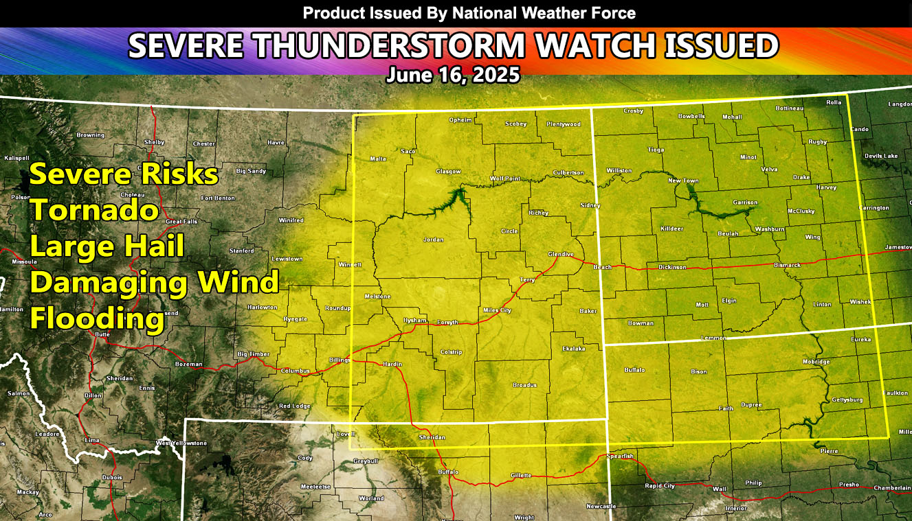
National Weather Force has issued a Severe Thunderstorm Watch effective now through sunrise Monday for the following zones;
Issued Zones: MONTANA – Central, Northeast, East, Southeast, South … WYOMING – Northeast … NORTH DAKOTA – Southwest, West, Northwest, North, Central, South … SOUTH DAKOTA – Northwest, North …
Date Issued: June 15th, 2025 at 3:30pm MDT
Discussion: A shortwave trough will move across the Pacific Northwest today, out of Oregon and Washington. The upper lift associated with it will work with strong instability, bringing rapid severe thunderstorm development. Storm motion will be to the east with time. Some low-level shear is in the area for low level rotation, that can lead to the chance of a tornado. Main concerns will be large hail and damaging winds,, with short term flooding in the strongest cells. The cells will start in Montana and Wyoming this evening, and through the overnight push a line of storms, mainly across most of North Dakota in a bow echo fashion for damaging winds till sunrise Monday morning.
Raiden Storm
Master General Meteorologist