
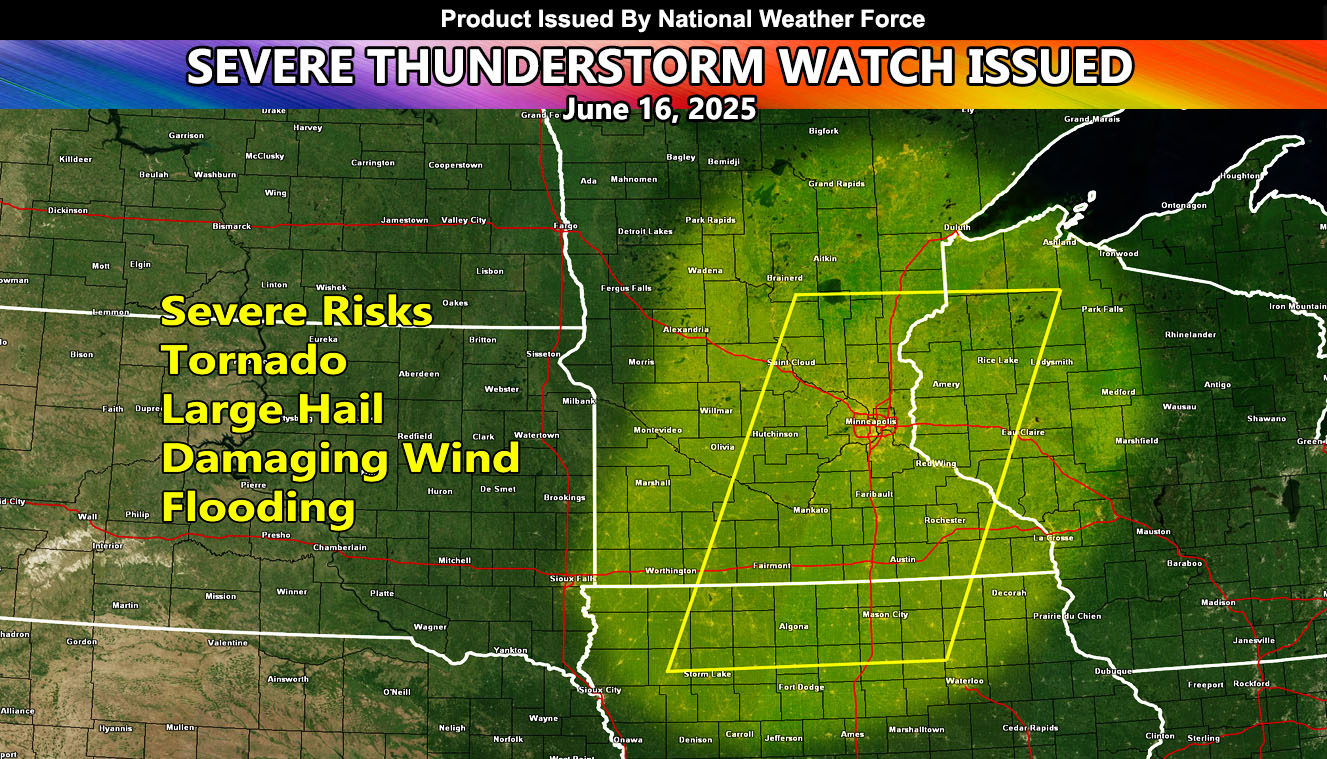
National Weather Force has issued a Severe Thunderstorm Watch effective 12pm through 12am CDT for the following zones;
Issued Zones:
Minnesota: West, Central, East, Southeast, South, and Southwest.
Iowa: Northwest, North, and Northeast.
Wisconsin: West and Northwest.
Date Issued: June 16th, 2025 at 7:45am CDT
Discussion: A shortwave trough will move across the Upper Midwest today, out of the Northern Plains. The upper lift associated with it will work with strong instability, bringing rapid severe thunderstorm development. Storm motion will be to the east with time. Some low-level shear is in the area for low level rotation, that can lead to the chance of a tornado. Main concerns will be large hail and damaging winds,, with short term flooding in the strongest cells. The cells will weaken near the midnight hour and the watch will end.
A Severe Thunderstorm Watch is issued at National Weather Force when conditions are favorable for quarter-sized hail, damaging winds over 55 mph, and tornadoes (if mentioned), and issued custom to you for the best lead-time possible.
Raiden Storm
Master General Meteorologist