
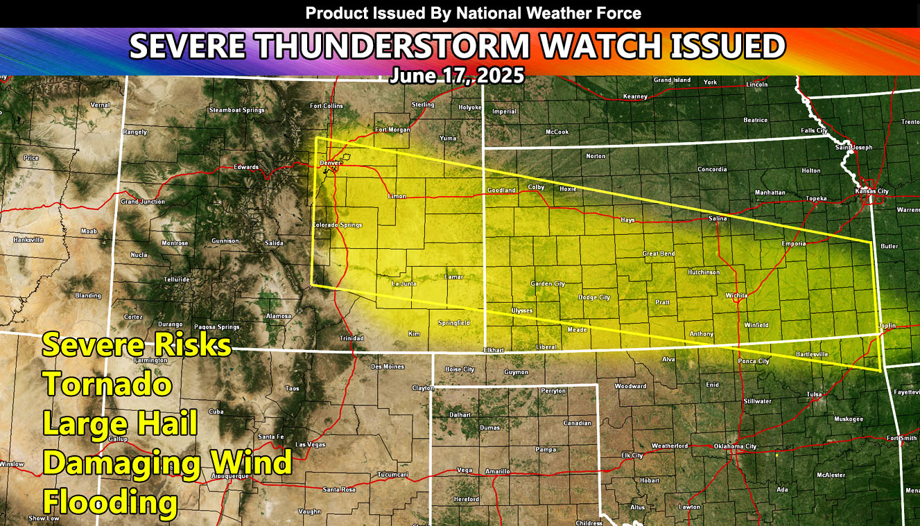
National Weather Force has issued a Severe Thunderstorm Watch effective now through Wednesday 5am CDT for the following zones;
Issued Zones:
COLORADO: Central, East, and Southeast.
KANSAS: Northwest, West, Southwest, Central, South, and Southeast.
Date Issued: June 17th, 2025 at 11:30am CDT
Discussion: A disturbance moving across Northern Colorado at the current time we move into the Denver forecast area this afternoon. This will pop off severe thunderstorms along the front range. These storms could produce isolated tornado activity with them as convergence at the surface is present, with instability. This area of lift will move into Kansas through the evening and overnight hours, giving a major light show as well. All modes of severe weather will be likely today and tonight in the watch zone, but the main event will be large hail, damaging winds, and flooding.
A Severe Thunderstorm Watch is issued at National Weather Force when conditions are favorable for quarter-sized hail, damaging winds over 55 mph, and tornadoes (if mentioned), and issued custom to you for the best lead-time possible.
Raiden Storm
Master General Meteorologist