
 National Weather Force has issued a Special Weather Statement, effective Friday, June 20th, 2025 for the following zones;
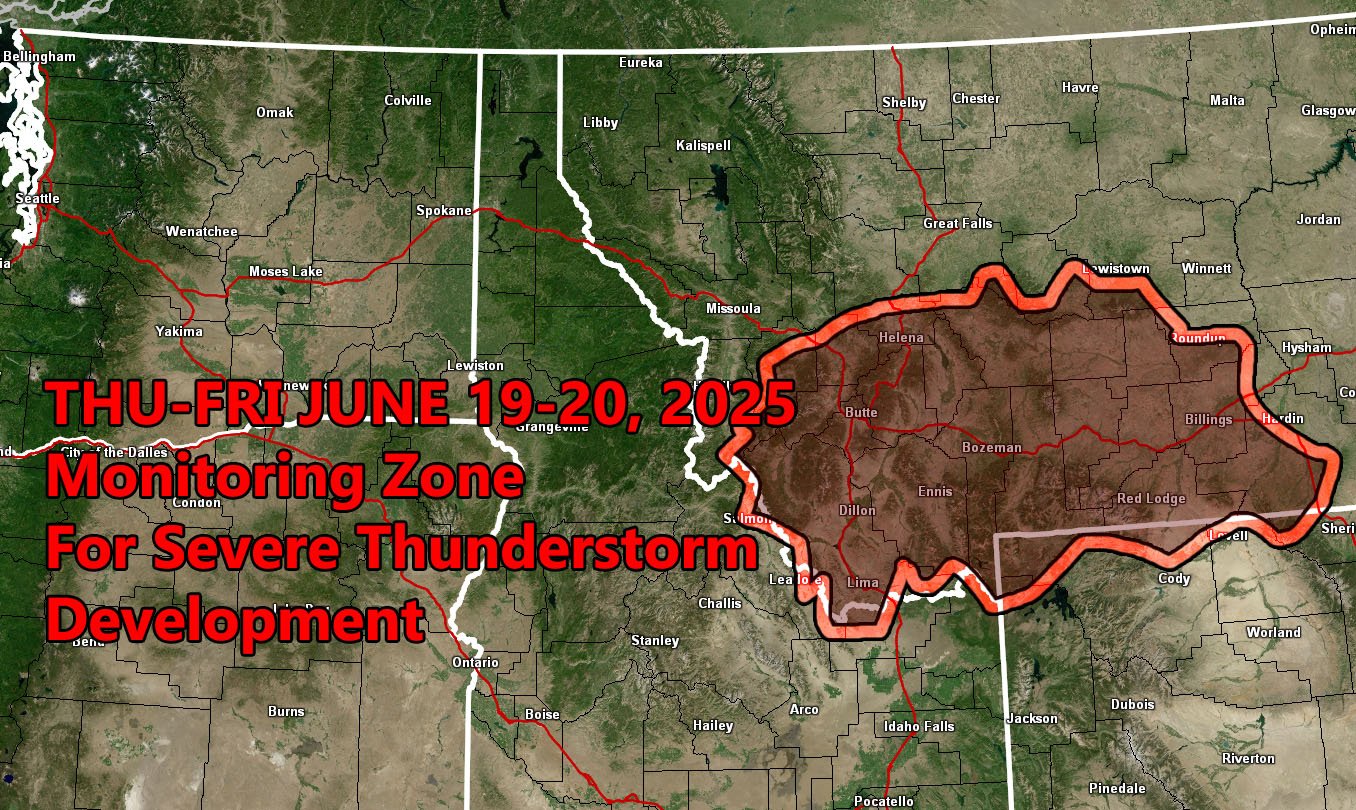
Issued Zones:
MONTANA: Southwest, Central, and South
Date Issued: June 17th, 2025 at 8:20pm MDT
Discussion: A trough of low pressure will be moving across the Pacific Northwest by the end of this week. This is a wide low-pressure system that will bring strong upper divergence (lift) to the southwest half of Montana. This, with cold air aloft pooling in, will make for stronger instability. Given the lift and instability profiles, a small section of the state will have the ingredients for severe thunderstorms surrounding areas like Butte and Bozeman. National Weather Force will issue the final product if needed, by Friday morning.
A Severe Thunderstorm Outlook is issued at National Weather Force when conditions are favorable for quarter-sized hail, damaging winds over 55 mph, and tornadoes (if mentioned), and issued custom to you for the best lead-time possible.
Raiden Storm
Master General Meteorologist