
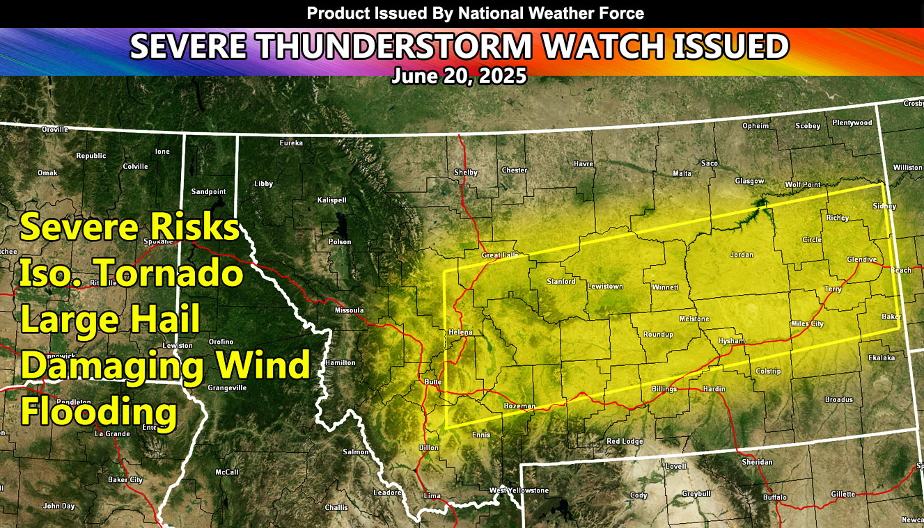
National Weather Force has issued a Severe Thunderstorm Watch effective 9am, until 11:59pm, Friday, June 20th, 2025, for the following zones;
Issued Sectors:
Northern Rockies Sector
Issued Zones:
MONTANA: Southwest, West, Central, East, Southeast, and South.
Date Issued: June 19th, 2025 at 5:40pm MDT
Discussion: A rare weather system for this time of year will move across the Pacific Northwest. As stated in the previous article for Montana, today would have some severe thunderstorms. We have seen a few of them in the Southwestern Montana forecast zones today. However, tomorrow, Friday June 20th, 2025 – we will see a lot more activity given the upper divergence (lift) part of the upper-level low that will be crossing the Oregon/Washington border.
As as upper ascent ahead of it takes hold, storms will be at severe threshold at around 9-10 a.m. local time, with a window from then through the entire day, and into the night. The convergence boundary will be west to east across the entire span of the state. Instability does hold on after the watch expires (midnight), but severe storms are still possible in Eastern Montana through at least sunrise on Saturday morning.
A Severe Thunderstorm Watch is issued at National Weather Force when conditions are favorable for quarter-sized hail, damaging winds over 55 mph, and tornadoes (if mentioned), and issued custom to you for the best lead-time possible.
Raiden Storm
Master General Meteorologist