
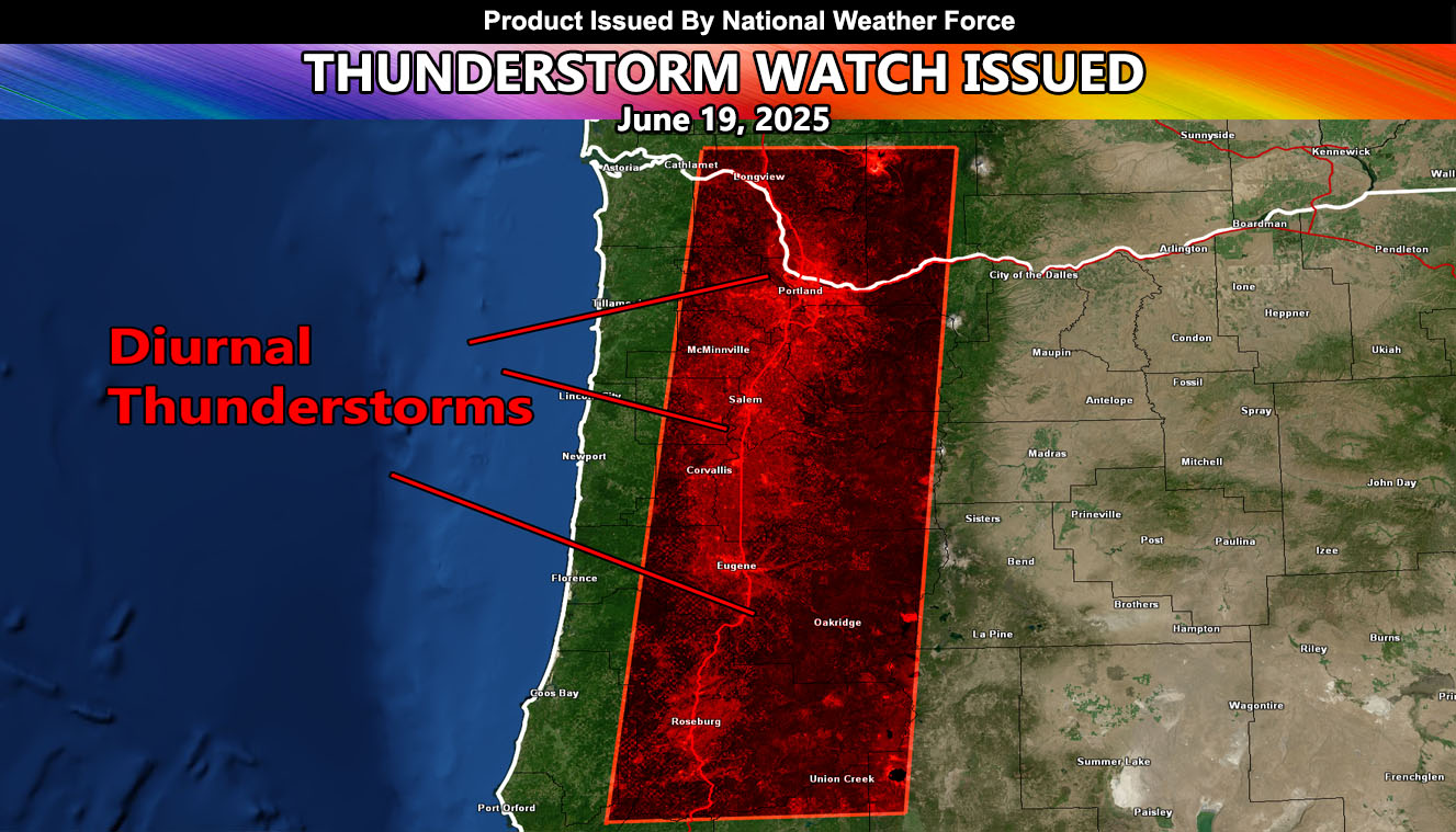
National Weather Force has issued a Thunderstorm Watch effective 11am, until 8:00pm, Friday, June 20th, 2025, for the following zones;
Issued Sectors:
Pacific Northwest Sector
Issued Zones:
OREGON: West, mainly along and near the Willamette Valley.
WASHINGTON: Southwest.
Date Issued: June 19th, 2025 at 5:20pm PDT
Discussion: A rare weather system for this time of year will move across the Pacific Northwest. The center of the system will move across Seattle and into Eastern Washington through the watch period. Looking at the mid/upper level winds, strong divergence, or lift, will be present on the southern end of the center of the upper system. This means that thunderstorm tops up to 20,000 FT will be likely. With a freezing level of around the 5,000 foot mark, we can expect the column to be thick enough to charge the cloud for lightning to be in the forecast.
A Thunderstorm Watch is issued at National Weather Force only within the rare sectors for them, given mainly the West Coast states. Thunderstorm Watches are not issued East of the Rockies due to regular thunderstorms being quite normal. However, when the Western United States has a chance of thunderstorms, it will be issued. Within it, small hail, gusty winds, lightning, and small scale flooding will all be likely.
Raiden Storm
Master General Meteorologist