
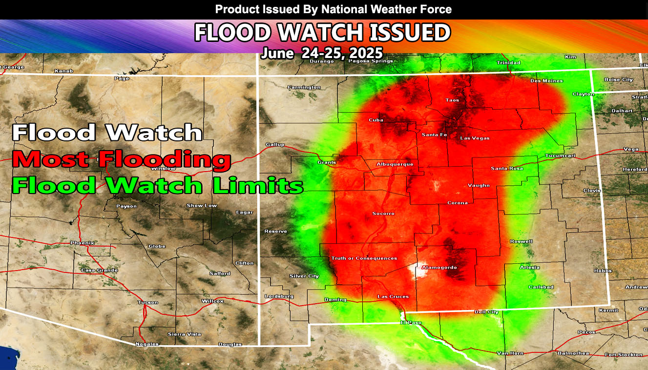
National Weather Force has issued a Flood Watch effective Tuesday and Wednesday, June 24-25, 2025, for the following zones;
Issued Sectors:
Southern Rockies Sector
Issued Zones:
NEW MEXICO: Southwest, Central, West, Northwest, North, Northeast, and South.
Date Issued: June 20th, 2025 at 6:30pm MDT
Discussion: Thunderstorms in Western Mexico are apparent on satellite images. These are due to former Major Hurricane Erick’s outflow, with accompanied moisture and upper-dynamics. As the the moisture continues northward, it will be swept across New Mexico this next week. The main depth of the moisture will be from Tuesday into Wednesday, where the most flooding will occur. Thunderstorms will accompany the flooding. Flooding like this can bring additional debris flows from any burn areas.
A Flood Watch is issued at National Weather Force when conditions are favorable for heavy rainfall within a short period of time, which will cause flooding. Burn areas from past or current fire zones will also have a flood risk at any time during these higher rainfall rates, (if mentioned), and issued custom to you for the best lead-time possible.
Raiden Storm
Master General Meteorologist