
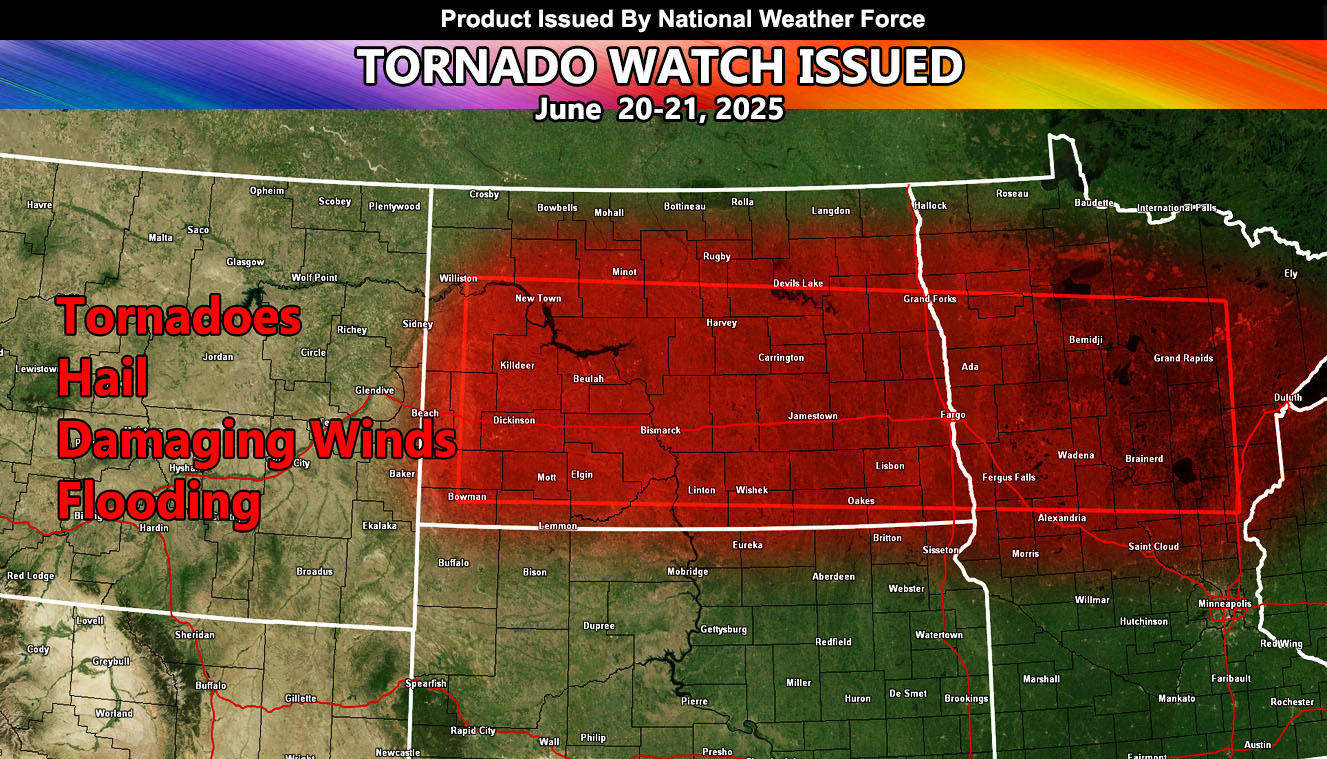
National Weather Force has issued a Tornado Watch effective 6pm today, until 5:00am, Saturday, June 21st, 2025, for the following zones;
Issued Sectors:
Northern Plains Sector
Issued Zones:
NORTH DAKOTA: West, Southwest, South, Southeast, East, and Central.
MINNESOTA: West, Northwest, North, Northeast, East, and Central.
Date Issued: June 20th, 2025 at 6:25am CDT
Discussion: A ridge of high pressure south into the Great Plains will be responsible for tow factors. One, the strong west to east flow within the northern periphery of it – and also carving a trough to the west, impacting the Pacific Northwest today. This trough of low pressure will be the lift source that will move out of Montana this evening, igniting severe thunderstorms in Southwestern North Dakota. This upper lift will continue moving eastward with time, becoming an overnight event for the Eastern half of North Dakota into Minnesota. Given the shear, tornadoes, some strong will be possible with it. However, the main concern will be the damaging winds associated with it. Without tornado potential, this would be the Enhanced Severe Thunderstorm Watch, the highest severe thunderstorm watch at the National Weather Force. But because tornadoes are likely with this system, a tornado watch will do. The storms will vacate Eastern Minnesota by sunrise Saturday morning.
A Thunderstorm Watch is issued at Arizona Weather Force when conditions are possible for thunderstorms, covering 50% of the watch zone. Thunderstorm Watches at Arizona Weather Force are private, issued ahead of time to the public by AZWF as the lead-time is extremely important to you.
Raiden Storm
Master General Meteorologist