
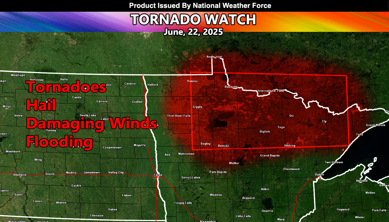
National Weather Force has issued a Tornado Watch effective now, until 12:00am CDT, for the following zones;
Issued Sectors:
Northern Plains Sector
Issued Zones:
MINNESOTA: Northwest, North, and Northeast
Date Issued: June 22th, 2025 at 1:25pm CDT
Discussion: Storms continue to plague the extreme Northern Plains as a zonal flow continues within the northern periphery of the ridge of high pressure to the south. An upper-low ejecting into Canada will swing a frontal zone through Minnesota during the watch period. Strong low-level shear in the front, with southeast backing winds, could make this an event where a strong tornado situation is possible. Given the strength it could be, this is a higher end tornado watch for strong tornadoes likely. This will move east of the watch zone after the midnight hour.
Given the numbers at National Weather Force’s tornado risk model, an EF3+ tornado is possible with this system.
A Tornado Watch is issued at National Weather Force when conditions are possible for tornadoes. A Tornado Watch can come in two alerts, a regular watch for tornadoes, or the Enhanced Tornado Watch for a more severe outbreak of them over a wide area. Severe weather with large hail, damaging winds, and flooding also accompany these watches. Tornado Watches at National Weather Force are private, issued ahead of time to the public by NWF as the lead-time is extremely important to you.
Raiden Storm
Master General Meteorologist