
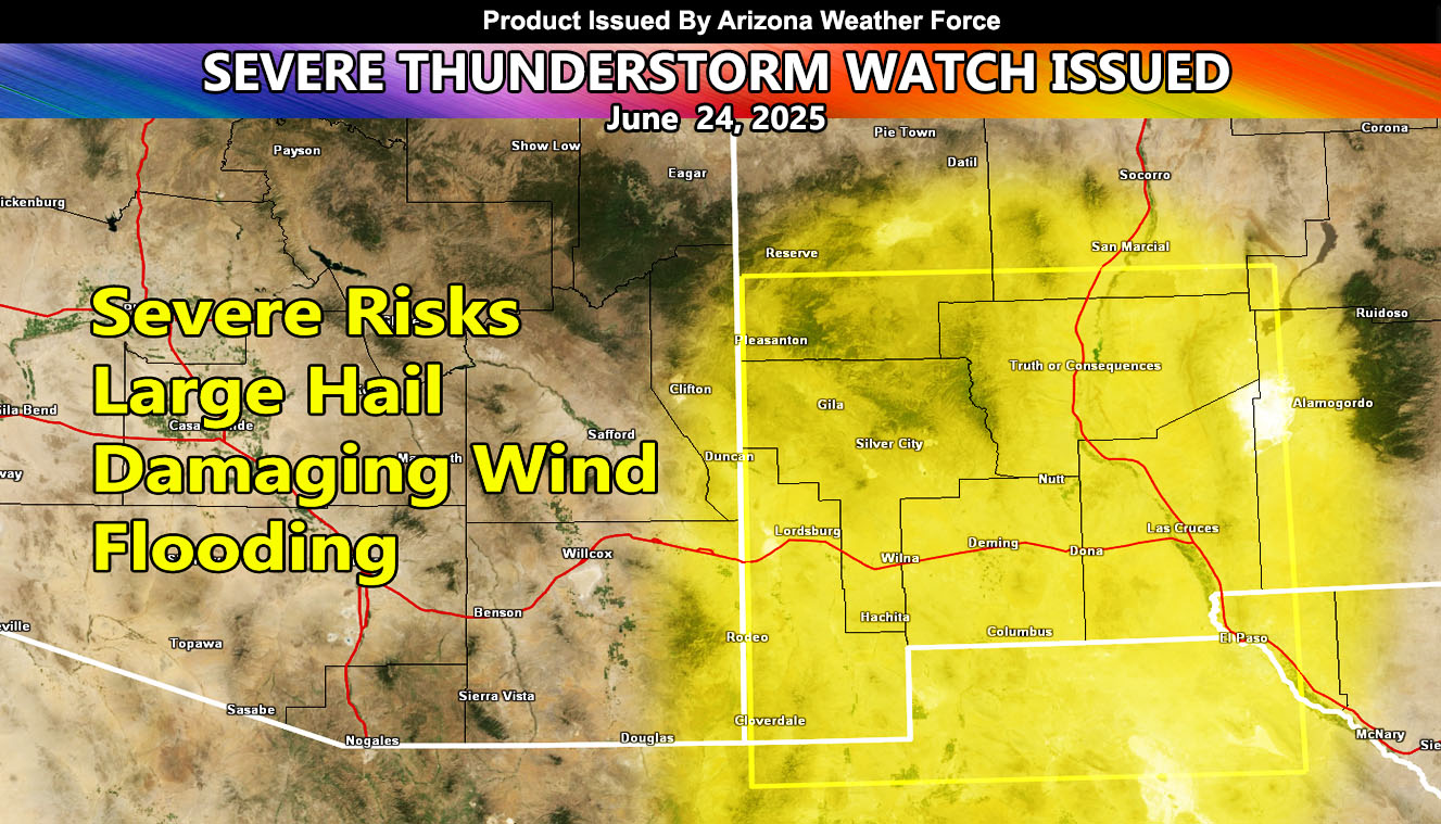
National Weather Force has issued a Severe Thunderstorm Watch effective 9am today, until 2am, Wednesday for the following zones;
Issued Sectors:
Southern Rockies Sector
Issued Zones:
New Mexico: West and Southwest.
Date Issued: June 24th, 2025 at 8:15am MDT
Discussion: Deep monsoon moisture in from Mexico is present over the watch zone today. This should be the most active zone of the week’s event. Storm motion will be to the northeast as a ridge of high pressure will be parked east of the area, and a trough of low pressure parked off the west coast. While this Severe Thunderstorm Watch doesn’t stretch to Albuquerque, damaging winds from a bow echo will be possible in that area, north of this watch. This watch is mainly for damaging winds and large hail. Further north, expecting dime to penny sized hail and damaging winds … whereas in the watch zone over quarter-sized hair and microbursts. Because this has an upper-level dynamic, we could see these easily go through most of the night in the watch zone.
A Severe Thunderstorm Watch is issued at National Weather Force when conditions are favorable for quarter-sized hail, damaging winds over 55 mph, and tornadoes (if mentioned), and issued custom to you for the best lead-time possible.
Raiden Storm
Master General Meteorologist