
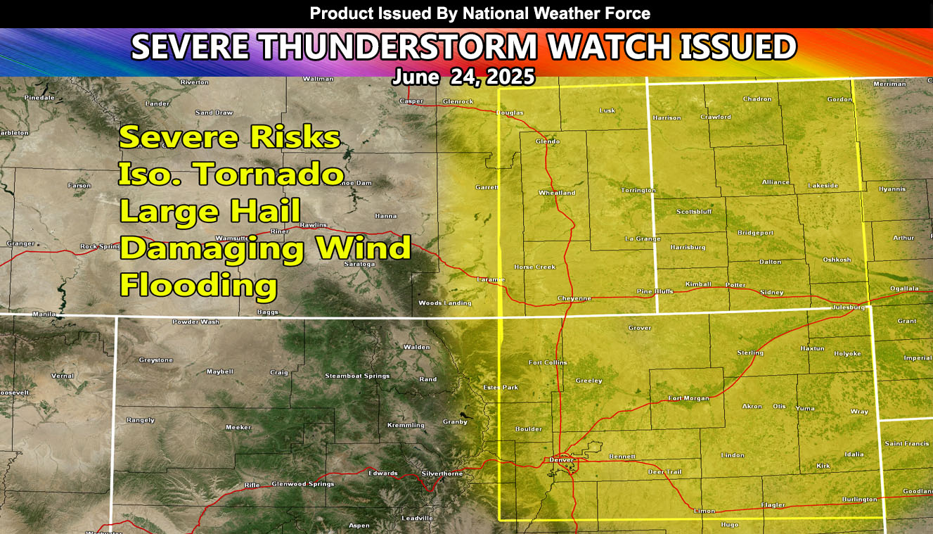
National Weather Force has issued a Severe Thunderstorm Watch effective 11am until 10pm, today, for the following zones;
Issued Sectors:
Southern Rockies Sector
Central Plains Sector
Issued Zones:
Colorado: Central, North, and Northeast.
Nebraska: Southwest, West, and Northwest.
Wyoming: Southeast.
Date Issued: June 24th, 2025 at 9:55am CDT
Discussion: Upper-level lifting along with instability developing over the front range will bring rapidly developing severe thunderstorms through the watch area. Storms will develop just west or directly over the Denver Metro zones as well, and Denver is a target for large hail/damaging wind/isolated potential for this watch zone. Activity will move to the east-northeast out of Wyoming and Colorado … into Western Nebraska where the watch will end on time.
A Severe Thunderstorm Watch is issued at National Weather Force when conditions are favorable for quarter-sized hail, damaging winds over 55 mph, and tornadoes (if mentioned), and issued custom to you for the best lead-time possible.
Raiden Storm
Master General Meteorologist