
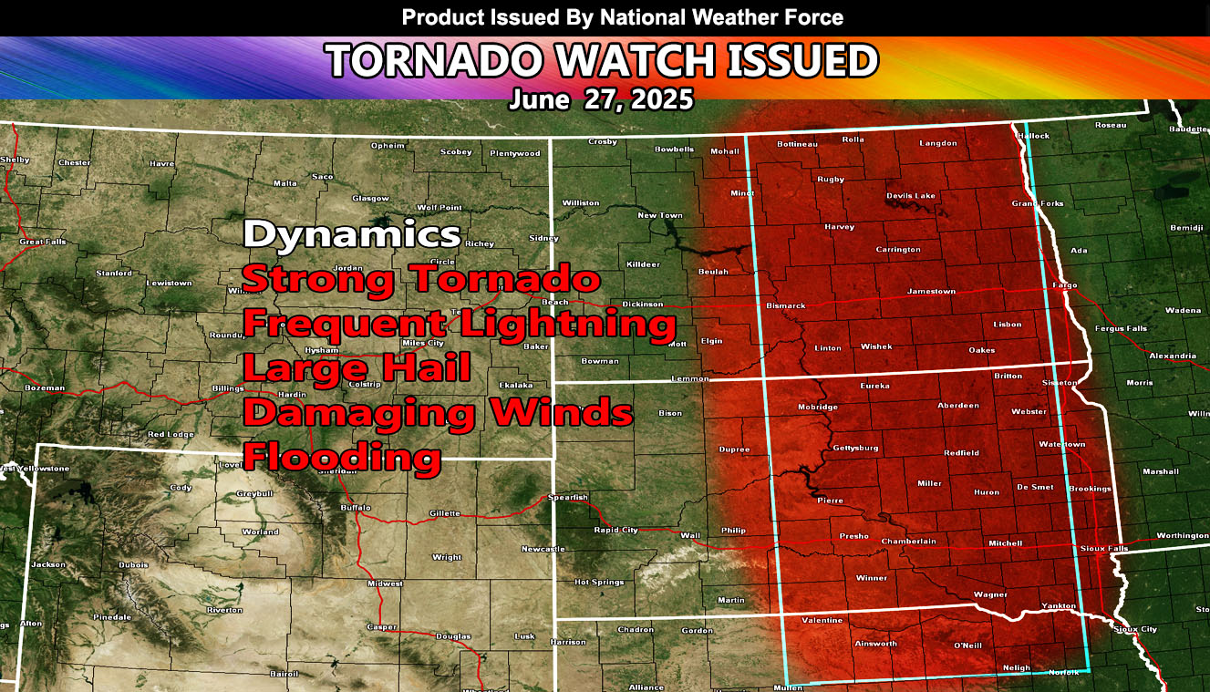
National Weather Force has issued a Tornado Watch effective now, until 4:00am, Saturday, June 28th, 2025, for the following zones;
Issued Sectors:
Northern Plains Sector
Issued Zones:
NORTH DAKOTA: South, Central, North, Northeast, East, and Southeast.
SOUTH DAKOTA: South, Central, North, Northeast, East, and Southeast.
NEBRASKA: North.
Date Issued: June 27th, 2025 at 12:40pm CDT
Discussion: A ridge of high pressure south of the watch area, similar to a week ago – will bring a dry-line across West-Central North and South Dakota this afternoon and evening. This will ignite severe thunderstorms along it, moving to the east with the evening and night hours. Storms will be concentrated where the low-level shear and moisture in the low-levels is maximized. This means that discrete supercells forming along this boundary will be likely, owning to tornado, hail, damaging wind, and flood risks. We could easily see a huge lightning show similar to the storms a week ago in South-Central and Southeastern North Dakota.
Given the moisture profiles, Central South Dakota looks to be the weakest for any storm activity, being between the two focus spots, which will be the southern half of North Dakota, and the central border of Nebraska and South Dakota.
Given the numbers at National Weather Force’s tornado risk model, an EF3+ tornado is possible with this system.
A Tornado Watch is issued at National Weather Force when conditions are possible for tornadoes. A Tornado Watch can come in two alerts, a regular watch for tornadoes, or the Enhanced Tornado Watch for a more severe outbreak of them over a wide area. Severe weather with large hail, damaging winds, and flooding also accompany these watches. Tornado Watches at National Weather Force are private, issued ahead of time to the public by NWF as the lead-time is extremely important to you.
Raiden Storm
Master General Meteorologist