
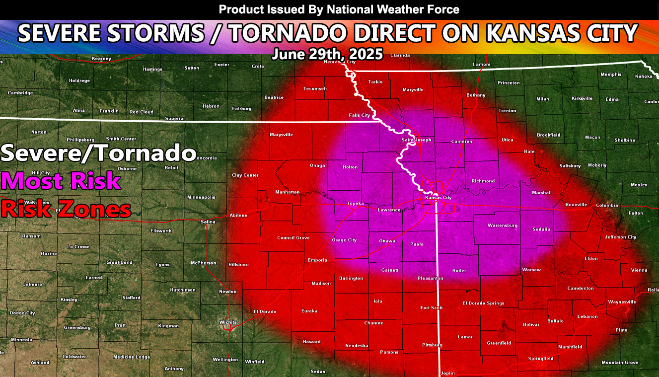
National Weather Force’s Central Plains Weather Force sector is zoning in on a severe weather event that warrants attention for those in or around the Kansas City, Missouri forecast zones for June 29th and into overnight hours, but also zones for the following areas;
KANSAS: Northeast and East.
MISSOURI: Southwest, West, Northwest and Central.
A weather system that is currently affecting South Dakota and Minnesota this evening will move southward over the night, and then into the focus spot of this forecast for later Sunday. What we have here is a system that will round the developing high pressure system over the four corners, which will bring a due north to south flow across the region. Ingredients to look for with this event will be the high instability factor, which will drive rapidly developing thunderstorms. The low-level shear is also in play, which will up the tornado potential. Another thing that will bring the severe thunderstorms through the area that evening and overnight will be the strong upper-level divergence (lift) above 25,000 ft. This forms directly over the system.
Severe Thunderstorm and/or tornado watches will be needed for this event, so for further interests in or around the focus zone surrounding Kansas City, Missouri, continue to monitor the latest forecasts.
Raiden Storm
Master General Meteorologist