
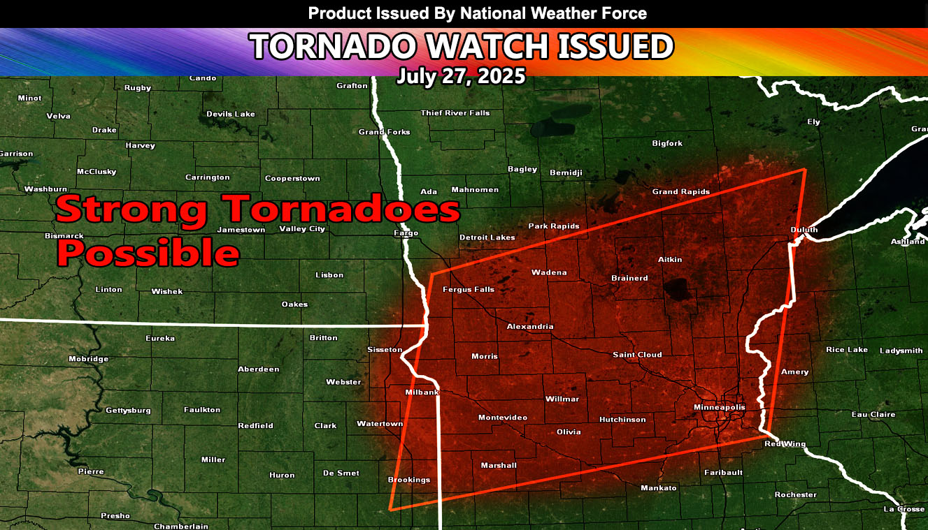
National Weather Force has issued a Tornado Watch effective now, until 12:00am, July 27, 2025, for the following zones;
Issued Sectors:
Northern Plains Sector
Issued Zones:
MINNESOTA: West, Central, Northeast, and East
Date Issued: July 27th, 2025 at 3:25pm CDT
Discussion: An upper level impulse from west to east will move across the watch area this evening. This will bring an explosive development of thunderstorm activity that will go quickly severe. Given the unidirectional upper-level winds, discrete supercells will be likely. Given low level shear numbers mixed in with surface instability, tornadoes, some strong will be extremely likely through the evening and even into some of the night.
Given the numbers at National Weather Force’s tornado risk model, an EF3+ tornado is possible with this system.
A Tornado Watch is issued at National Weather Force when conditions are possible for tornadoes. A Tornado Watch can come in two alerts, a regular watch for tornadoes, or the Enhanced Tornado Watch for a more severe outbreak of them over a wide area. Severe weather with large hail, damaging winds, and flooding also accompany these watches. Tornado Watches at National Weather Force are private, issued ahead of time to the public by NWF as the lead-time is extremely important to you.
Raiden Storm
Master General Meteorologist