
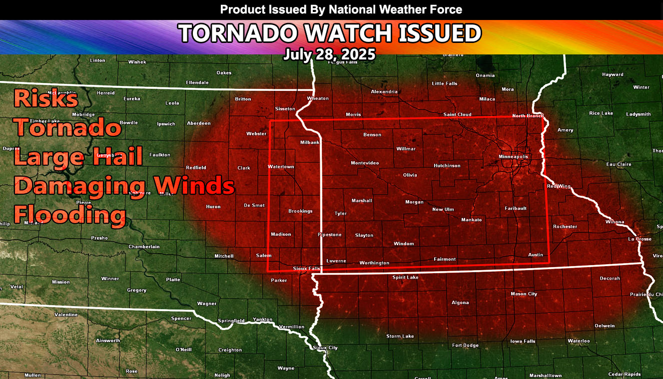
National Weather Force has issued a Tornado Watch effective now, until 12:00am, July 28, 2025, for the following zones;
Issued Sectors:
Northern Plains Sector
Issued Zones:
MINNESOTA: West, Central, East, Southeast, South, and Southwest.
SOUTH DAKOTA: Northeast, East, Southeast.
Date Issued: July 28th, 2025 at 11:40am CDT
Discussion: The upper-level jet stream remains in place, similar to yesterday, across the same areas affected in this watch. Severe Thunderstorms will develop across South Dakota by early evening and move into Minnesota over the evening and night hours. The main focus spot will be damaging winds/tornado chances within the watch area, especially Southwestern Minnesota, where the worst dynamics will be placed. Storms will contain damaging winds, large hail, tornado risk, and flooding …
A Tornado Watch is issued at National Weather Force when conditions are possible for tornadoes. A Tornado Watch can come in two alerts, a regular watch for tornadoes, or the Enhanced Tornado Watch for a more severe outbreak of them over a wide area. Severe weather with large hail, damaging winds, and flooding also accompany these watches. Tornado Watches at National Weather Force are private, issued ahead of time to the public by NWF as the lead-time is extremely important to you.
Raiden Storm
Master General Meteorologist