
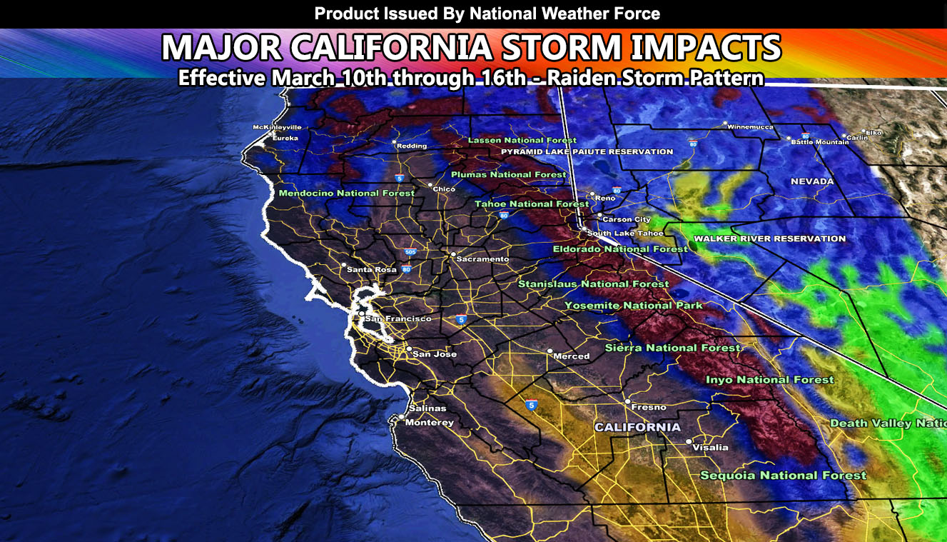
The Raiden Storm Pattern of March 2023 will begin later today as a series of storm systems impacts California. The storm will have two main hits, one tonight into Friday, and the other around the 14th. Read on for details within the rain, snow, and wind maps …
Want to follow these reports in your state area on Facebook?
CLICK HERE TO FOLLOW THE MAIN FACEBOOK PAGE
This is a follow-up to the official Long Range Weather Warning issued previous. Click here to read that.
In quote from it;
“National Weather Force models predicted at the beginning of the month that California would have a very dangerous period of storms. These storms will hit Central and Northern California by March 10th with the first arrival. The second arrival will be around March 14th. The reason this is a warning is because National Weather Force models have pegged an Emergency shade in the Sierra Nevada areas, including the western foothills.
Furthermore, a large area of extreme hits the metro areas all down the Sacramento and San Joaquin Valley areas. This is similar to the flooding events of a couple months ago. What is more dangerous however is that the coming storms will be warmer than a couple months ago. All the snow below the higher snow-level will melt and cause flooding as rivers and creeks become a roaring rapid.”
A Raiden Storm Pattern is a pattern that is seen by this office before any other source, be it a person or an app and as published to the source that predicted the pattern in the long range.
DO NOT FORGET TO LOOK AT THE VALID TIMING IT IS FOR
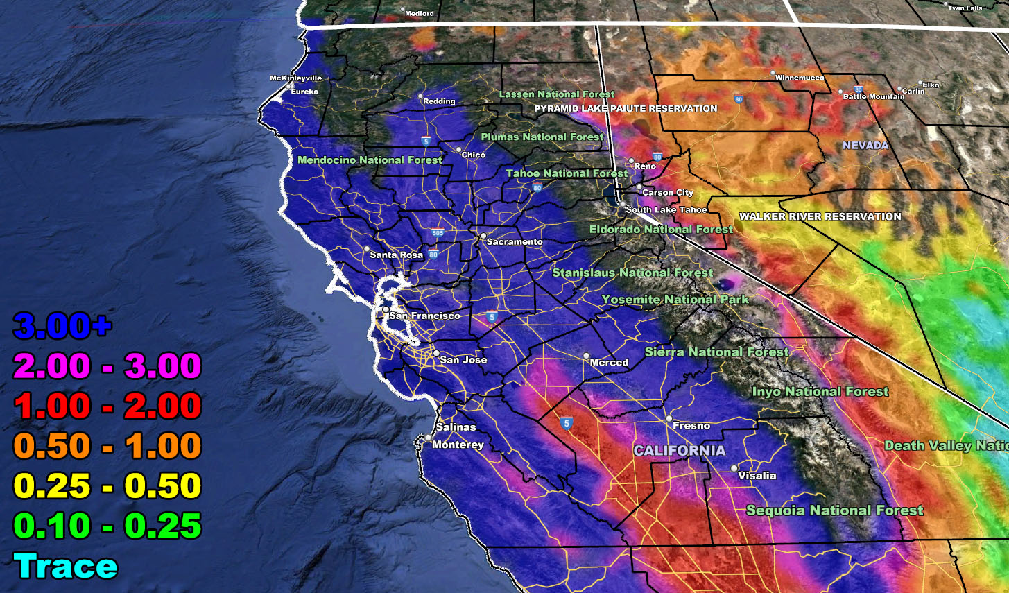
Rain Model – VALID TODAY THROUGH MARCH 16TH
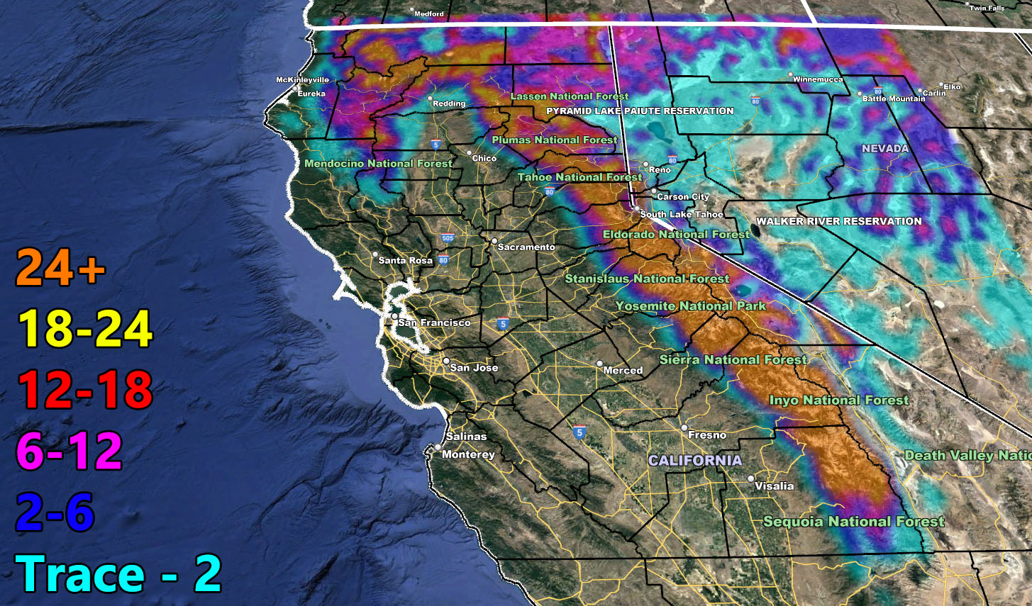
Snow Model – VALID TODAY THROUGH MARCH 16TH
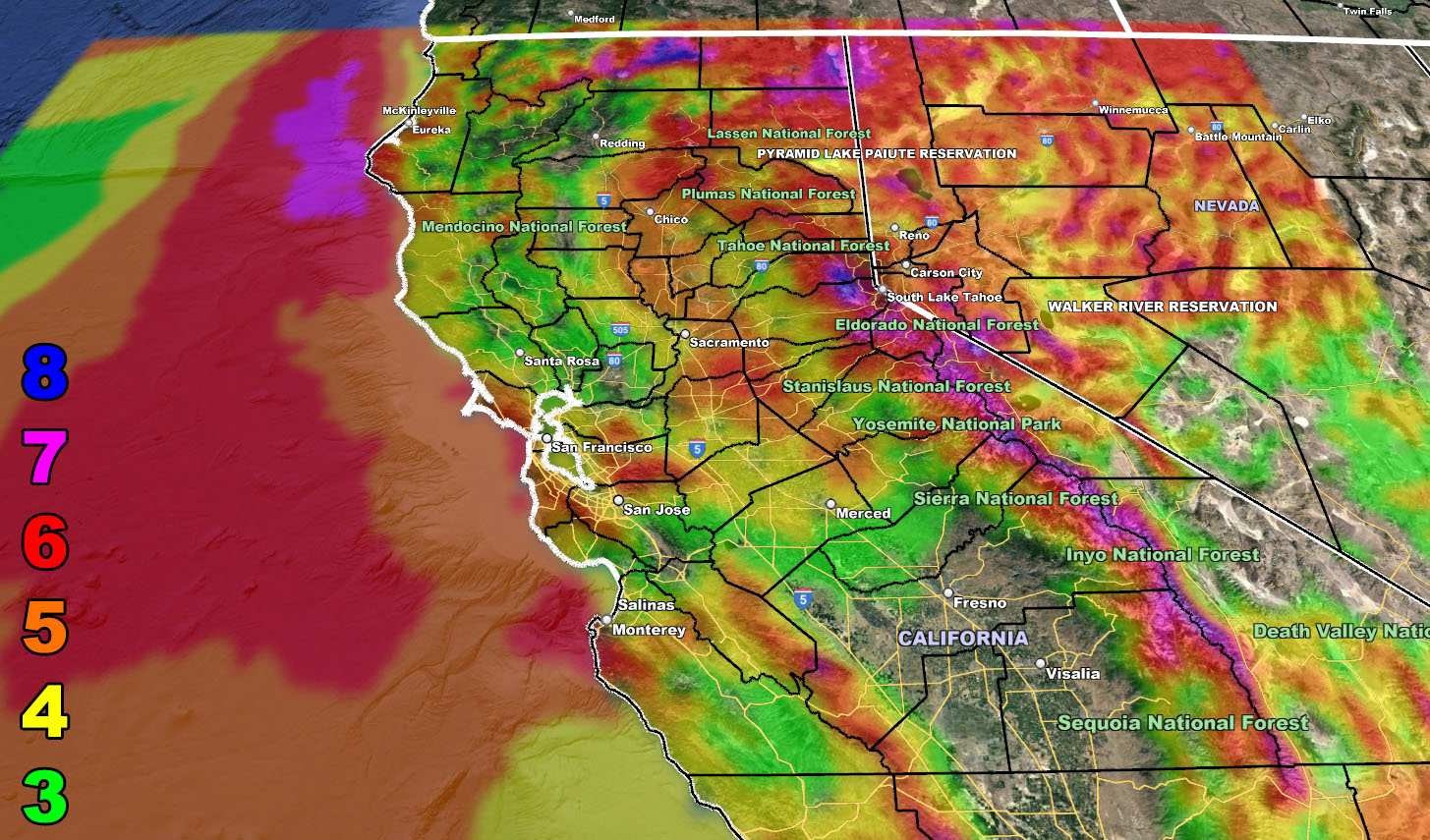
Wind Model – VALID TODAY THROUGH MARCH 16TH
Raiden Storm Wind Gust Intensity Scale –
8. Extensive widespread damage.
7. Trees are broken or uprooted, building damage is considerable. – High Profile Vehicle Roll-Over CERTAIN.
6. SOME Trees are broken or uprooted, building damage is possible. – High Profile Vehicle Roll-Over Likely, Do NOT recommend Traveling in this zone. This zone also is the starting zone where trees and powerlines will fall and damage cars and even kill people near or in them!
5. Slight damage occurs to buildings, shingles are blown off of roofs. HIGH WIND WARNING CRITERIA – High Profile Vehicle Roll-Over Possible if weight is not corrected.
4. Twigs and small branches are broken from trees, walking is difficult.
3. Large trees sway, becoming difficult to walk. POWER SHUTDOWN THRESHOLD DURING FIRE WEATHER / WIND ADVISORY CRITERIA
HOW TO GET THESE ALERTS?.
SIGN-UP TO THE FREE NWF E-MAIL ALERT SYSTEM FOR YOUR AREA HERE WHERE YOU PICK YOUR AREA IN YOUR OWN CONTROL PANEL BY STATE LOCATION AND GET NOTIFIED WHEN A POST IS MADE FOR YOU https://www.nationalweatherforce.com/national-weather-force-email-alert-system-sign-up/
FOLLOW the Facebook Page after reading this and interact with the post made about this, whether sharing, liking, or commenting … It will be answered
CLICK HERE TO FOLLOW THE MAIN FACEBOOK PAGE