
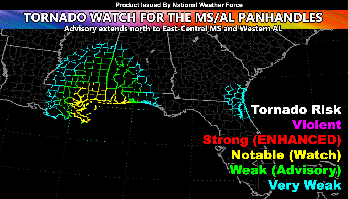
National Weather Force has issued a Tornado Watch effective now through this evening for the MS/AL Panhandles. Advisory does extend north into both inner state zones and east to the Western FL Panhandle so read on for details …
A pretty ragged atmosphere we have today with only small sections of upper divergence, which is not too strong to begin with. The storms will be strongest across parts of Southeastern Louisiana, in the Baton Rouge forecast zones during this period, stronger as they push eastward through the MS/AL Panhandle regions later in the period. Current surface observations shows that backing winds are in progress this afternoon already, which is a good sign for low level shear development as the storms move through. A notable value is showing up on the NWF Tornado Risk Model, which is what a full tornado watch is issued for.
Weaker conditions extend all the way through Central MS and east into AL on the north end of the zone, thus a tornado advisory is issued up there.
Conditions for tornadoes do extend east to the Western FL Panhandle zones as well, including Pensacola.
Want notifications? Sign into the free email alert system and choose your state area(s) -Southern California and Arizona are not served though.
LINK TO REGISTER IF ELSEWHERE – http://www.nationalweatherforce.com/national-weather-force-email-alert-system-sign-up/
Have a comment? Ask on the FB post – You can even ask your city and get an answer if you are confused – The NWF Facebook Page Link By Clicking Here
Tornado Watch issued for the Mississippi and Alabama Panhandles, Advisory Extends North to Portions of Both…
Posted by National Weather Force on Sunday, May 2, 2021