
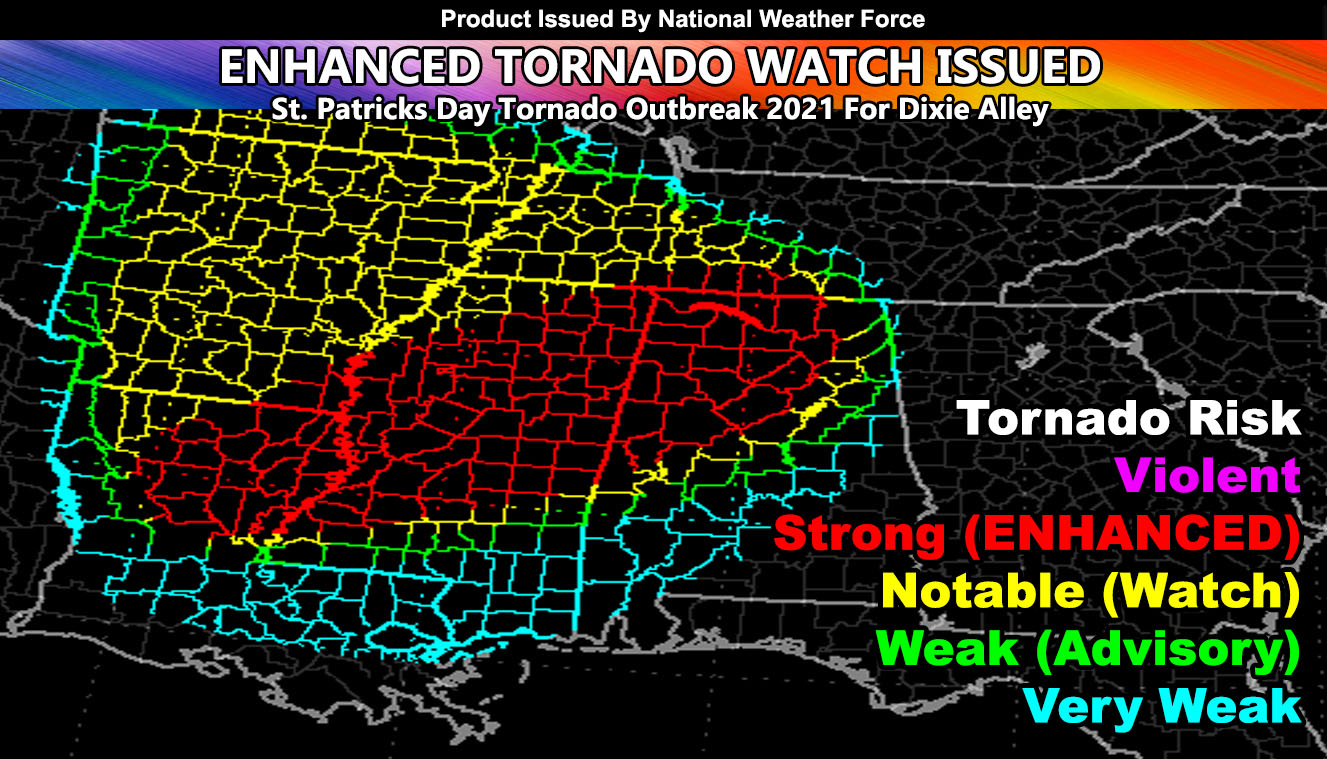
National Weather Force has issued an ENHANCED TORNADO WATCH extending from Northeast Louisiana northeast through Central and Northern Mississippi and Alabama, effective today into tonight. Other areas surrounding the enhanced watch are within regular tornado watch values so read on for details …
A system coming through Texas and Oklahoma is starting to affect the watch area with tornado warnings. Out ahead of the main surface forcing this morning there are tornado warnings in the watch zones. National Weather Force tornado risk model pinpoints the strongest will be where storms are not hindering the instability. Morning convection is failing to initiate in Northeast Louisiana and into most of Mississippi. This will force upwards when the surface convergence arrives later in the day.
More than enough low level shear is present to produce a strong tornado event. While not the ‘violent’ category, we could see a couple in that realm today. Anything red on the tornado risk model means EF3 or higher is possible, thus similar to a PDS Tornado Watch issued by ‘the other guys’, the red is similar in that is my Enhanced Tornado Watch zone. Storms will continue eastward into Alabama later in the period, you also are within the Enhanced Watch, including the Birmingham zones.
Want notifications? Sign into the free email alert system and choose your state area(s) -Southern California and Arizona are not served though.
LINK TO REGISTER IF ELSEWHERE – http://www.nationalweatherforce.com/national-weather-force-email-alert-system-sign-up/
Have a comment? Ask on the FB post – You can even ask your city and get an answer if you are confused
FINAL FORECAST: Tornado Outbreak Predicted Across Northeast Louisiana through Mississippi and Into Alabama; Risk Model…
Posted by National Weather Force on Wednesday, March 17, 2021