
A tornado outbreak is scheduled for the deep south of MS/AL today, St. Patrick’s Day. The line of storms will eventually go east into the Southeastern United States for Thursday on a weakening trend so read on for details …
Storms that will move through Mississippi and Alabama today, causing loss of life and property, will move eastward into Georgia by Thursday morning. The upper divergence will weaken as it does so, including the storms merging and going more linear than discrete supercells like what MS/AL will see today. This all points to a weakening trend.
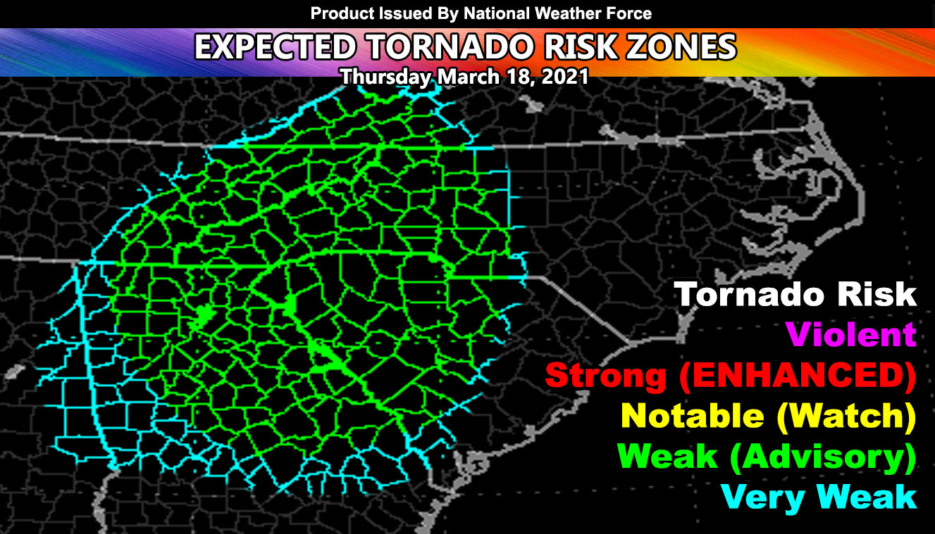
The National Weather Force tornado risk model has green for parts of Georgia, Tennessee, South and North Carolina, even the Virginia Panhandle on Thursday. The lack of rotation potential for convergence at the surface is making me halt Southern GA in a risk at this time. Convergence for rotation at the surface will center closer to the surface low, so while it remains a low-end tornado risk, it is not a strong risk or dangerous outbreak. Still, green means that EF0-1 tornadoes are possible.
Lack of forcing is keeping me from moving this activity further east into the Eastern Carolinas. It may just be too weak to produce there. It will shove east through the evening and eventually offshore into the Atlantic during the night.
Want notifications? Sign into the free email alert system and choose your state area(s) -Southern California and Arizona are not served though.
LINK TO REGISTER IF ELSEWHERE – http://www.nationalweatherforce.com/national-weather-force-email-alert-system-sign-up/
Have a comment? Ask on the FB post – You can even ask your city and get an answer if you are confused
Tornado Dynamics For the Southeastern United States For Thursday March 18, 2021
A tornado outbreak is scheduled for the…
Posted by National Weather Force on Wednesday, March 17, 2021