
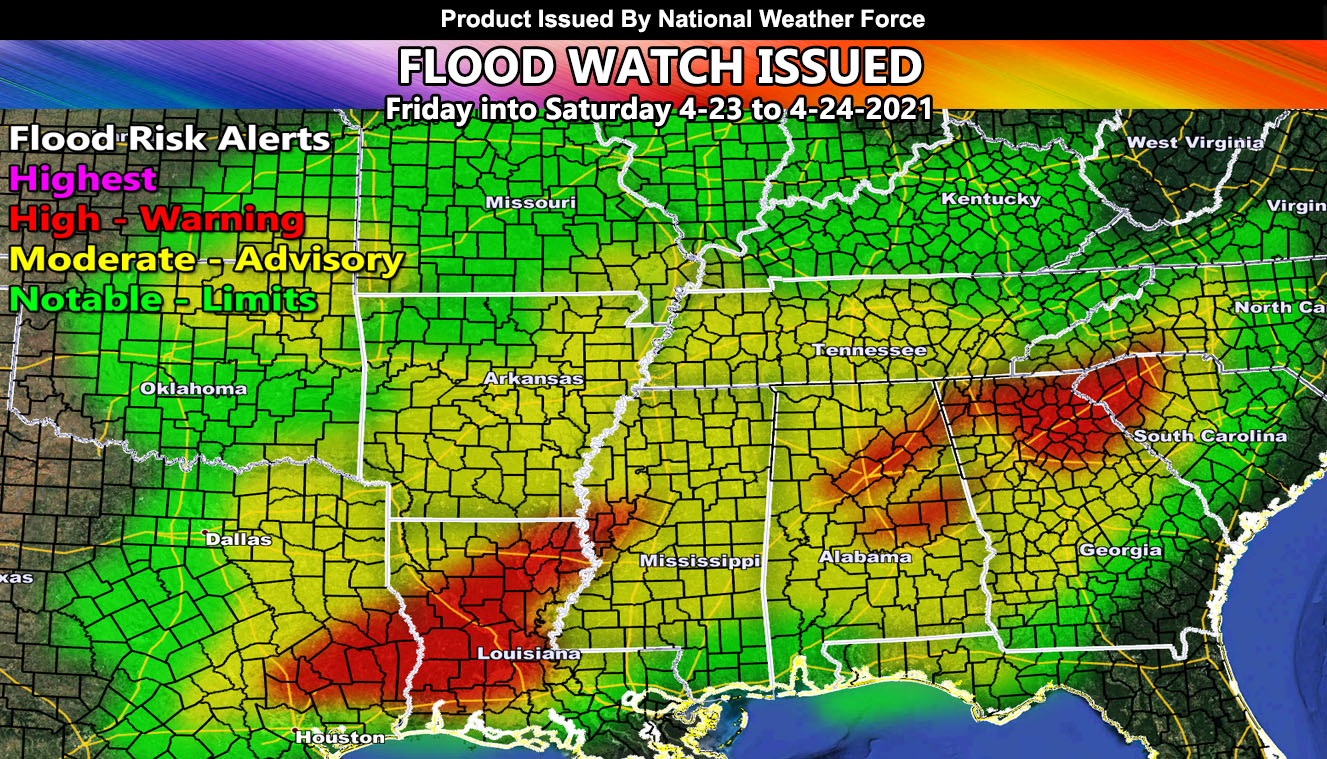
National Weather Force has issued a Flood Watch effective this Friday into Saturday starting in Texas, gliding eastward overnight and into Saturday for the rest of the Gulf States, including parts of the Carolinas so read on for details …
The National Weather Force flood risk model is showing a potent area of higher flood dynamics across this region in response to a dragging cold front that will bring showers and thunderstorms starting Friday for the Eastern half of Texas, spreading overnight through MS/AL and affecting GA/SC/NC by Saturday. The highest concentration of the heaviest activity will be in Southeast TX into most of Louisiana. the next happening across Birmingham, AL through Northern Georgia and Western South Carolina. Anywhere within the yellow or red in the NWF Model is considered a Flood Watch with this. The front will go as far south as the Florida Panhandle, but will not affect the peninsula.
There is also a risk of severe weather, including large hail, damaging winds, and tornado chances with the embedded clump of thunderstorm cells across the watch area.
Want notifications? Sign into the free email alert system and choose your state area(s) -Southern California and Arizona are not served though.
LINK TO REGISTER IF ELSEWHERE – http://www.nationalweatherforce.com/national-weather-force-email-alert-system-sign-up/
Have a comment? Ask on the FB post – You can even ask your city and get an answer if you are confused – The NWF Facebook Page Link By Clicking Here
Flood Watch Issued for Texas Eastward Through The Gulf States Friday into Saturday; Tornado Dynamics Included
National…
Posted by National Weather Force on Thursday, April 22, 2021