
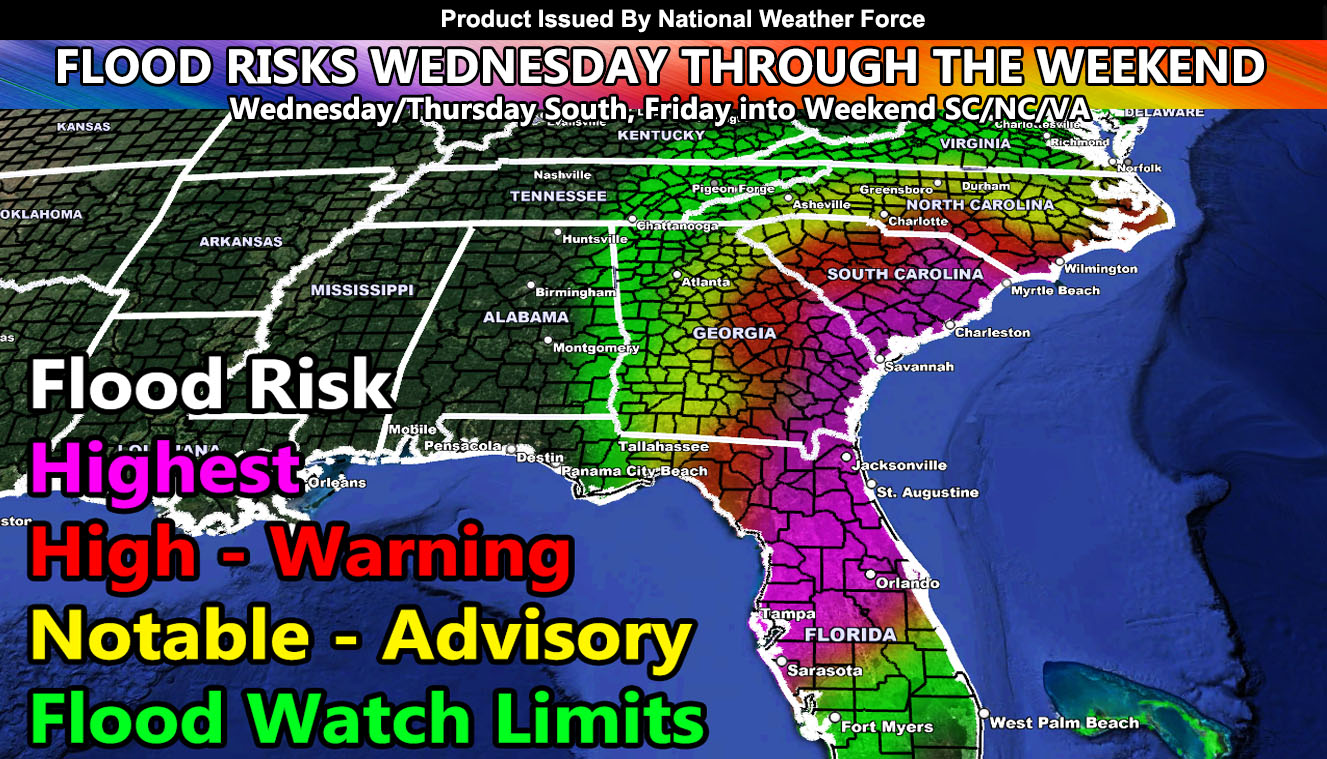
The NWF Flood Risk Model has ran for the landfall point of at or near Venice, Florida and the risks from that are as followed; Read on for the maps, including zoom in for Florida, Georgia, South Carolina, North Carolina, and as far north as Virginia. NWF Flood Watches now cover those zones so use the key to the left of the model images to assess your area. This is based off the landfall point listed above so read on –
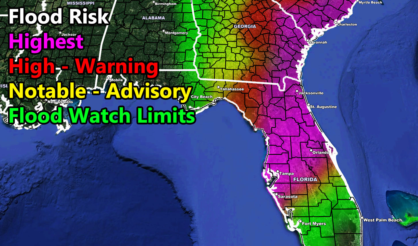
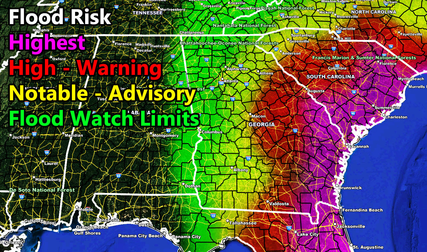
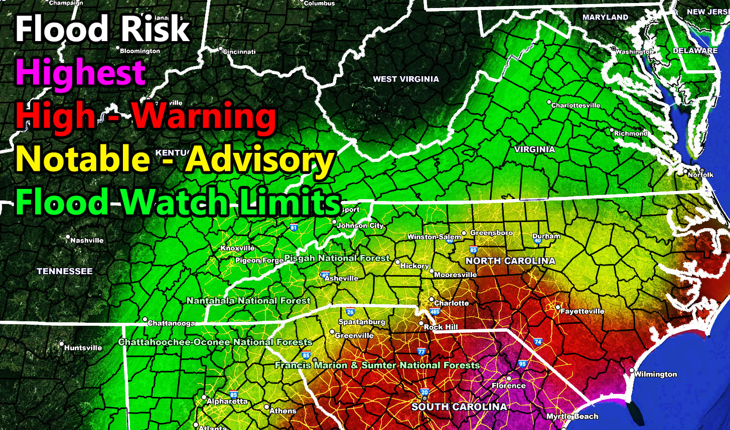
Here are the zoom in images of the NWF Flood Risk Model. Southern end gets hit Wed/Thu, the Carolinas/VA more so Friday into the Weekend – These images are clickable –
CLICK HERE FOR THE FINAL LANDFALL POINT –
HOW TO GET THESE ALERTS?.
SIGN-UP TO THE FREE NWF E-MAIL ALERT SYSTEM FOR YOUR AREA HERE WHERE YOU PICK YOUR AREA IN YOUR OWN CONTROL PANEL BY STATE LOCATION AND GET NOTIFIED WHEN A POST IS MADE FOR YOU https://www.nationalweatherforce.com/national-weather-force-email-alert-system-sign-up/
FOLLOW the Facebook Page after reading this and interact with the post made about this, whether sharing, liking, or commenting … It will be answered
CLICK HERE TO FOLLOW THE MAIN FACEBOOK PAGE